DISPATCHER'S | R E T U R N - TO - M I S T Y - M O O R I N G S |
|
|
|
|
| RIBBON |
B R I E F I N G |
|
1 Hydaburg |
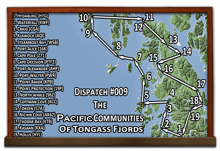
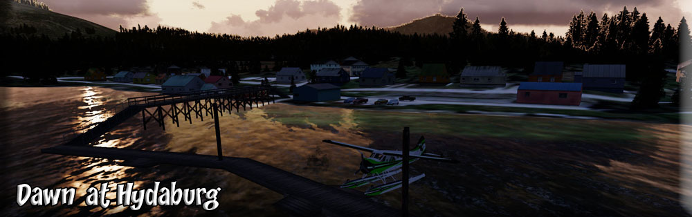
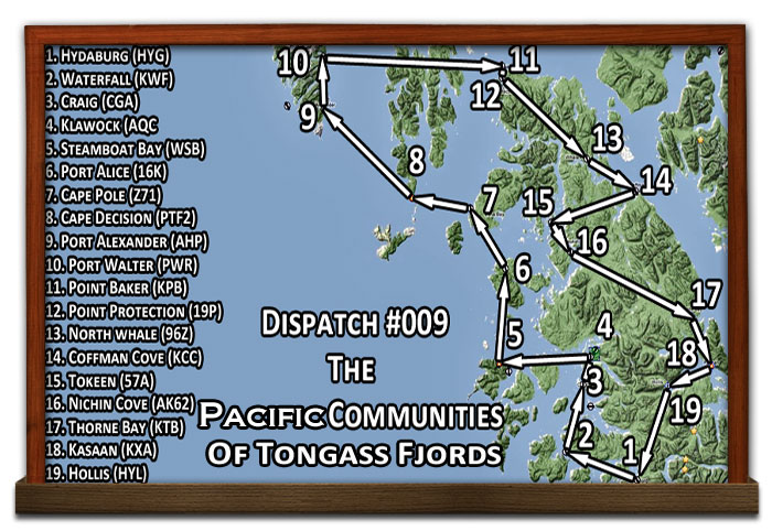
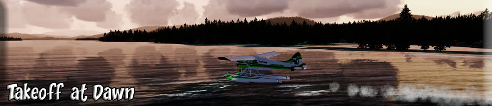
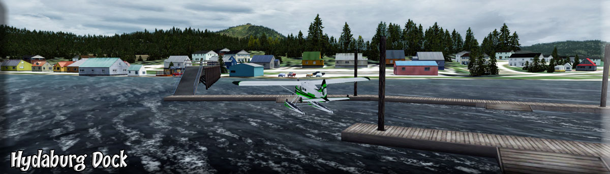
Dispatch 009 The purpose of Dispatch #009 is to familiarize you with the area north and east of RTMM ... most of this is covered in the Tongass Fjords Package. There are some wonderful communities to discover in this area if you have this software package. The Lat/Long coordinates at the left start you at the dock (water). Also, the GPS way points are now listed with each location. As you fly to the various communities, you can read about them in the dispatch. A flight plan for the entire route can be found by clicking this: Zip of Flight Plan Here. As you fly the trip, there is a QUICK MAP link in the Ribbon Column that, if you click it, will bring up the route map so you don't have to go all the way to the top to refer to your location. Hydaburg founded in 1912 is presently reporting a population of 380, is located on the southwest coast of Prince of Wales Island. (Starting the trip at dawn) Its fascinating history can be traced back to the 1700s, when Haida Indians came to Prince of Wales Island from Graham Island, located off of British Columbia. Three Haida villages, Sukkwan, Howkan, and Klinkwan, combined in 1911 in order so that their children could attend school. The next year it was designated as the Hydaburg Indian Reservation. A trading company, sawmill, and village store were soon to follow.In 1926, the land was redesignated to its former status as Tongass National Park but close to 200 acres were set aside for the school and the surrounding town. A fish processing plant and three canneries were opened in the late 20's and 30's.The amending of the Indian Reorganization Act in 1936 to include Alaska Natives, allowed Hydaburg to be the first village in Alaska to form an IRA Council. Hydaburg continues to flourish and today boasts the highest population of Haida in Alaska. Much of the lifestyle centers around subsistence hunting and fishing, and traditional arts such as wood carving and weaving are still a way of life. |
|
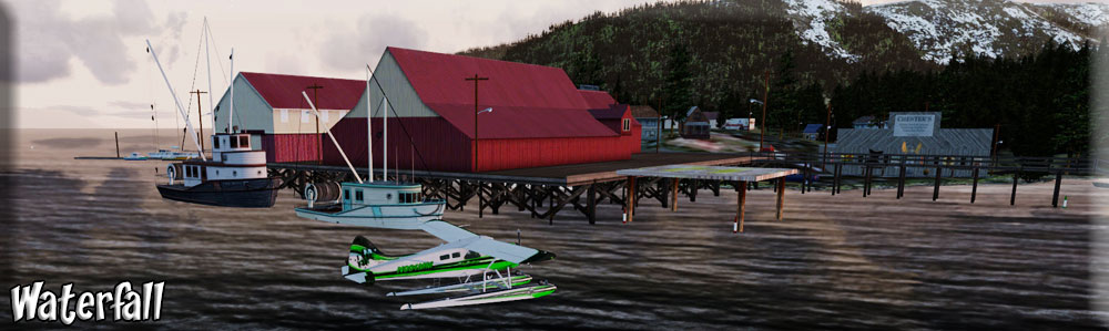
2 Waterfall |
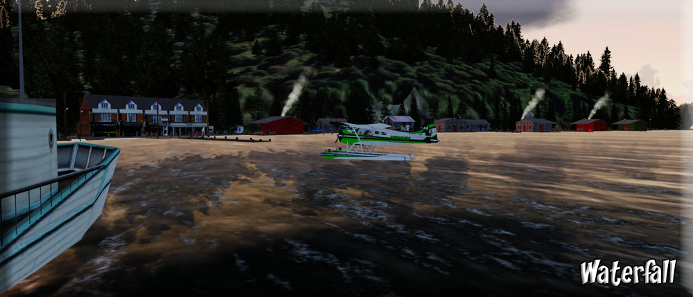
Waterfall is an unincorporated area on the west coast of Prince of Wales Island in Prince of Wales-Hyder Census Area, Alaska, United States, approximately 60 miles (100 km) west of Ketchikan. (Takeoff from Hydaburg at dawn for Waterfall) The primary industry was Waterfall Cannery, built in 1912 as a salmon processing facility. The cannery closed in 1973 and was renovated into the Waterfall Resort, a sport fishing lodge. Waterfall is not connected to the island's road system; visitors to the resort arrive by floatplane from Ketchikan. The annual return of Halibut and Salmon to our prime location on Prince of Wales Island in Alaska’s Inside Passage near Ketchikan, AK gives Waterfall Resort its legendary reputation for premier Alaskan Sportfishing. (Waterfall at Dawn) Our location on Prince of Wales Island, just a short Alaska Airlines flight from Ketchikan, offers Alaska fishing opportunities both rich and plentiful, with teaming populations of Alaska King Salmon, Halibut, Silver (Coho) Salmon, Ling Cod, Snapper, Rockfish and more. In fact, the historic Waterfall Cannery, the origins of Waterfall Resort, was once one of the most productive Salmon Fishing Canneries in all of Alaska. (Waterfall Cannery) |
|
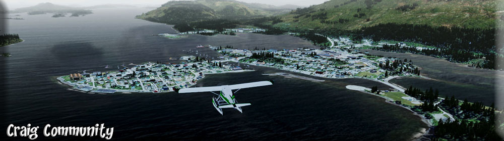
3 Craig |
Craig, AK: The Tlingit and Haida peoples have historically utilized the area around Craig for its rich resources. With the help of local Haidas, a fish saltery was built on nearby Fish Egg Island in 1907 by Craig Miller. Between 1908 and 1911, he constructed the Lyndenburger Packing Company and cold storage plant at the present site of Craig. In 1912, a post office, a school, a sawmill, and a salmon cannery were constructed. (Flying to Craig) Production at the cannery and sawmill peaked during World War I. A city government was formed in 1922. Excellent pink salmon runs contributed to development and growth through the late 1930s -- some families from the Dust Bowl relocated to Craig during this time. During the 1950s, the fishing industry collapsed due to depleted salmon runs. In 1972, Ed Head built a large sawmill six miles from Craig near Klawock, which provided year-round jobs and helped to stabilize the economy. Head Mill was sold in the early 1990s to Viking Lumber. A federally-recognized tribe is located in the community -- the Craig Community Association. (Moored at Craig) Craig is predominantly a fishing community. According to Census 2010, there were 537 housing units in the community and 470 were occupied. Its population was 20 percent American Indian or Alaska Native; 65 percent white; 0.3 percent black; 0.8 percent Asian; 0.2 percent Pacific Islander; 13.3 percent of the local residents had multi-racial backgrounds. Additionally, 3.3 percent of the population was of Hispanic decent. | |
4 Klawock |
Klawock, AK: Klawock's first settlers were Tlingit who came from the northern winter village of Tuxekan. They used it as a fishing camp for the summer period, and called it by several different names: Klawerak, Tlevak, Clevak, and Klawak. In 1868, a trading post and a salmon saltery were opened; some years later, in 1878, a San Francisco firm opened the first cannery in Alaska. In the following decades, several others were established. A post office was established in 1882. The 1890 census recorded the town's population as 260. The Alaska Native Brotherhood (ANB) and Alaska Native Sisterhood (ANS), nonprofit organizations, were established by residents in 1912. Its founders and many volunteers built the Town Hall and a community center, in 1939. In 1929 the town incorporated as a city, and in 1934 Congress awarded federal funding for the expansion of the cannery, on the condition that the community remain liquor-free. At the same time, the Klawock Cooperative Association (a nonprofit organization) was formed to manage the cannery. The 5,000 foot and paved Klawock Airport is the only airport on Prince of Wales Island and serves as the air transport gateway for nearby Craig as well. It receives charters and daily scheduled passenger service from Ketchikan from Promech and Pacific Airways. (Approach to AQC) | |
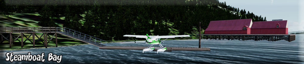
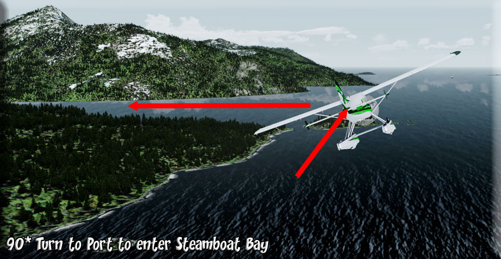
5 Steamboat Bay |
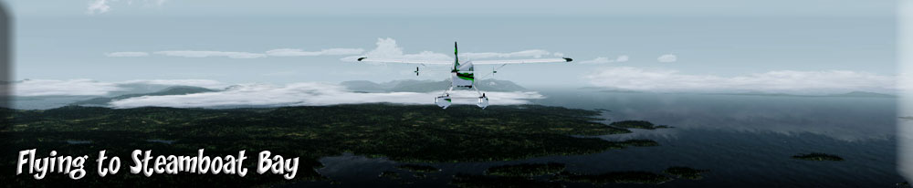
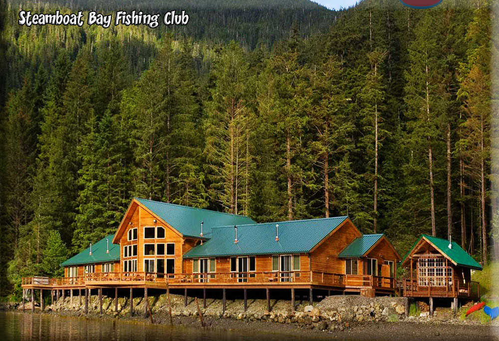
Steamboat Bay (Flying to Steamboat Bay) Noyes Island The Kingfisher Lodge is located on Noyes Island, very near Steamboat Bay. Kingfisher Charters and Lodge offers the best of Alaska fishing on the nation's 3rd largest island, Prince of Wales Island. With fewer than 13 guests you will have virtual privacy with your friends. (Steamboat Bay Approach) Surrounded by pristine waters, this archipelago offers Alaska fishing at its best, a challenge with the promise of great reward to saltwater fishing enthusiasts, and an unsurpassed variety of scenic delights for the nature enthusiast. We'll explore sheltered coves and open waters, guiding you to some of the best saltwater fishing in Alaska. Kingfisher Lodge offers saltwater fishing, a vacation with deluxe accommodations and friendly, supportive staff dedicated to your complete satisfaction. Relax in our comfortable, very private lodge by the waters of the great North Pacific. Wake refreshed, enjoy breakfast, and head for the boat, where your Alaskan fishing guide awaits. Then prepare yourself for the adventure of a lifetime! Our 32' full walk-around boats provide exceptional comfort for up to 6 anglers and an amazing 360 degree view for sightseeing. (The Steamboat Fishiing Club Lodge) |
|
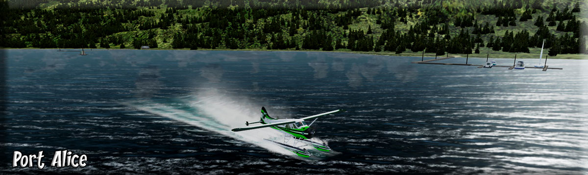
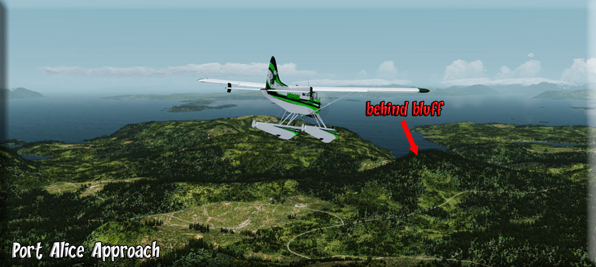
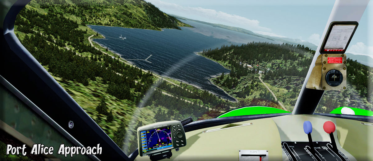
6 Port Alice |
Port Alice, AK: (Approach at Port Alice) (Port Alice Landing)
The population of Port Alice is approximately 30. |
|
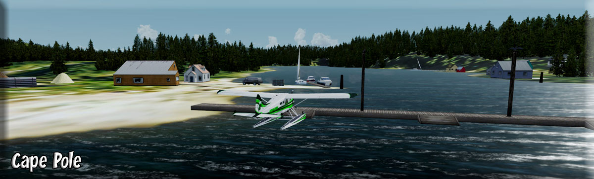
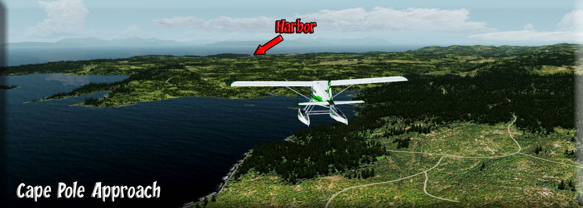
7 Cape Pole (Edna Bay) |
Cape Pole - Edna Bay, AK (Cape Pole) The small ocean community of Edna Bay is located in the Tongass National Forest. With lush rain forest plant life covering every inch of the island, wildlife that is just as abundant, and the most pristine blue ocean you'll ever see; every day in Edna Bay offers a beautiful new pallete of natural display. Open areas are filled with a diverse assortment of wild flowers and edible berry producing plants. The lush green old growth forests are carpeted with thriving ferns and soft green moss. With wildlife prevalent in so many places, Edna Bay offers an unsurpassed recreational experience and is a truly beautiful place to live. (Approach to Cape Pole) The climate is moderate, with warm winters and mild summers. It tends to rain, or be overcast more in this part of the state than in other areas. Though the area isn't plagued by the typical below zero, heavily snowed, Alaskan winter. The summers are equally pleasing with temperatures rarely going above 90 degrees on the hottest of days. The island has many naturally occurring species of animals that may be harvested. The bear, deer, and large assortment of ocean fish offer an exceptional subsistence lifestyle to those who live here, and allow them to do so in comfort. The managed logging on the island only helps to improve the land animal populations by opening up more areas for the animals to find natural food sources, and escape predators. The island also has a large population of timber wolves that keep the other large animal groups in check - other predator species include martens, mink and eagles. There is a wide array of non-predatory local bird species as well - including hummingbirds. The community of Edna Bay was established in 1983, after the great logging expeditions of the 1950's. The name Edna Bay was originally given to the area by the U.S. Coast and Geodetic Survey in 1904. The land that the community currently occupies is located on the Southeastern corner of Kosciusko Island, and was initially part of a large state land disposal sale. At it's peak there were well over 100 people living here in the bay, but as logging subsided, so did the population. Edna Bay was originally established as a fishing community, not just because of the logging that was thriving here initially. Many of the original fisherman that came to the bay still reside here today. Edna Bay is in the perfect protected location with excellent access to the local fishing grounds. At one time, there was even a fish scow located in the bay which provided local fisherman with a place to sell their catch. Today, there are only about 50 people residing here year-round, but the population is once again beginning to increase. |
|
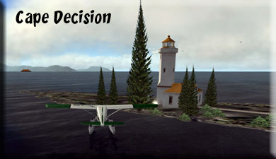
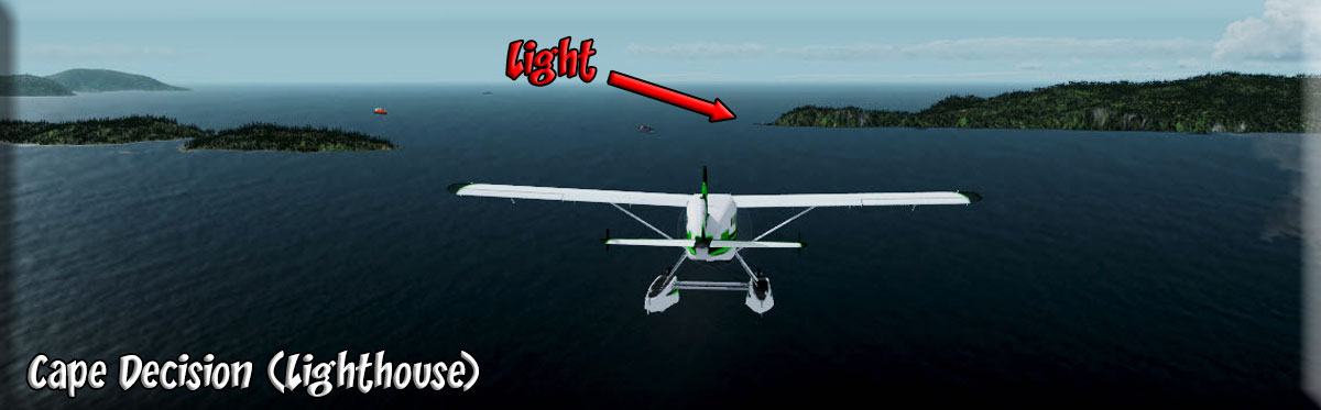
8 Cape Decision (Light) |
Cape Decision Lighthouse: The concrete lighthouse features a central, square tower rising to a height of seventy-five feet, with a one-story structure wrapped about its base. The lighthouse provided quarters for three keepers and also housed generators for the light and fog signal. A Class A radio beacon was placed on the rocks just seaward of the lighthouse. H. O. Essig was stationed at Cape Decision from 1943 to 1946. One perk that came with the remote assignment was three full months of leave after a year at the station. Still, that was not enough incentive for most men to sign up for more than a single year at the lighthouse. Essig “thoroughly enjoyed both the experience and the place,” but realized that “it requires a certain breed of cat to handle it.” The men were expected to operate the station with a minimum amount of supervision, and at least during Essig’s stay, things ran quite smoothly. (Cape Decision Approach) Essig recalls that before one relief keeper was sent to the lighthouse from the Coast Guard base in Ketchikan, the chaplain’s office called him in and warned that “everything gets lit but the light” out at Cape Decision. Essig does admit that when the crew learned of V-E day, two of them took a ride aboard the mail boat to Port Alexander to procure some …uh…well…. “lemonade.” Oh, and there was that time when rough seas forced them to land a twenty-case shipment of beer eight miles from the station, but they needed something to help ease the boredom and loneliness of life at Cape Decision. On September 1, 1974, the last live-in crew left the lighthouse, being replaced by a reliable diesel generator. The station was later converted to solar power to further reduce the maintenance work required during the regular Coast Guard visits. During one such checkup visit, performed on October 11, 1989 by an Aids to Navigation Team from Sitka, disaster was just barely avoided. Cape Decision Lighthouse Lens Rather than haul trash away from the site, it was typically placed in 55-gallon barrels and burned. The team retrieved two such barrels from the boathouse that day, placed them outside on the wooden walkway, and filled them with debris. “I added the customary one gallon of diesel to each barrel to ensure complete combustion of the trash,” said MK1 Ron Conklin. Conklin then accompanied the two other Coast Guardsmen to the lighthouse, gave them work assignments, then picked up a fire extinguisher and headed back to the boathouse to tend the fire. (Cape Decision Landing) (Fuel Available at pump) As Conklin reached the helicopter pad, he noticed thick black smoke emanating from beneath the boardwalk near the boathouse. It wasn’t immediately clear if the pier was on fire, or if the thick smoke from the barrels was simply swirling down through the pier. After discharging the 30-pound extinguisher into the two barrels, Conklin discovered, much to his alarm, that the pier was indeed ablaze. Conklin sprinted back to the lighthouse yelling “Fire!, Fire!”. With additional extinguishers in hand, the three-man crew scampered back to the boathouse and attempted unsuccessfully to subdue the flames. Realizing that the fire could spread to surrounding structures, Conklin broadcasted a mayday call to the Coast Guard. The men then formed a bucket brigade to transport water to the fire from the station’s cistern, located thirty feet away. Help finally arrived in the form of a helicopter from Sitka and the buoy tender Woodrush. As the helicopter was approaching to land, the fuel inside the boathouse exploded sending a tremor along the pier. Portable firefighting equipment was off-loaded from the helicopter after it was able to safely land, and the Coast Guardsmen had the fire under control in about four hours. Although the exact cause of the fire was listed as ""unknown,"" it is most likely that either the diesel leaking from the barrels or airborne embers ignited the pier. The boathouse and a good section of the pier and catwalk to the helicopter were destroyed in the blaze. |
|
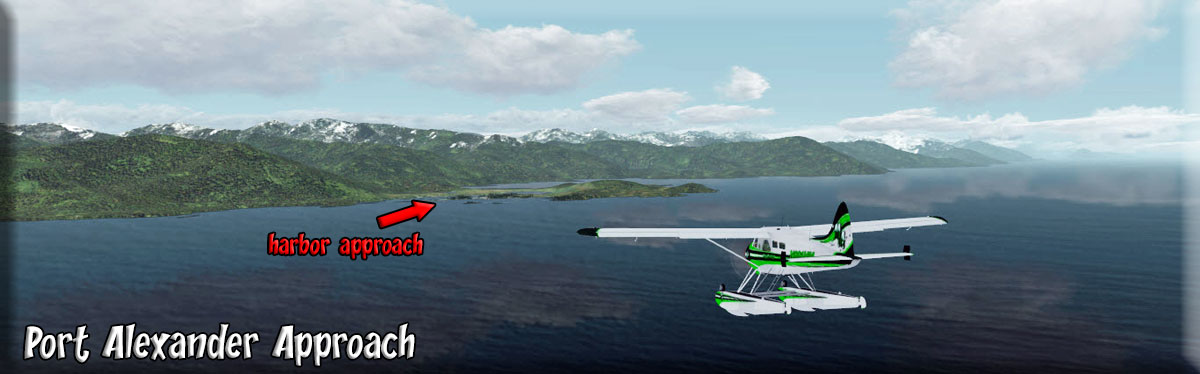
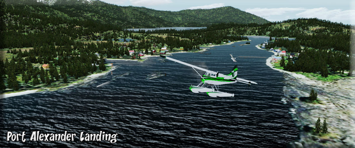
9 Port Alexander |
Port Alexander is located on the southeastern tip of Baranof Island, about five miles north of Cape Ommaney and 85 miles south of Sitka. It provides a safe harbor during the gales and storms that frequent Chatham Strait. It lies at approximately 56° 15' N Latitude, 133° 38' W Longitude (Sec. 07, T065S, R070E, Copper River Meridian). The community is located in the Petersburg Recording District. The area encompasses 3 sq. miles of land and 12 sq. miles of water. In 1795, the British explorer Capt. George Vancouver, recorded his entry into the cove which is now called Port Alexander. He was looking for Natives to trade with, but found only a deserted village. The site was named in 1849 by Capt. M.D. Tebenkov, Governor of the Russian American colonies. (Port Alexander Approach) In 1913, salmon trollers discovered the rich fishing grounds of the South Chatham Strait area, and fishermen began using the area as their seasonal base. Two floating processors arrived soon after. By 1916, there was a fishing supply store, a shore station owned by Northland Trading and Packing Company, and a bakery at Port Alexander. Families of fishermen began coming to the community during the summers, and many of the first arrivals lived in tents. Karl Hansen, a Norwegian immigrant, operated a fish-buying station, the Pacific Mild Cure Company. He also sold supplies and fuel, and installed a wireless station. During the 1920s and 1930s, a year-round community had evolved around the prosperous fishing fleet, and houses, stores, restaurants, a post office and a school were constructed. The summer population would swell to over 1,000 people. A soda fountain, butcher shop, dairy, dance hall and hotel were built. Beginning in 1938 fish stocks declined dramatically, and processing became uneconomical. The outbreak of World War II essentially collapsed the town's economy; Karl Hansen left Port Alexander in the late 1940s, after 20 prosperous years and 10 years of struggle, bankrupted. By 1950, 22 residents lived in the town year-round. In the 1970s, State land disposal sales and upswings in salmon stocks enabled new families to build and settle in the community. (Port Alexander Landing) |
|
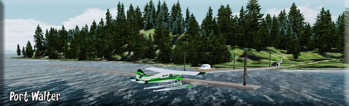
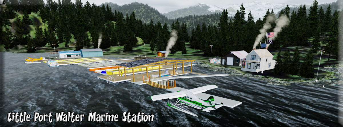
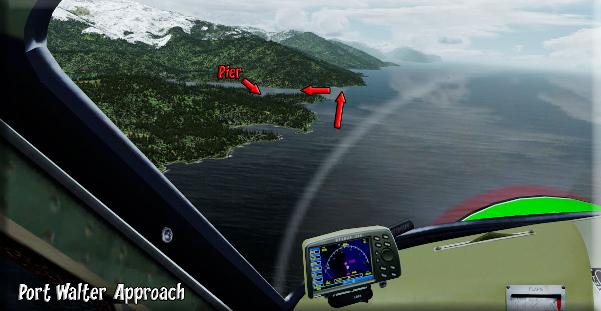
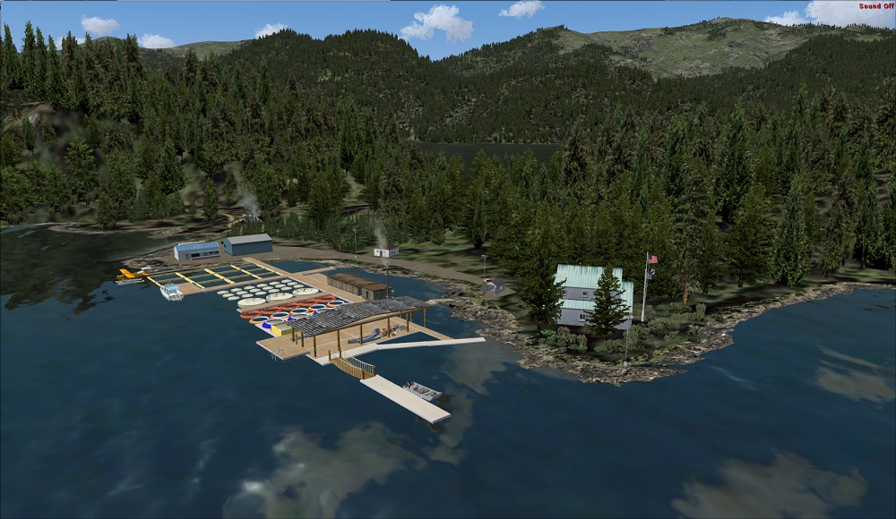
10 Port Walter Dock |
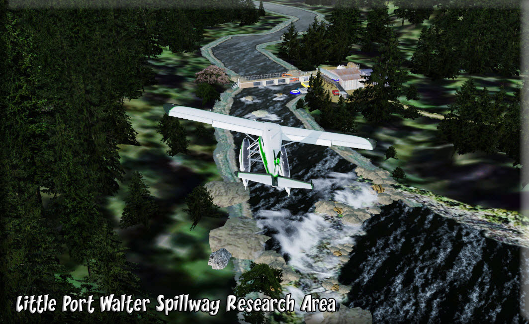
Port Walter is located on the southeastern side of Baranof Island in southeast Alaska. It is made up of two parts: Little Port Walter and Big Port Walter. Little Port Walter was the home of a herring saltery during the turn on the century and the ruins can still be seen. Little Port Walter had a small community at one time but has been replaced by a research station that studies the life cycles of several species of Salmon. There is a staff of 3–15 state and federal employees running the research station year-round. There is a dock, and the harbor itself is a safe anchorage. (Port Walter Approach) You Land at the Port Walter Dock. Then you can fly low/slow back around the point holding it to starboard to arrive at the Little Port Walter Marine Station and Research Center. SEE MAP When at the station dock, look to the left and taxi over to the spillway area, pretty amazing. The Little Port Walter (LPW) research station is the primary field research facility of the Auke Bay Laboratory and is located 110 miles south of Juneau, Alaska, near the southeastern tip of Baranof Island. LPW is the oldest year-round biological research station in Alaska and has been host to a wide variety of fisheries research projects since 1934. The station is on U.S. Forest Service land in the Tongass National Forest and is accessible only by boat or seaplane. Personnel stationed at LPW range from a mid-winter low of 2 to a summertime high of 25 to 30 researchers and support staff, depending on the requirements of the various experiments under way. (spillway area) |
|
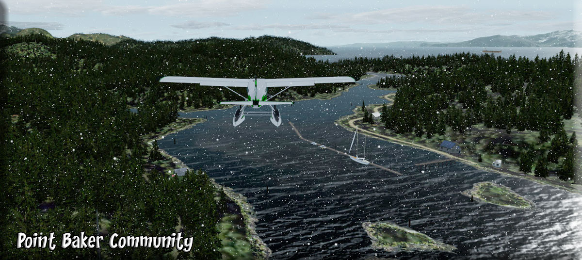
11 Point Baker |
|
|
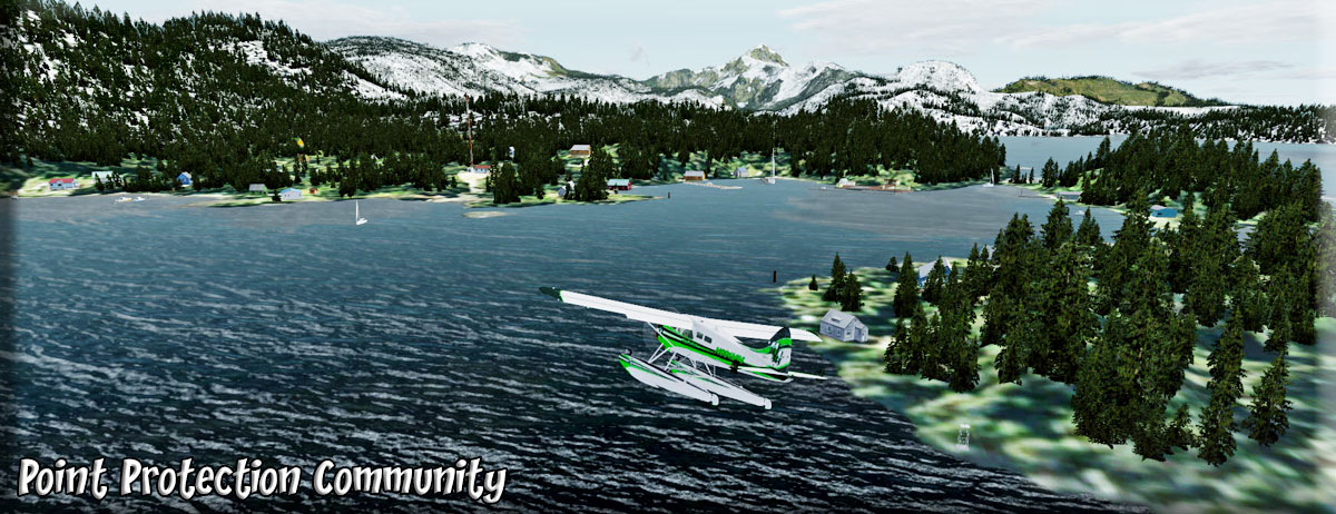
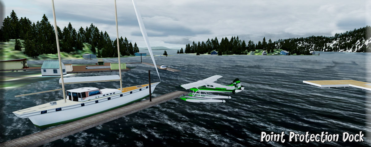
12 Point Protection |
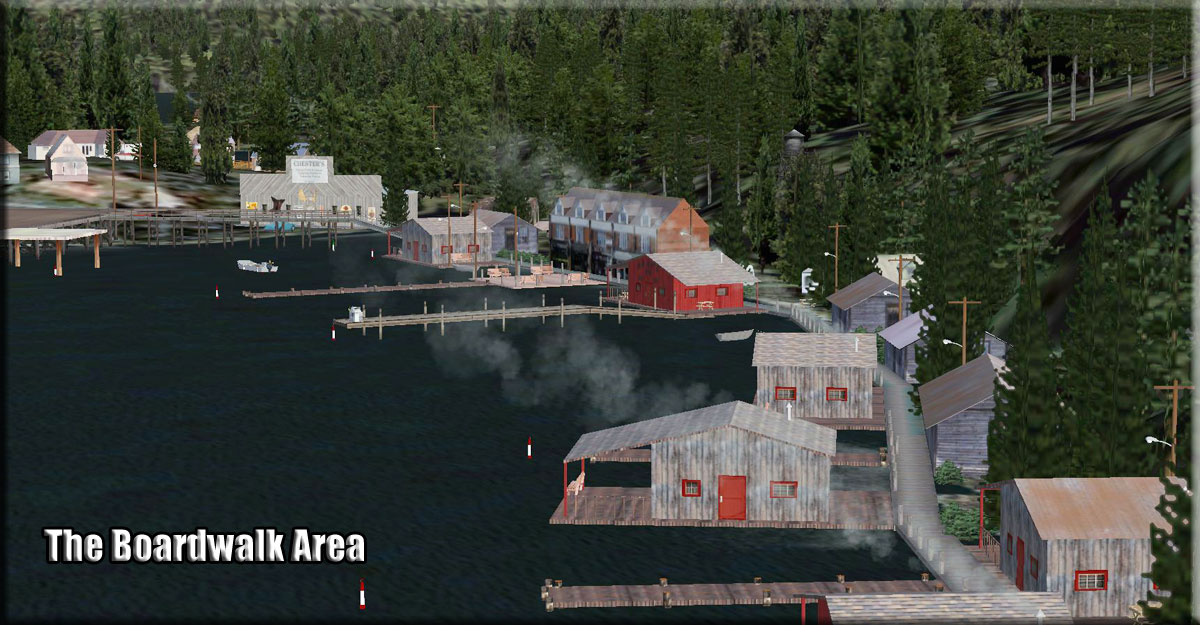
Point Protection First settled as a remote supply-stop for trollers, Wooden Wheel Johnson established a fuel dock, store, and fish buying station in the early 1900's. Later, in the mid-40's another colorfully named character, Buckshot Woolery, opened the B.S. Trading Post at this lonely site. Additions came in the next decade, including a warehouse but unfortunately the business closed in the early 1970's. As with Whale Pass, state land disposal programs have enabled the area to sustain a small year-round population. With a fleet of gillnetters and trollers that call Port Protection home, commercial fishing is the principal occupation. For tourists and travelers alike there are a number of area fishing lodges and the halibut fishing is excellent in these waters. The town itself is remarkable with numerous artists residing in Port Protection. Carving, painting, writing, and other crafts are year-round pastimes. Just walking the boardwalk through the woods here unveils secrets at every turn. Houses are tucked away like gems and the famed "Stairway to Heaven" provides access to an unparalleled view of the town and beyond from the ridge line above. (At the Dock) NOTAM: Lighted Helipad ... very well-done and highly-detailed little community. A good "start point" for flights. |
|
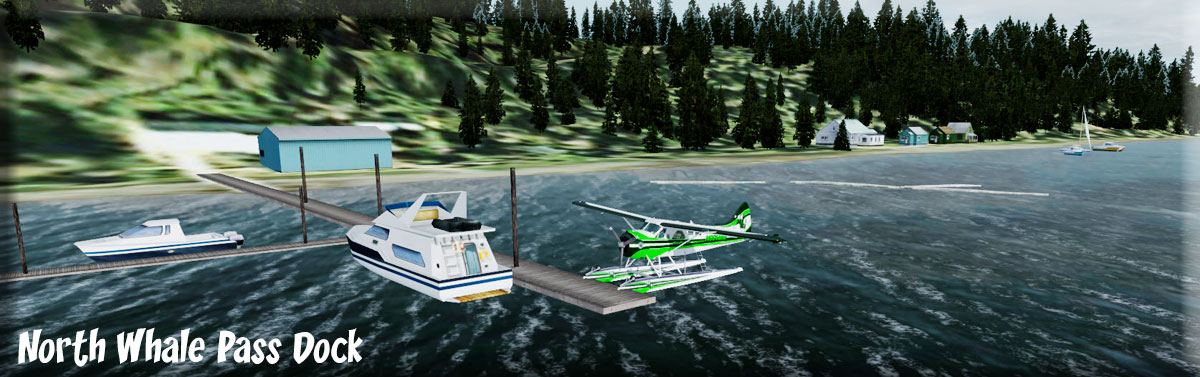
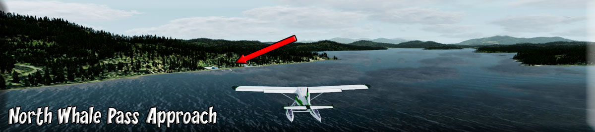
13 North Whale Pass |
North Whale Pass The area has been the site of logging camps continuously since 1964. In the early 1980s, the last camp moved out, and the area was permanently settled as the result of a state land disposal sale. The logging road was completed in 1981, and private phones were installed in 1992.
(Approach)
Many Whale Pass residents are homesteaders who enjoy a subsistence lifestyle. Due to declining enrollment, the school was closed for the 98/99 school year. Students are home-schooled. According to Census 2010, there were 61 housing units in the community and 20 were occupied. 87.1 percent white; 9.7 percent Pacific Islander; 3.2 percent of the local residents had multi-racial backgrounds. Additionally, 3.2 percent of the population was of Hispanic decent. NOTAM: Detailed community with AI traffic. |
|
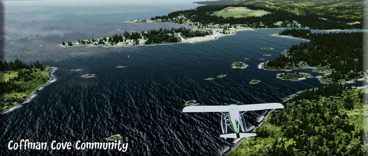
14 Coffman Cove |
Coffman Cove: A state-owned seaplane base is available. There is a boat harbor and launch ramp. Services include; overnight lodging with meals provided, RV park/campground, cabin rentals, guided fishing charters & stream fishing, vehicle rentals, out door recreational rentals, oyster sales, B&B’s, gas station, liquor store, gift sales, welding, construction & contracting, and a public library with wireless internet access. Our library is within walking distance of the harbor, very convenient for visitors.
Recreational fishing along shore, and in nearby streams is very admirable. Luck Lake offers a nice beach for camping with an amazing surrounding for kayaking, canoeing, swimming along with prime trout fishing. Eagle Creek, Luck Creek, and Log Jam Creek produce exciting stream fishing for tourists. Sweetwater Lake provides a fun adventure by kayak, canoe, or small boat through a lagoon that leads into Barnes Lake. Forest Service cabins available for overnight paddlers at both lakes. Tour the Honker divide canoe trail through peaceful radiant land. Accommodating board walk leads to Hatchery Creek Falls, with breathtaking views of Mother Nature. (Landing Approach) Access to Coffman Cove by paved road through the National Tongass Rain Forest has increased the economic vitality. The town served for decades as a base for loggers. The closing of Ketchikan Pulp Co. in 1997 compelled residents who stayed to find other economic niches. The town was named by Lt. Comdr. A.S. Snow, USN, after Lt. Dewitt Coffman, in 1886. The town has about 200 residents and can be accessed by two roads, boat, float plane, or ferry. Coffman Cove was founded as a logging camp in the 1950’s, but the economy is now centered mostly within tourism. The town has been incorporated since 1989. Coffman Cove is the only small community on the north end of Prince of Wales Island that is paved. (Coffman Cove Dock) |
|
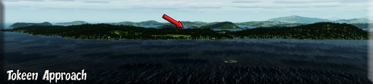
15 Tokeen |
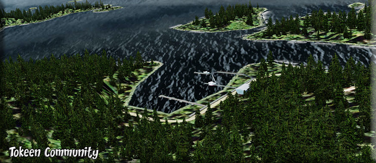
Tokeen: Long ago, Southeast Alaska Indian children played with dolls that had marble heads. Their parents had probably painstakingly chiseled the marble from deposits near Prince of Wales Island (near today's Ketchikan). In 1909, steam-powered machinery provided an easier way to remove the stone, and a new industry was born. One of the best known marble quarries was at Tokeen on Marble Island, off the west coast of Prince of Wales Island. Blocks of marble, some weighing as much as 11 tons, were quarried from the island and loaded onto flat cars. The gravity-operated cars traveled down narrow-gauge track to the beach, where the marble was loaded on barges for shipment to the Vermont Marble Company mill at Tacoma. There the stone was sawed and polished for use in buildings throughout the Northwest. Because of the high shipping costs, very little of the polished Tokeen marble was ever returned to Alaska. An exception is the marble used in the state capitol at Juneau, which has four pillars and much interior trim of Tokeen marble. At the peak of marble production, there were eight quarries employing 70 workers at Tokeen. The workers lived in bunkhouses, took their meals in the company dining hall, and worked six days a week for nine months of the year. The quarries yielded more than $2.5 million in marble before the operation ended in 1927. Most of the buildings at Tokeen have rotted away now, and the quarries are filled with water. In fact, one of the quarries served as a marble-lined swimming pool for loggers who harvested timber near the site half a century after the last block of marble had been carried away. |
|
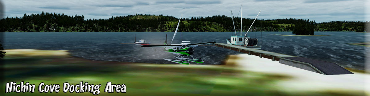
16 Nichin Cove (Naukati Bay) |
Nichin Cove: Named "Naukatee Bay" in 1904 by the U.S. Coast & Geodetic Survey, who recorded it as the local Indian name. It was a logging camp at one time, but later was settled as a Department of Natural Resources land disposal site. In 2002 Naukati Bay needed funds to assist in the community financial needs and obtained a grant from the State of Alaska and also with financial help from the United States Forest Service built a "Oyster Nursery". The Oyster Nursery raises oyster spat (seed) from as small as 3mm to a marketable 18mm-25mm (1") and sells the larger healthy oysters to the grow out farms in the area and across Alaska. Naukati Bay's Oyster Nursery has been the only successful nursery in Alaska and provides the oyster farmers with a premium product that gives the farmers a one year head start to bring their product to market as well as having a dramatically reduced mortality rate. The Naukati Oyster Nursery provides our community over $20,000 a year in revenue to be used for everything from supporting our youth to repairing our roads. |
|
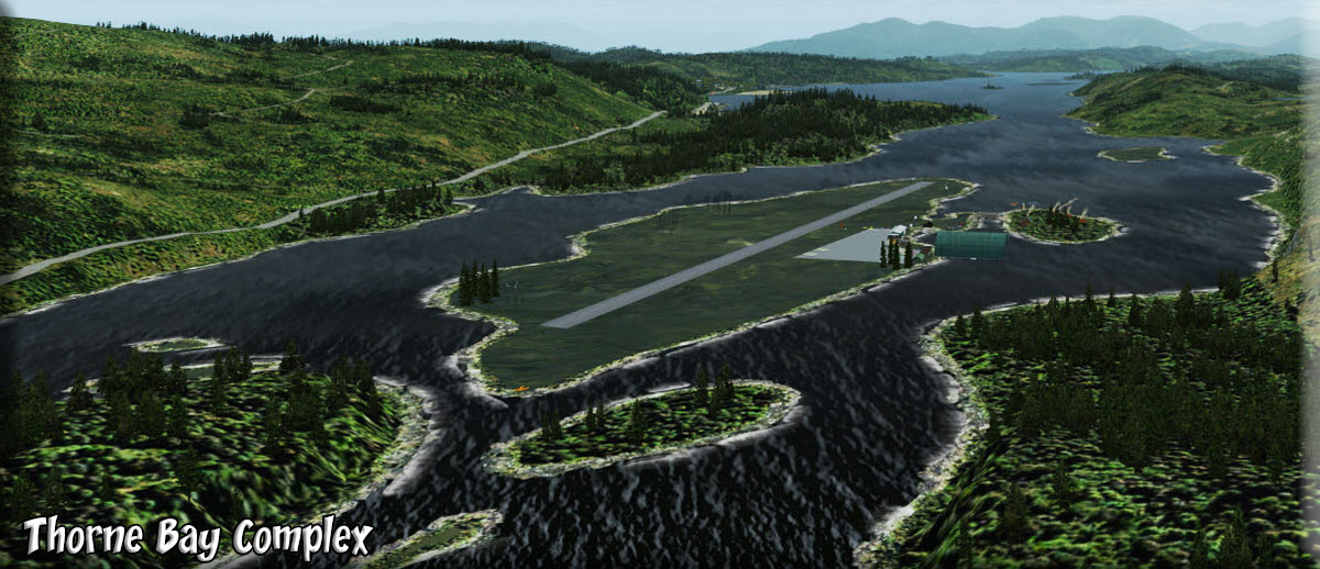
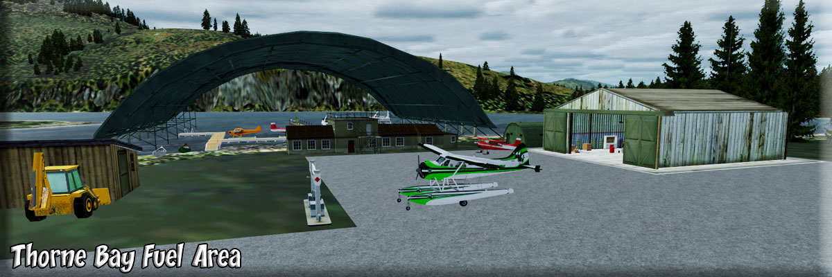
17 Thorne Bay |
Thorne Bay originally began as a large logging camp for the Ketchikan Pulp Company in 1960 that was originally located in Hollis. Being a floating camp at the time, most Hollis residents resided in float houses. In the 1960s and 1970s it was the largest logging camp in North America and was host to over 1500 residents at its peak. It became a second-class city in 1982 and in 2001 the logging company pulled out having been a victim of breach of contract from the U.S. Forest Service The U.S. Forest Service signed a contract in 1954 guaranteeing 150 mmbf per year for the pulp mill and sawmills in Ketchikan. By 1990 that figure was down to approximately 50 mmbf per year. Currently Thorne Bay features many seasonal residents and an employment sector based primarily in Forest Service and public education. In the1970's-80's Thorne Bay was the World's largest logging camp and it still holds the record. Thorne Bay also has the worlds largest tree grapple, which local teenagers call "the claw." The grapple is placed in front of the small town, with a sign that says Thorne Bay |
|
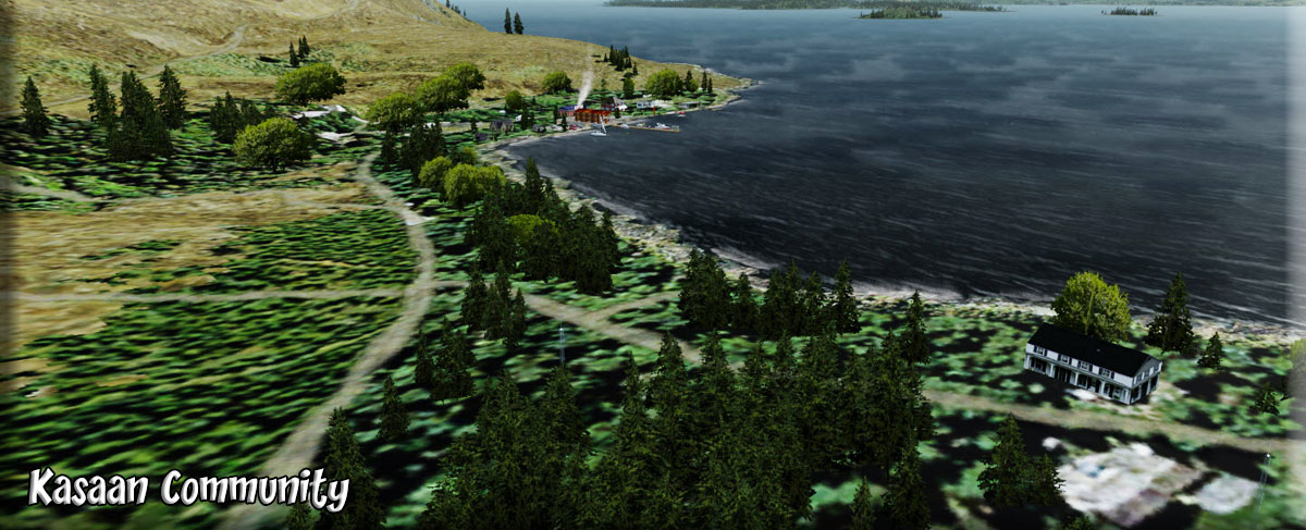
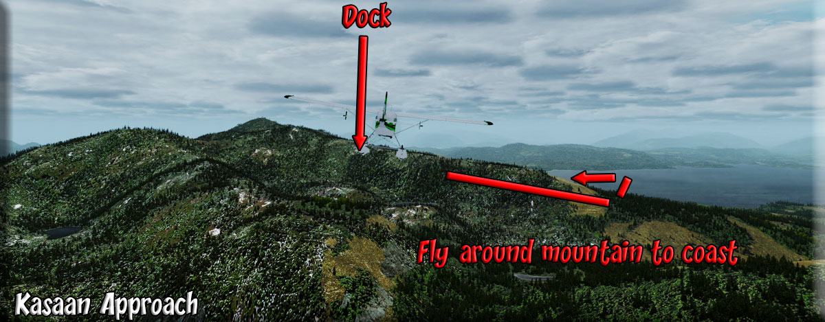
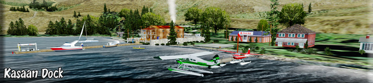
18 Kasaan |
Kasaan: Originally Tlingit territory, Kasaan gets its name from the Tlingit word meaning "pretty town." Haidas migrated north from the Queen Charlotte Islands in the early 1700s to the Island and established the village now known as "Old Kasaan," 7 miles south on Skowl Arm. In 1892 the Copper Queen mine, camp, sawmill, post office and store were built on Kasaan Bay, and the Haida people relocated to this new village. In 1902 the first salmon cannery was constructed in Kasaan. The cannery burned in 1907, 1910 and again in 1911, but was rebuilt each season. The cannery operated sporadically until 1953. During this time, Kasaan had a school, three stores, a Presbyterian Church and other businesses. Chief Sonihat built the Whale House, a traditional long house which became the focus of the new Kasaan Totem Park, established during the 1930s. Many of the totems left from the old village site were moved to the park in 1938. Kavilco, Inc., the local village corporation, purchased the old cannery buildings and property in 1974, and in 1980 removed the cannery buildings. Remnants of the historical Karta River village and petroglyphs lie north of the city, and the Old Tom Creek village and fort lie south of the city. Today, Kasaan was traditionally a Haida village, but the population has become mixed, with Haidas, Aleuts, Eskimos and non-Natives. Subsistence activities are a major contributor to villagers' diets. Most villagers participate in subsistence or recreational activities for food sources, harvesting deer, salmon, halibut, shrimp and crab. With the addition of tourism, the mainstays of that economy is fishing, mining and logging. |
|
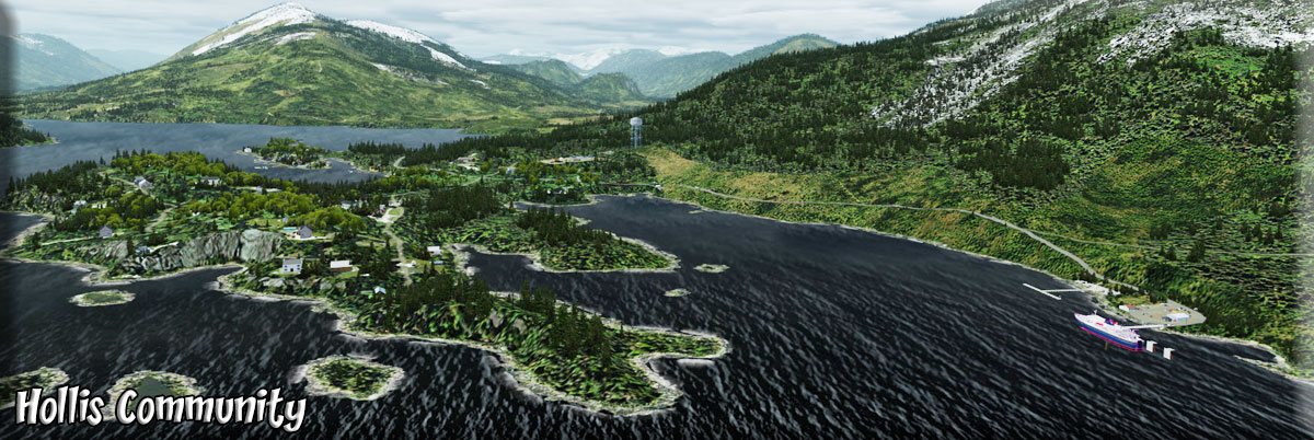
19 Hollis |
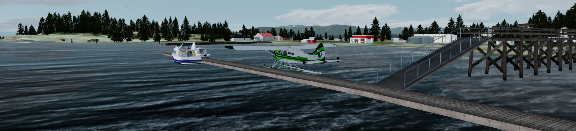
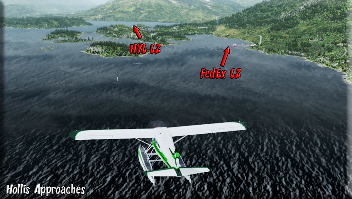
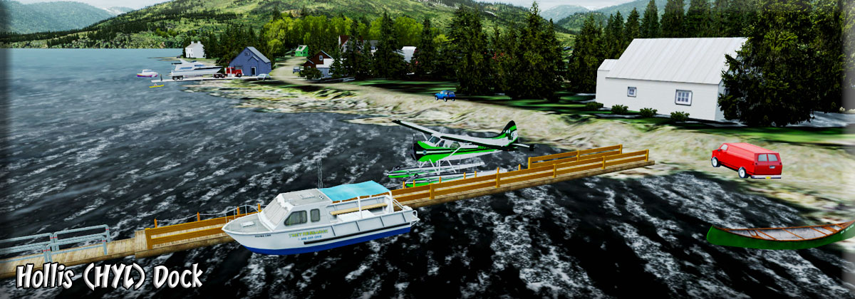
Hollis: Hollis was a mining town at the turn of the century, with a population of more than 1,000. Gold and silver were mined until about 1915. (Approach) (HYL Docking) (FedEx Docking) In 1953, Hollis became a logging camp when a long-term timber contract was enacted with Ketchikan Pulp Co. The camp served as the base for timber operations on Prince of Wales Island until 1962 when it was moved 45 miles north to Thorne Bay. The area was permanently settled in recent years through a state land sale. NOTAM: If houses are off the ground, reset mesh (world/mesh) to "2". Then reset it back to "5") |
|
1 Hydaburg (destination) |
Hydaburg: Returning to Hydaburg we fly a direct heading o 175 for 16.9 miles. The History can be seen at the first entry at the top of this Dispatch Ribbon. You have now gotten a "tour" of the Tongass Fjords Coastal Area. We hope you enjoyed the tour and learned some geographical and historical facts along the way. |
|
Copyright Return to Misty Moorings 2021
|