DISPATCHER'S | R E T U R N - TO - M I S T Y - M O O R I N G S |
|
|
| RIBBON |
B R I E F I N G |
|
Latitude: N55 15.59 |
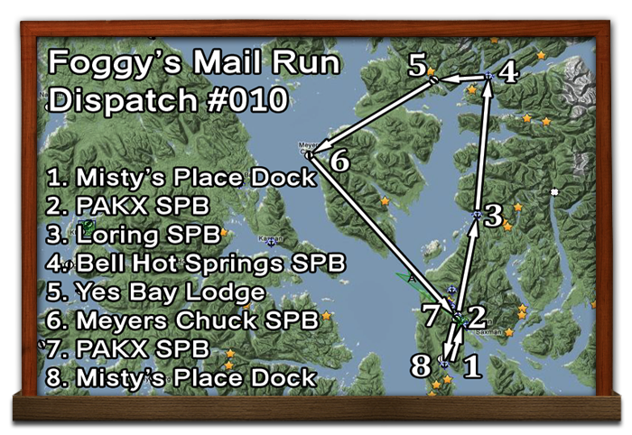
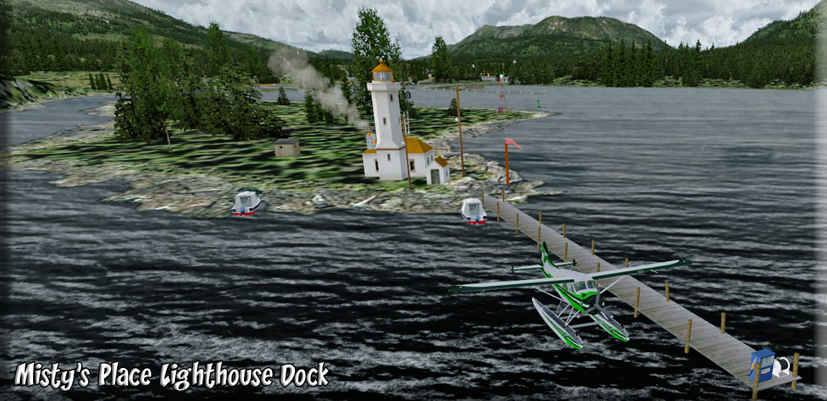
Foggy needs your help. Because he has to drive 80 miles tomorrow to an appointment, he's going to miss tri-weekly mail run for the area. He knows you are a good pilot and has asked if you would do the mail run for him, using either your plane or his. Foggy flies the Flight Replica Cub which has an optional Baggage Pod fitted under the cockpit area - that he keeps as a permanent fit. He'll let you borrow his plane. Fuel at start was 120lbs.Take the ferry across the Narrows and drive on down to Misty's Place and she'll have it fueled up for you and moored at the dock (mooring to left). You can download the flight plan here. On the seat of the plane is a note from Foggy giving you some helpful navigational instructions: |
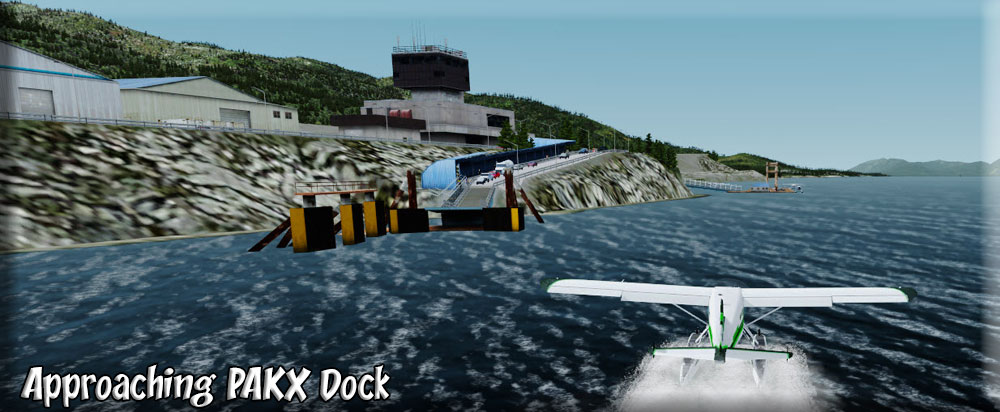
| 2 Ketchikan SPB (PAKX) ------ Direct Heading: 357 Distance: 6.0 m Way Point: PAKX |
Foggy: "I usually fly from Misty's Place over to the dock at PAKX to pick up about 160 pounds of mail and packages. Some I strap into the back seat! If the clouds are low you may want to fly the Nichols Passage to Tongass Narrows instead of flying over the mountain. Be sure to check with PAKT as you will be crossing their airspace and patterns." |
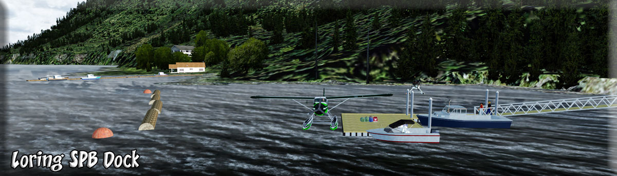
| 3 Loring SPB (13Z) ------ Direct Heading: 348 Distance: 14.0 m Way Point: 13Z |
Foggy: " If the weather is good and you fly directly to Loring, the mountains area bout 3000 feet. Usually it is just as easy to fly a 300 heading up the Narrows until Guard Light is at 270, then turn to 021 for 11.1 miles... this will take you right to Loring SPB and you won't need a lot of altitude. This is what I call the " Clover Passage route". For an easy way point, if you fly directly over Hump Island, you will be 6.5 miles from Loring on a heading of 019. Hump is a good way point to watch for, you'll fly right over Grant Island then settle in for the approach.. Tell Mac at the dock I'll see him on the next run." |
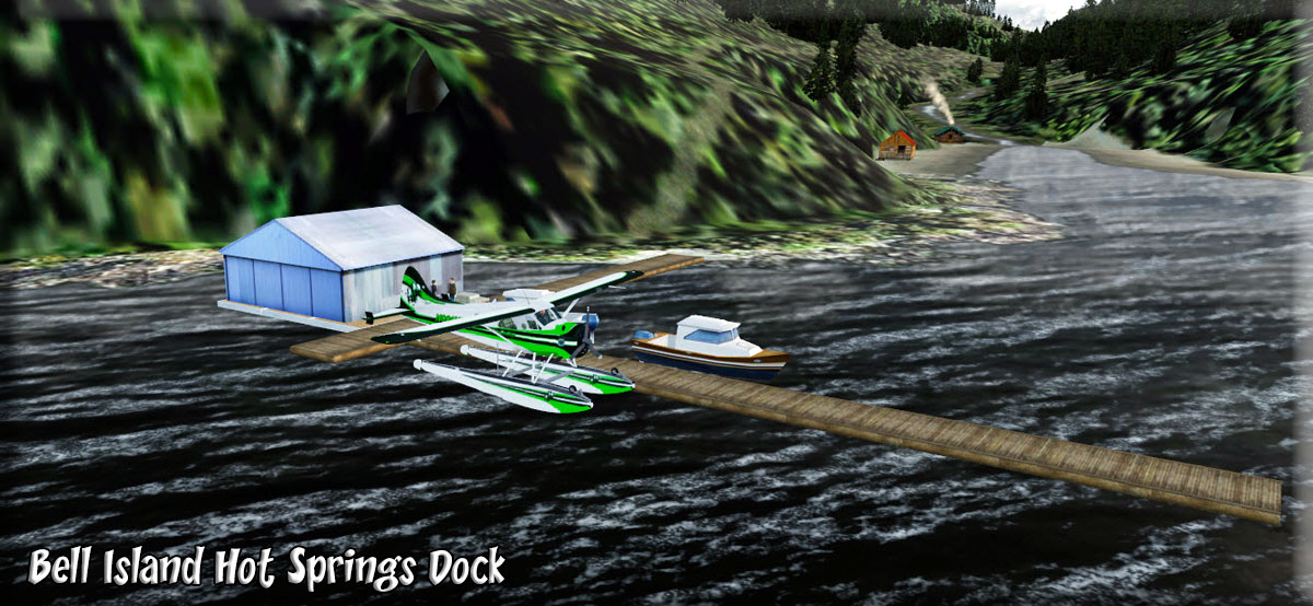
| 4 Bell Island Hot Springs ------ Direct Heading: 345 Distance: 18.8 Way Point: KBE |
Foggy: "Bell Island is only about 20 miles flying directly on 345. Tall mountains between so best to just take off on a heading of 250 , round Indian Point (2 miles) to starboard and fly the coastline about 345. Traitor's Cove will pass to port about 4 miles ahead. Then watch for Bushy Point 2 miles ahead. You'll pass Chin Point and Nose Point then Braun Point comes into view. Gedney Bay goes off to starboard. Watch for Blind Pass (to the starboard side of Black Island). You can follow Blind Pass right to Bell Island Hot Springs. As you pass over Blind Pass Cabin, give the wings a waggle for me, Ben and Krista are renting that cabin for the week. Coming out of Blind Pass at 030, Bell Island is 3 miles dead ahead.. Drop off the packages at the dock and get the mailbag from Sammy who'll be watching for you." |
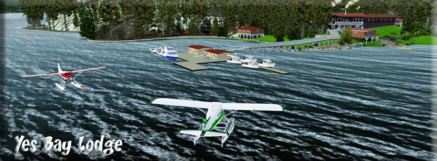
| 5 Yes Bay Lodge ------ Direct Heading: 248 Distance: 6.2 Way Point: YBL1 |
Foggy: "Take off about 210 heading for Yes Bay Lodge. Black Island is 3 miles ahead. Fly to starboard to have it pass by to port and Yes Bay is only 3 beyond Black Island. Fly to the starboard shore of the channel. At Syble Point turn to starboard into Yes Bay and follow it for 3 miles, Yes Bay Lodge is ahead to starboard. I always carry the bags up to the dock to the lodge for them. And they ALWAYS offer me a cup of coffee and a breakfast roll for my trouble ... the rolls are "to die for" ... Marge will pull a hot one for you out of the oven ... BEST part of the trip!!" |
| 6 Meyers Chuck SPB (84K) ------ Direct Heading: 212 Distance: 18.1 Way Point: 84K |
Back at the dock, we are ready to head to Meyers Chuck. So you pick up Foggy's note and read what is next: Foggy: "Best to take off about 120 and fly to the end of Yes Bay. At Bluff Point (the end of the bay), I usually turn to starboard to 223 and follow that heading 18 miles to Meyers Chuck. I pick up the gps heading and fly that over Spacious Bay and the flatlands ahead. In low ceiling weather, this is a good route, it is very flat. The water ahead is Vixen Inlet. Stay low and follow it's port shoreline. Union Point juts out into the water, fly over it and set a heading of 125 and you'll be at Meyers Chuck in 5 miles. I always make a swing out over Hisery Island then cut sharply back to port to line up on "the chuck". Mike will help you with the mail bags." |
| 7 Ketchikan SPB (PAKX) ------ Direct Heading: 117 Distance: 29.0 Way Point: PAKX |
Foggy: "From the dock at Meyers Chuck, I head about 190 for take off (the radio antenna to port). Once out over the water, set a heading for Ketchikan PAKX ... about 20 miles over water. Head about 154 and keep the shore line about 1 mile to port. At Niblick's Point (widest part of the island) turn to 100 and head over Guard Lighthouse and into the Tongass Narrows to land at PAKX." |
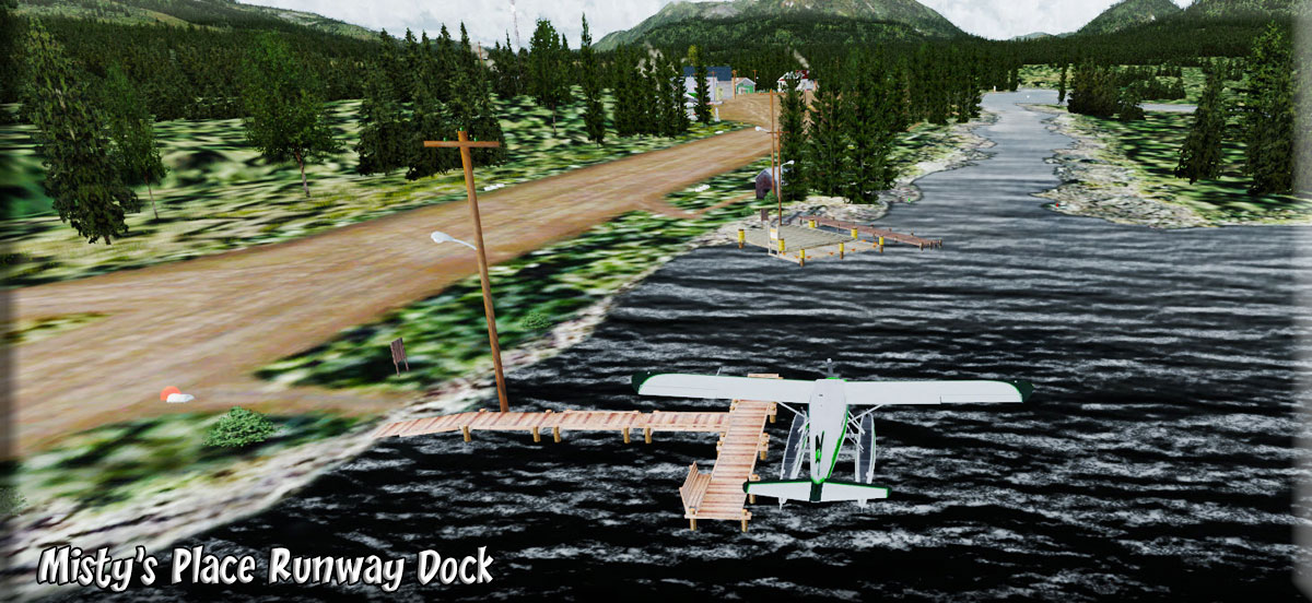
| 8 Misty's Place (PF21) ------ Direct Heading: 177 Distance: 6.6 m Way Point: PF21 |
Foggy: "Don't forget to pick up items that might have come in that need to go to Misty's Place, sometimes old Jake just doesn't remember. Then you head of down the Tongass Narrows over Pennock Island, turn to starboard into Nichols Passage, watch for Bostwick Inlet to starboard ... turn into it to starboard and line up on Misty's Place. If you call ahead, she'll probably be at the dock in the golf cart with a cup of coffee for you. I'll fuel up the plane when I'm back tomorrow. Thanks for helping out." |
Copyright Return to Misty Moorings 2021
|