DISPATCHER'S | R E T U R N - TO - M I S T Y - M O O R I N G S |
|
|
| RIBBON |
B R I E F I N G |
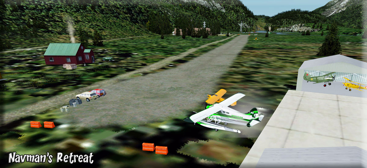
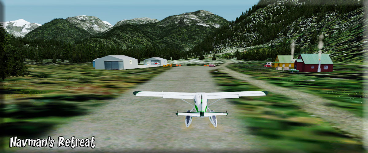
1 Navman's Retreat |
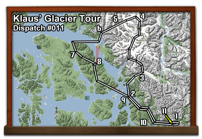
We start of at the runway (on land) at Navman's Retreat (coordinates to the left). We will fly to Wrangell to pick up our tour people, then head up over LeConte and Baird Glaciers making some scenic stops along the way. Leaving the glaciers we fly to a USFS cabin for a "wave" if in a plane, or a landing if in a helicopter. We then fly on to Peterson-Johnson Airport for passenger pickup/dropoff. Back to Wrangell down the Blind Slough. Drop off most of the passengers and head for Harding River USFS Cabin to drop off a passenger, then back home to Navman's Retreat. Your flight plan is HERE ... it only is from Wrangell over the glaciers and back to Wrangell ... getting from and to Navman's Retreat is your navigation choice. |
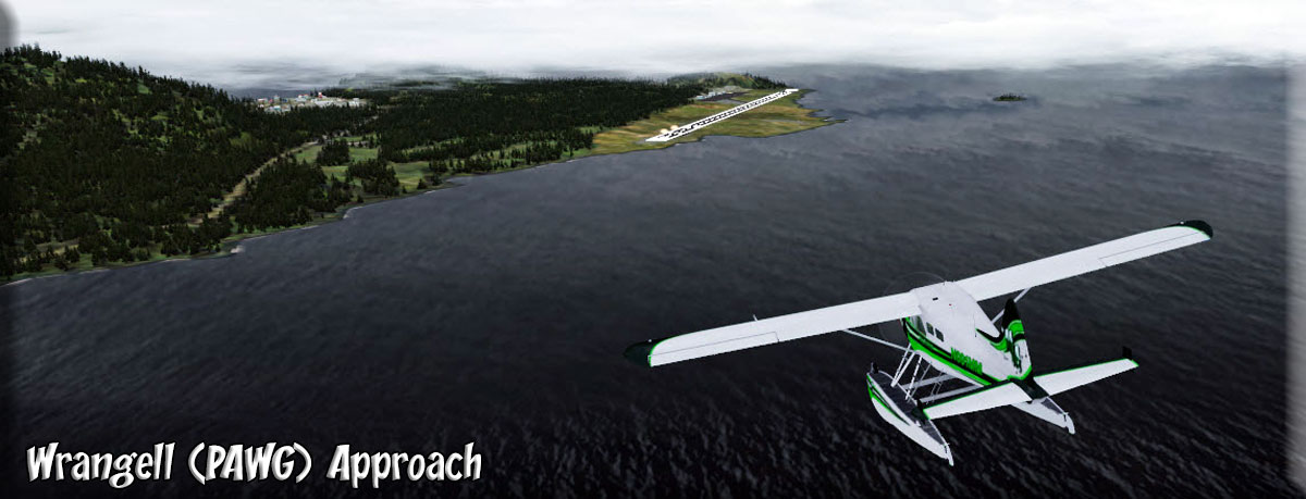
| 2 Wrangell (PAWG) ------ Direct Heading: 227 Distance: 33.9 m Way Point : PAWG |
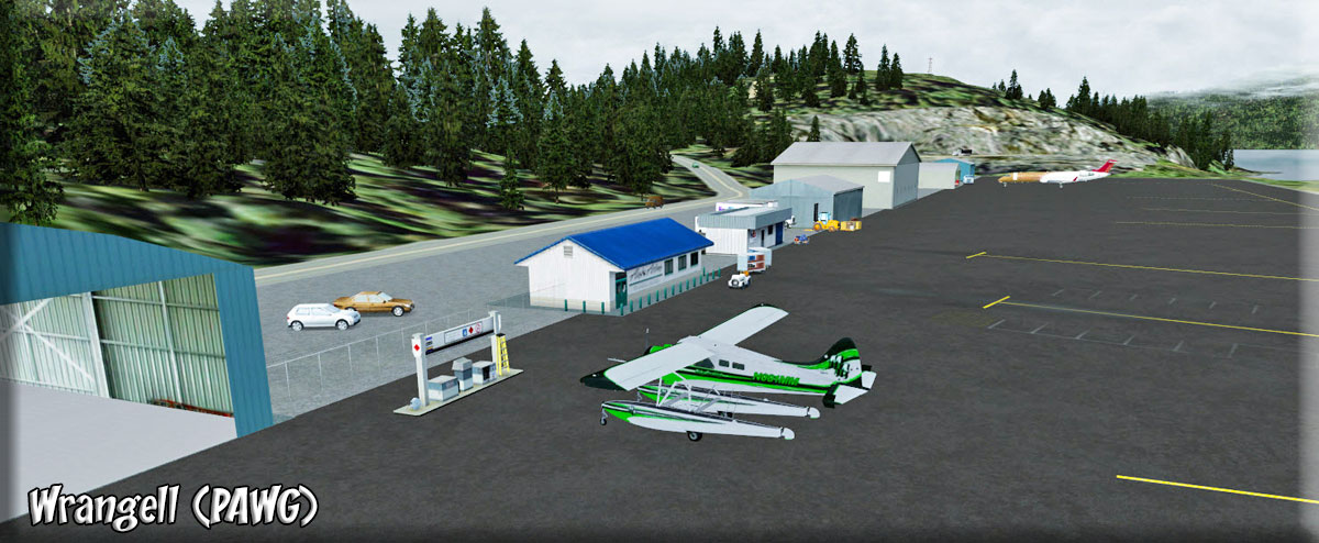
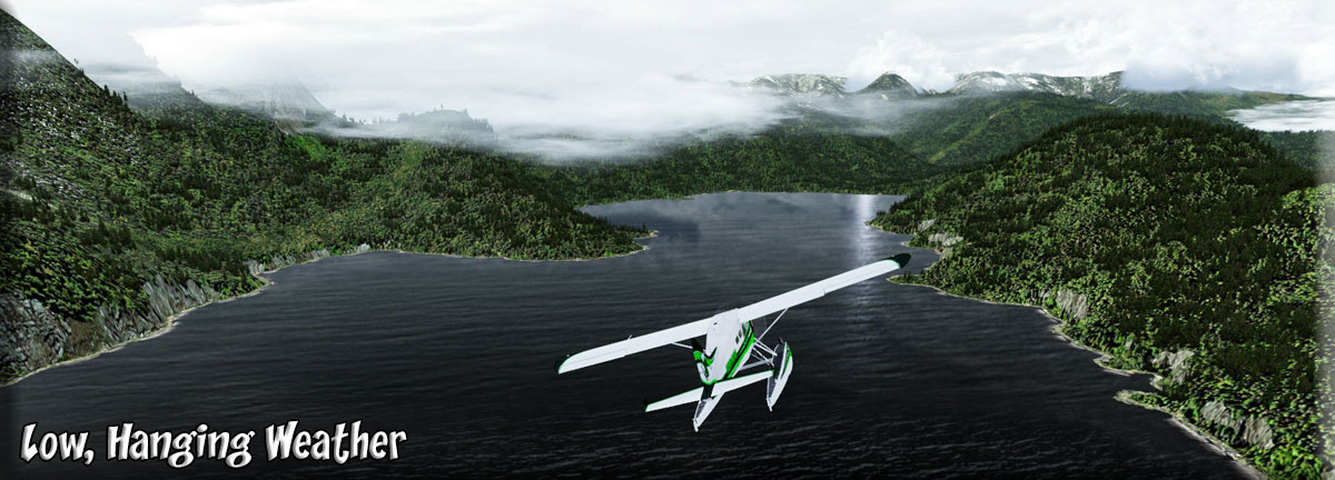
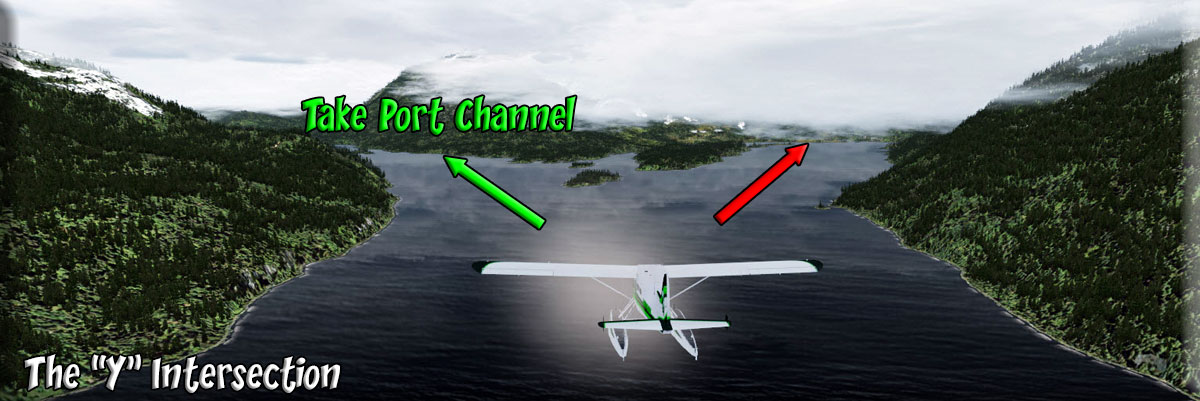
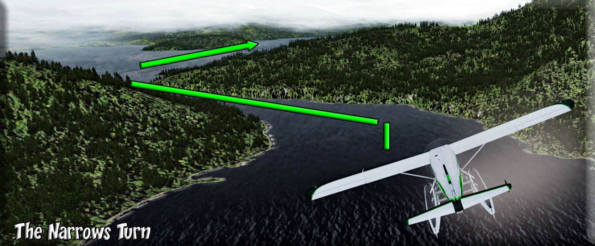
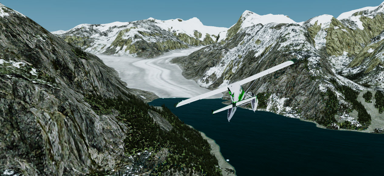
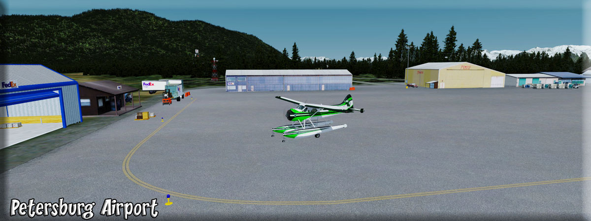
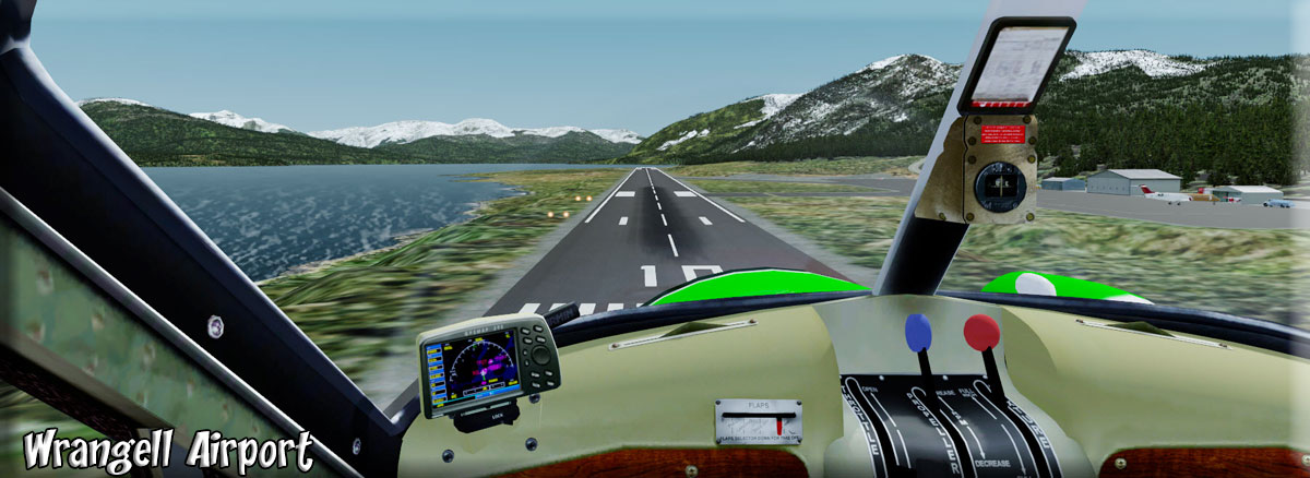
"How" you fly this dispatch depends on the weather. The VFR instructions will get you from here to there safely if the weather is "low" and "hanging" as it often is in this area. Otherwise, you can fly at a higher altitude using the direct PAWG. (But you will miss some beautiful scenery if you do). NOTAM: If weather ceilings are low, it is best to postpone this flight. You will be flying through all altitudes on this route and there is little instrumentation available. "Cold Fronts" is the best weather for this dispatch. Leaving Navman's Retreat, we fly 247 up the Bradford River which becomes the Bradford Channel. Turn to port into the Blake Channel and follow it to its end where you will stay to the starboard shore. You come to a "Y" intersection (see screenshot) and you take the port channel. You will come to a "narrows" where the channel turns hard to port then back to starboard, now follow the channel all the way to Wrangell, ahead 10 miles. (Approach) Land and pull up to the building with the blue roof. Your tour passengers are waiting for you there. You are headed for the entrance of the Stikine River and the LeConte Glacier. |
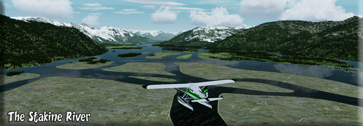
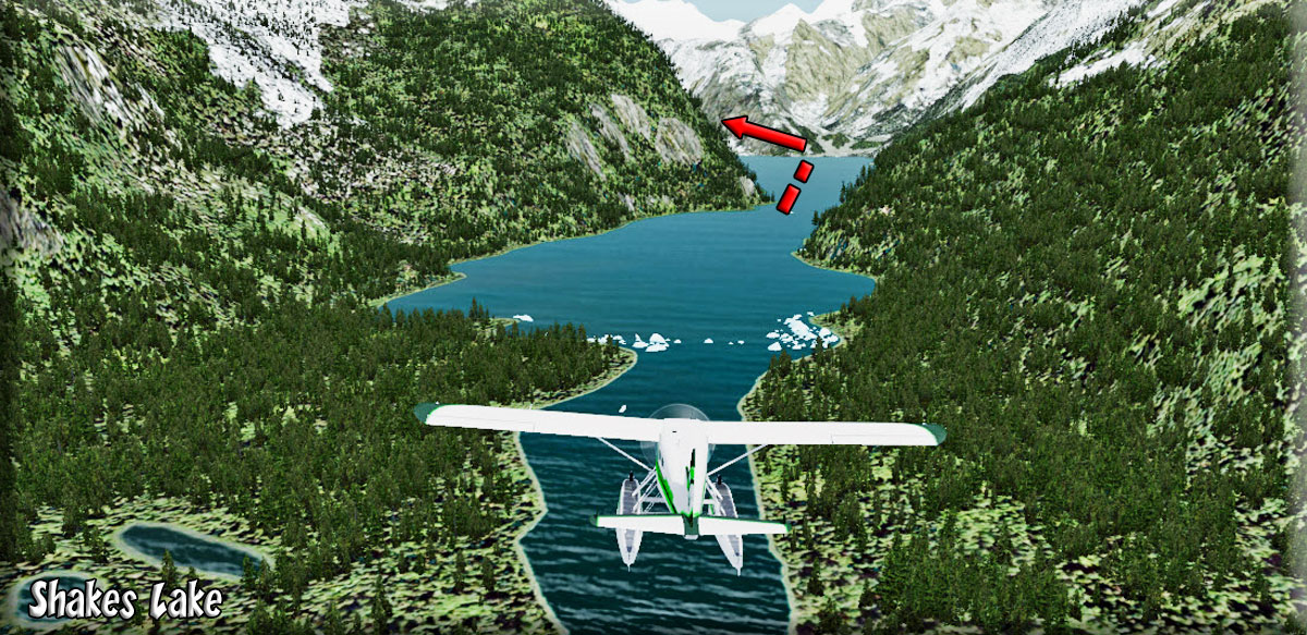
| 3 Shakes Lake/Stikine River ------ Direct Heading: 360 Distance: 18 m Way Point : R460A Way Point : R528A |
(Set Way Point for R460A, Koknut USFS Cabin) You welcome your passengers aboard and tell them what to expect. From Wrangell fly 330 for 7.2 miles to the outfall of the Stikine River then turn up the river (about 026) for 11 miles. (Reset Way Point to R528A). As you approach R528, watch for a narrow "lake" to port, make a port turn to fly over that lake. This leads to Shakes Lake. Here you will begin to see icebergs that have "calved" off of the LeConte Glacier ahead at the end of Shakes Lake. Be ready to start climbing and turning to port to head up the glacier. Here's some information to share with your passengers: Flight Seeing Info: The river is navigable for approximately 210 km (130 mi) upstream from its mouth. It was used by the coastal Tlingit as a transportation route to the interior region. The first European to explore the river was Samuel Black, who visited the headwaters during his Finlay River expedition in 1824. It was more extensively explored in 1838 by Robert Campbell, of the Hudson's Bay Company, completing the last link in the company's transcontinental canoe route. In 1879 the lower third was traveled by John Muir who likened it to "a Yosemite that was a hundred miles long". Muir recorded over 300 glaciers along the river's course. The Grand Canyon of the Stikine has been successfully navigated by less than 50 expert whitewater kayakers. It is considered one of the world's most difficult whitewater rivers in that particular section. From 1897 to 1898 it furnished one of the laboureous routes to the Klondike Gold Rush in the Yukon Territory. Several railway schemes were floated to provide an "All Canadian" route to the Dawson goldfields—A Teslin Railway, Omineca Railway, and the Canadian Yukon Railway promoted by the CPR. Railway contractors were hired and ready to build the route, though the Federal Senate and American government prevented the five hundred mile project from proceeding. Several river steamers were built to haul materials to Glenora to aid the project. The first road bridge was built across the river in the 1970s as part of the Stewart-Cassiar Highway. In 1980, BC Hydro began to study the feasibility of building a five-dam project in the Grand Canyon, however the plan quickly led to opposition by conservation groups and a long struggle over the fate of the river. The mouth of the river in the United States provides a habitat for migratory birds and is protected as part of the Stikine-LeConte Wilderness Area. The river is noted for its prolific salmon runs despite heavy depletion by commercial fish traps during the early 20th century. The force of the current in the river's Grand Canyon limits the salmon runs to the lower one-third of the river, and to its lower tributaries. You now should be approaching WayPoint R528A, it is for the "Shakes Lake Slough USFS Cabin" which you can point out as you fly over. However, here you turn 90 degrees to port to head for the glacier flying over Shakes Lake. |
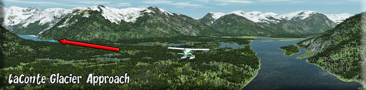
| 4 LeConte Glacier ------ Direct Heading: 352 Distance: 25 m Way Point : SRC5 Way Point : SRC6 |
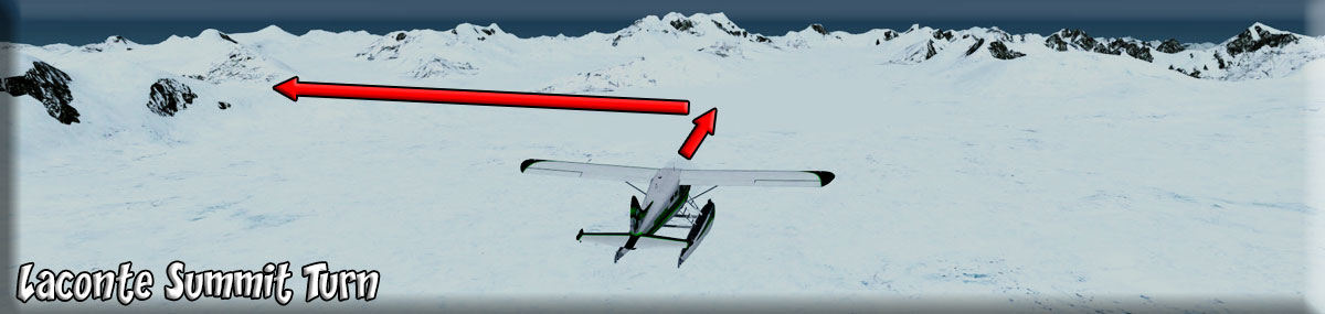
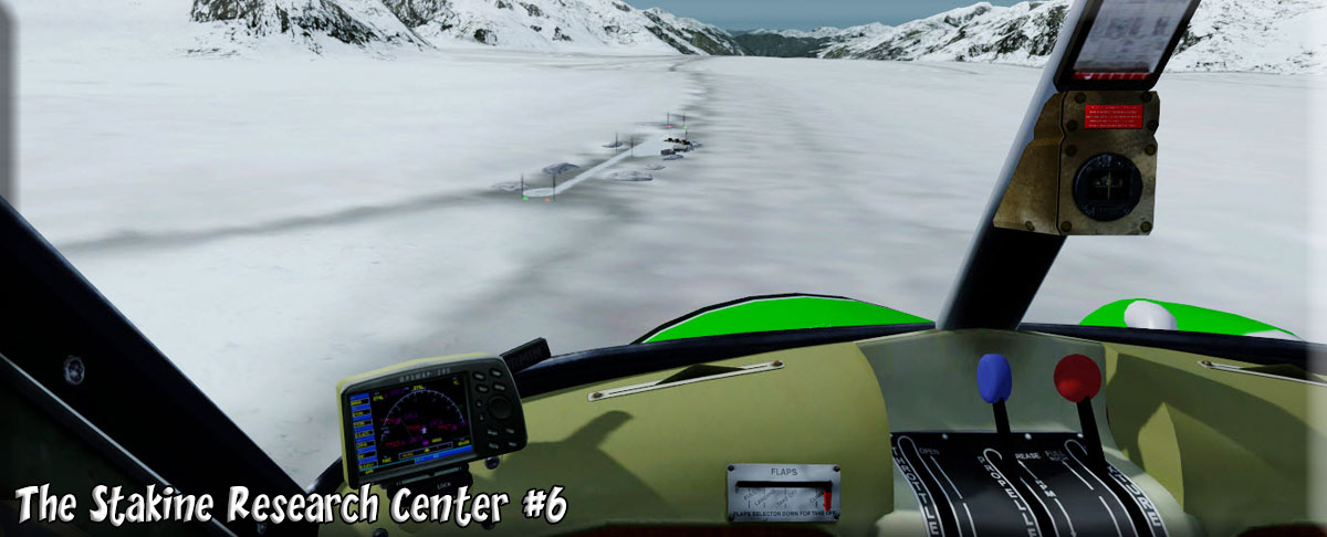
At the end of Shakes Lake, we encounter the LeConte Glacier and begin climbing to 8,300 feet following the curves of the glacier. At the initial split, fly to port. Follow the glacier. You will see Devil's Thumb in the distance, when the glacier splits higher up, stay to port heading toward Devil's Thumb. Flight Seeing Information: Near this south end of the Stikine Icefield, LeConte Glacier is the southernmost active tidewater glacier in the northern hemisphere. Since first charted in 1887, it has retreated almost 2.5 miles. Today, LeConte is considered in a stable position. Due to the deep water (810 feet) of the bay, LeConte calves instead of advancing. (Thomas Bay, in contrast, is about 300 feet deep.) Beginning in 1983, measurements of LeConte's terminus (the point farthest from the head of the glacier) have been taken by Petersburg High School students. Results show the glacier generally moves forward in the spring after the cold winter weather decreases melting. In the fall, after warmer summer temperatures, it retreats. As Devil's Thumb passes to port, tell them about it: (Follow the glacier to as it curves to starboard) If you have climbers aboard, they may ask you to circle Devil's Thumb ... it is quite a site up close! When the glacier splits 2 mile ahead, take the port branch. Devils Thumb, or Daalkunaxhkhu shaa in Tlingit, is a mountain in the Stikine Icecap region of the Alaska-British Columbia border, near Petersburg. It is named for its projected thumb-like appearance. Its name in the Tlingit language has the meaning "the Mountain That Never Flooded" and is said to have been a refuge for people during Aangalakhu ("the Great Flood"). The most famous feature on the Devils Thumb among climbers is its unclimbed Northwest Face, rising 6,700 ft (2,042 m) from the Witches Cauldron at its base to the summit, at an average angle of 67 degrees. This is the steepest face of this size in North America. The conditions prevalent also make it perhaps the most dangerous climbing proposition on the continent. The first ascent of the Devils Thumb was a landmark in North American mountaineering. Fred Beckey, along with Clifford Schmidtke, and Bob Craig, climbed the East Ridge, a route that combined technical difficulty equal to anything ever climbed on the continent to that time with great remoteness and terrible weather conditions. The infamous Northwest Face has seen many failed attempts starting in 1977 (possibly earlier), through the present; at least three teams have died on the face. In 1977 Jon Krakauer successfully climbed the East Ridge of the Devils Thumb. Use WayPoint SRC5 (Stakine Research Center #5 as a guide. Watch your map! You can land at the Stakine Research Center #5 or do a "touch and go". Continue across the glacier summit, watch the flight plan map for a slow turn to port. You will see a ridge of pointed peaks across the horizon, this is where you start you port turn. You can use WayPoint SCR6 for the #6 Stakine River Research Station. You can also do a touch and go there if you like. When the LeConte ends, you will see ragged mountain peaks ahead, but look to port and you will see the beginning of the Baird Glacier. This is where you should land and let your guests walk "on top of the frozen world" of LeConte Glacier and looking down the river of ice that is the Baird Glacier. You can land on the glacier. Break out the hot coffee and pass it around. |
| 5 Baird Glacier ------ Direct Heading: 219 Distance: 25 m Way Point : SRC6 |
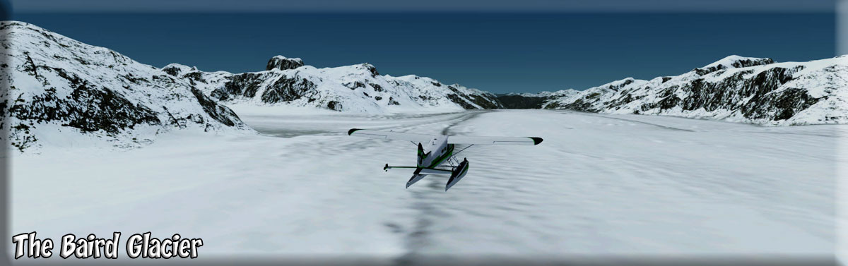
After coffee, pictures and congratulations ... everyone gets back into the "WARM!" aircraft and prepares for a beautiful run down the Baird Glacier ... almost a straight river of ice. Flight Seeing Information - This glacial valley was carved only recently (in geological time) and the many floods from ice dam breaks has continued to slow the growth of plants that will eventually take over. The glacier itself, seen in the distance, has not receded much in recent years, however, its height has dropped dramatically. A few years ago when we walked up onto the moraine, we needed to take a few step up onto the ice, now we walk down the moraine about 20 feet to get to the ice! On higher ground where the flood waters and tide have not reached, mosses, lichens and fungi were the first to take hold. Followed by the first flowering plants, Dwarf Fireweed, and grasses. The Alders are a very recent addition. You can also land at the Stakine River Research Center #6. Once you pass WayPoint SRC6, you follow the Baird Glacier. |
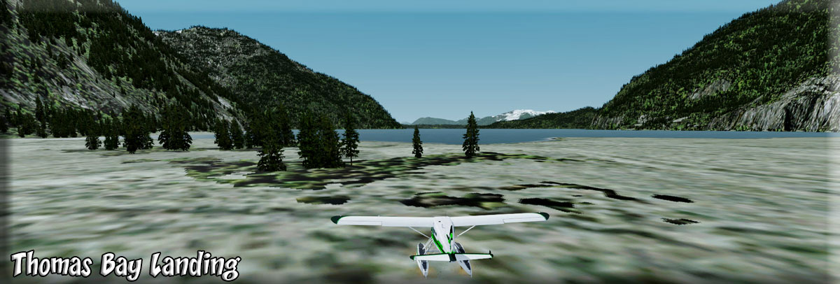
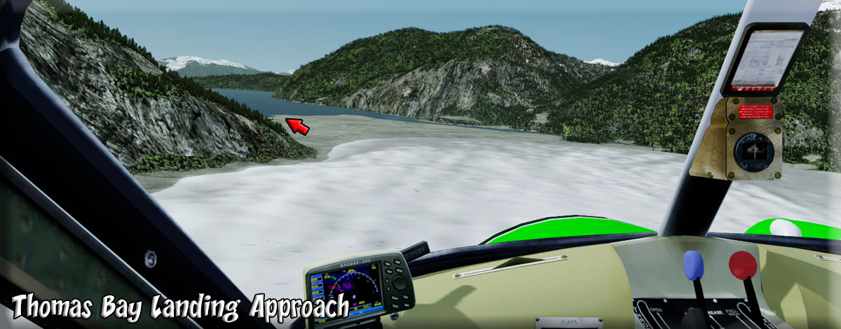
| 6 Thomas Bay Landing ------ Direct Heading: 221 Distance: 20 m Way Point : R542A |
We now fly down the Baird Glacier. You will see Oasis Glacier coming in from the starboard side. Begin preparing for landing when you see this feature. We land at the foot of the glacier so the guests can get a good look at Thomas Bay and see the beautiful wildflowers that grow in this area. (You can use WayPoint R542A to give you a bearing for Thomas Bay). (Approach) Flight Seeing Information - Thomas Bay is known for being rich in gold and quartz. The wildlife has moose, brown bears, black bears, squirrels, wolves, rabbits, and other common Alaskan creatures. The land has been used for logging. in 1900, the first documented account of the legendary devil creatures came to be thanks to Harry D. Colp, who wrote his account down. Harry Colp and three of his prospecting friends who are simply known as Charlie, John, and Fred, were staying in Wrangell, Alaska. As the story goes, Charlie received word from a native local of an area to mine for gold.
Charlie went to check out the native man's story of the gold that was to be found in the mountains in May 1900. By the time he returned, June 1900, he arrived without a coat or his hat, his canoe was empty, and looked like he had been "through hell". He did carry with him a large piece of quartz. Charlie claimed to have arrived in Thomas Bay, but couldn't find the half-moon shaped lake. Instead he spent some time off an 'S' shaped lake (actually called Ess Lake). He claimed that the surrounding area seemed oddly void of life. There were no squirrels, no birds, etc. Wanting to get his bearings after he found his large chunk of quartz, he climbed to the top of a ridge. From there he could spot Frederick Sound, Cape of the Straight Light, the point of Vanderput Spit (Point Vanderput), and Sukhoi Island from the mouth of Wrangell Narrows. Behind the ridge, Charlie finally spotted the half-moon shaped lake, which is where the Patterson Glacier turns into a lake that turns into Patterson River. We return to the aircraft and fly across Thomas Bay. We are headed next to the Portage Bay Dock Area. |
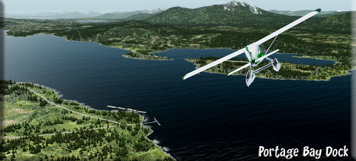
| 7 Portage Bay Dock TF11 ------ Direct Heading: 193 Distance: 17 m Way Point: TF11 Way Point: R497A |
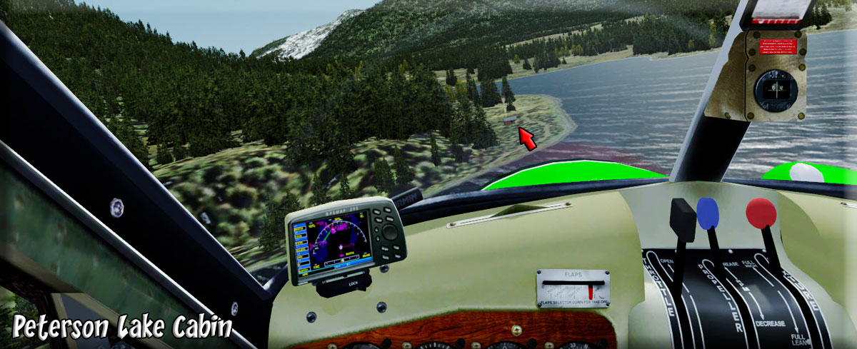
From Thomas Bay, we fly 180 for 5 miles at the exit of the bay at Spurt Point (R542A) and then set a heading of 248 for 14 miles, WayPoint TF11 for Portage Bay Dock. When we come to the coast, we keep the coast line to port, we find Portage Bay and fly over Portage Bay Dock. We turn to 125 flying down the bay toward Peterson Lake 10 miles ahead. The end of the lake is called Goose Cove. Fly a little to port to follow the valley to Peterson Lake. The Duncan Peaks will pass to starboard. We will fly over Peterson Lake Cabin (R497A). One passenger's wife is staying at this cabin. We do a low fly-by and he'll call her on the phone so she can take a picture of us coming over. The cabin is on the port shore. |
| 8 Petersburg (PAPG) ------ Direct Heading: 092 Distance: 7 m Way Point : PAPG |
From the Petersburg Lake USFS cabin, we fly 097 for about 7 miles to the Petersburg Airport. As you approach the airport, if the wind is right, fly over the little town by turning to port, then set up to land on Runway 22. We pause here at the airport for refreshments and fuel. There is a Brad's BBQ at the midway ramp. A short stop and we are on our way to Wrangell. |
| 9 Wrangell (PAWG) ------ Direct Heading: 112 Distance: 28 m Way Point: TF17 Way Point: TG1- |
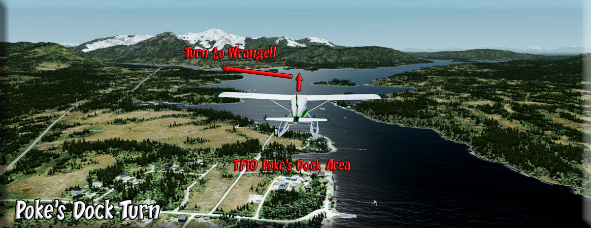
We leave Johnson Petersburg and fly down Skow Bay on a heading of 144 for 9 miles. You will see the a valley veering off to port, follow it. Toward the end, you will see the Blind Slough ahead about 1 o'clock (it is a short bay). Fly over it. Set the waypoint for Tonka Mountain Dock TF17 which we will fly over. Then set for TF10. Poke's Landing Dock, a few miles after Poke's Landing, which we also fly over, there is a "Y" water intersection ahead, take the port channel. Set the GPS for PAWG and fly to Wrangell. (Approach) You land and drop off the passengers who have cameras full of pictures and a head full of memories of a lifetime. After everyone says good-bye, you and you last passenger take off for the USFS Harding River Cabin. |
|
----- |
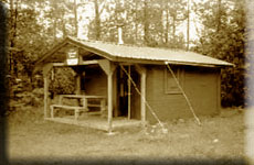
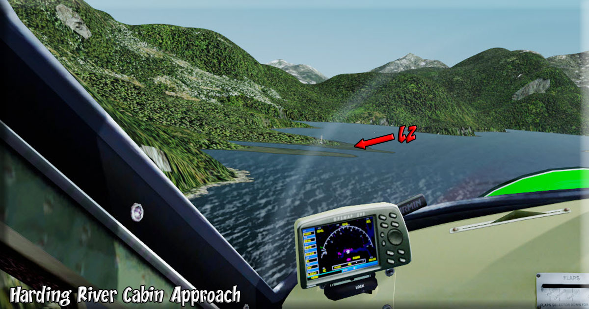
We fly up the Eastern Passage about 110 for 10 miles. Toward the end of passage, turn 90 degrees to port going over "The Narrows" then coming back to starboard to follow the Blake Channel. When we reach the Bradford Channel, we turn to port (069) to fly up the Bradford Channel. The USFS Cabin is on the port shore about 8 miles ahead. (Approach) There is a "flat area" in front of the cabin that you can land on, the best way is fly to the far side (across the channel from the cabin) of the Bradford Channel then turn to head directly for the cabin, landing in front, toward the cabin. Tricky but, you are good! You drop off the passenger, help him with his luggage and head back to take off for home. |
| 11 Navman's Retreat ------ Direct Heading: 056 Distance: 5.1 m Way Point: R188A |
Alone in the cockpit (at last!). You take off to head home back to Navman's Retreat ... only a five mile up the Bradford River ... watch for it to starboard. You land, tie down the plane, clean up the cockpit and head to the little office to write up the paperwork. You think about the many new memories the people in your tour group now have. But each time we make the trip up over the glaciers it is as thrilling as the first time and we too add even more memories of our own. You pour a cup of coffee and walk out and sit by the water to enjoy watching the sunset nestle in among the mountains giving way to a crisp Alaska night. A great trip, a great day. |
Route by Klaus Troeppner
Dispatch by JD Linn Copyright Return to Misty Moorings 2021 |