DISPATCHER'S | R E T U R N - TO - M I S T Y - M O O R I N G S |
|
|
| RIBBON |
B R I E F I N G |
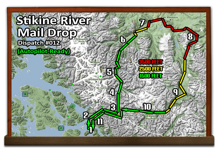
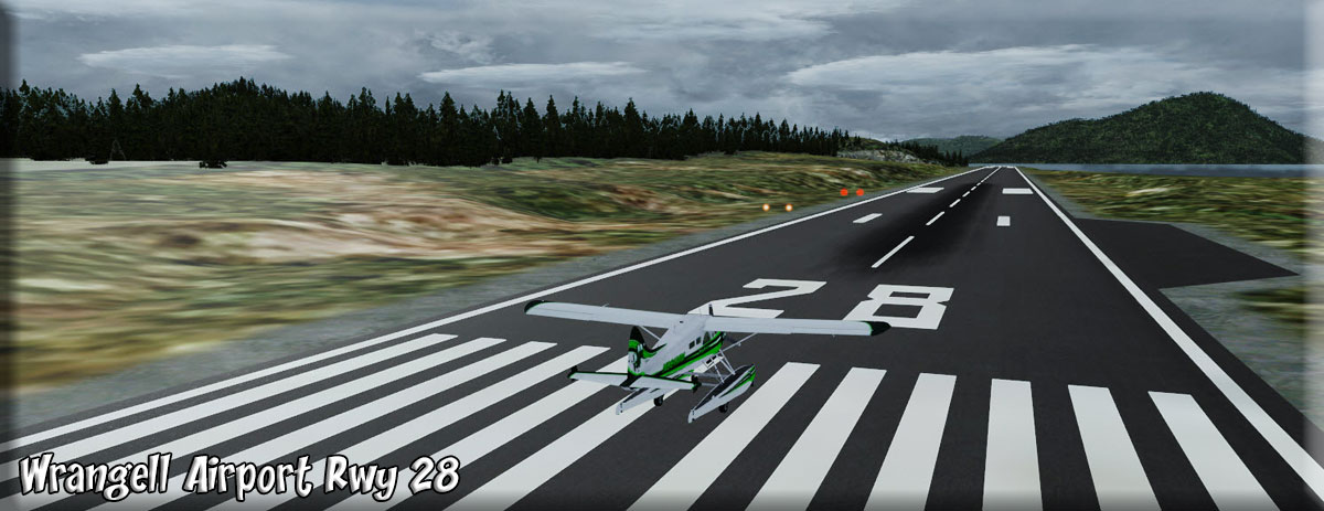
1 Wrangell (PAWG) |
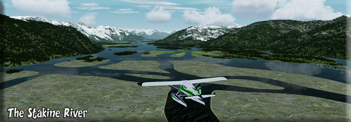
This is a weekly mail run that delivers mail and packages to some of the remote areas around the Stikine River Area. Since the mail must get through, you must fly in poor conditions. But your aircraft is equipped with autopilot and you have mapped your GPS to it perfectly. You can take off from Wrangell, set the autopilot and the altitude, then sit back and watch for problems, other aircraft and even enjoy some of the beautiful scenery of the area. The autopilot will make all the correct turns for you. This is especially helpful in very difficult weather conditions.. The dispatch map gives you safe altitude at various phases of the trip. If you have mail for a drop, or they have mail for you to pick up, then you drop down, make your landing, dropoff/pickup, and continue. If there is no mail, you fly over. On bad weather days, this is the time you must put your faith in the autopilot. (Download Flight Plan Here) |
| 2 Stikine River Entrance ------ Direct Heading: 116 Distance: 3.3 m Way Point: R526A Way Point: R529A Way Point: R526A |
NOTAM SAFE ALTITUDE 1500 FEET Set WayPoint to R526A. Set your altitude to 1500 and turn on the autopilot if you are using it. We fly from Wrangell (PAWG) to the entrance of the Stikine River. At the entrance, set WayPoint to R528A as we turn to 026 for 12 miles as the river bends to starboard. Then the river turns again to starboard and we come to a heading of 91 for 12 miles (GPS PTF8). The Stikine then turns northerly to port on a rough heading of 334 which we will (windingly) follow for 38 miles to Scud River Airport. |
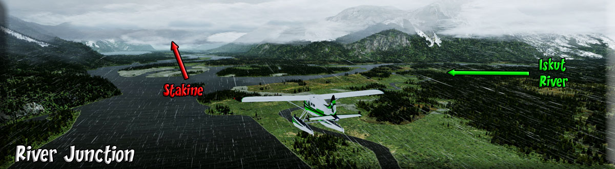
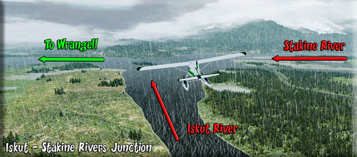
| 3 The Junction Stikine/Iskut ------ Direct Heading: 043 Distance: 22 m Way Point: |
As we turn northerly following the Stikine River, we come to an important junction. The Iskut River flows into the Stikine from Starboard. At the end of our run, we will be coming from that direction. |
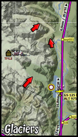
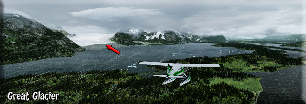
| 4 The Glacier Area ------ Direct Heading: 043 Distance: 15 m Way Point: |
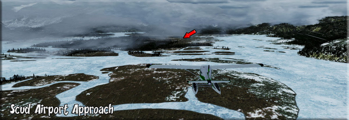
As we travel north, we pass several glaciers to port. The first is the Great Glacier. You will see many icebergs in the area that are calving from this beautiful glacier. As it passes to port, it reminds you of a wide, white flowing river coming from the mountains ... which it is ... except it is frozen. About 10 miles ahead, you will pass by the Mud Glacier. You will see a river coming in from starboard, that is the runoff from the Porcupine River 9 miles to starboard. On a clear day, you can see the glacier if you look up the river as you pass. In about 8 miles you will see the Flood Glacier pass by to port. That is the feature that lets you know Scud River Airport is 7 miles ahead in the center of the river basin. |
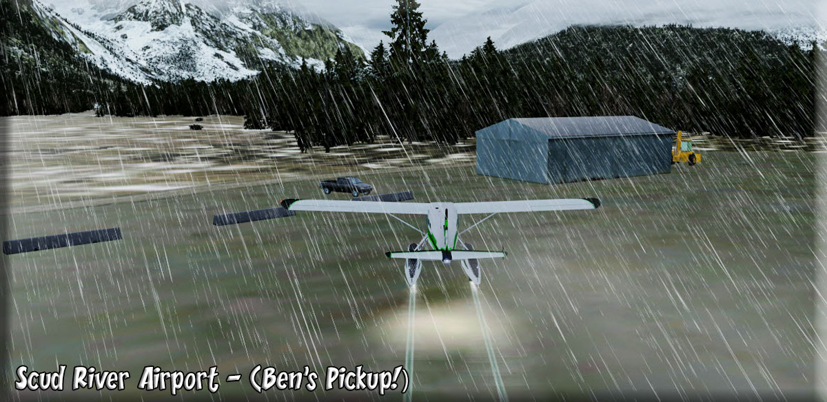
| 5 Scud River Airport ------ Direct Heading: 043 Distance: 7 m Way Point: |
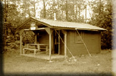
(Approach) The Scud River airport is listed as "closed" which means it is not being manned. However, there is a small building there where you can drop off the mail bags and pick up any that are left for you. People living back in this remote area appreciate the weekly mail drop and often they will meet you at the airport on "mail day". If there is a gray pickup truck, then you are in luck ... Ben Johnson always brings a hot thermos of coffee and home made rolls. You land hoping to see the Ben's pickup. You are in luck! |
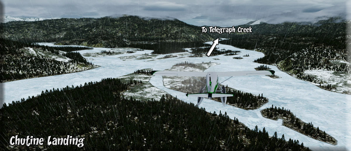
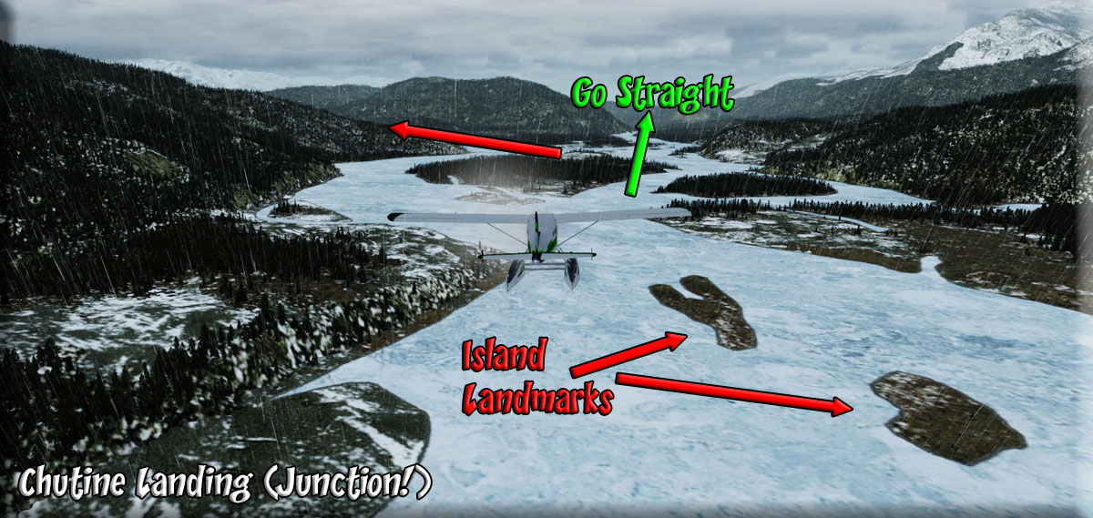
| 6 Chutine Landing ------ Direct Heading: 358 Distance: 23 Way Point: |
NOTAM ALTITUDE 2500 You take off from Scud River having exchanged some news and mail with Ben. You now head for Chutine Landing which is a key way point. The river basin splits and you fly to starboard. Watch for the signature shape of the two islands as you approach, this will help you identify Chutine Landing. Make sure you flight straight, slightly starboard, do NOT turn to port toward the larger branch of the river. This also is a good place to increase your altitude to 2500 feet. We will follow the river basin to Telegraph Creek. |
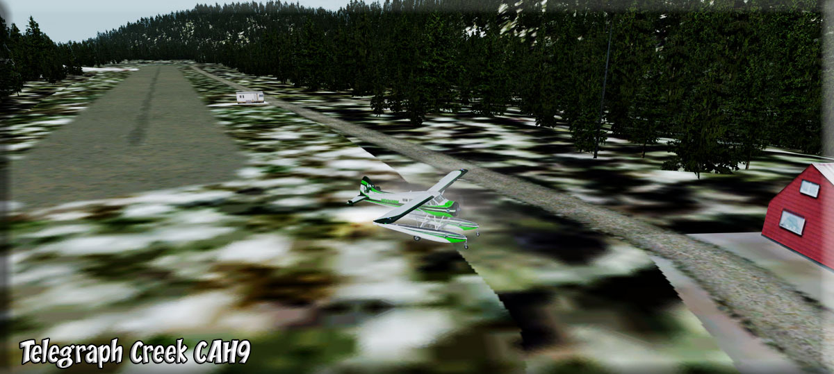
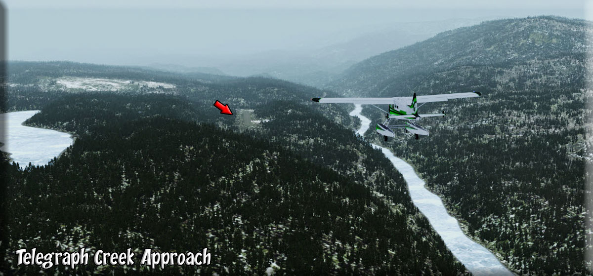
| 7 Telegraph Creek CAH9 ------ Direct Heading: 018 Distance: 20 m Way Point: CAH9 |
As you fly the river basin and as you approach Telegraph Creek, watch for the runway just off the river to port. (Approach) Turning a little to port will put you right on the lineup of the runway. Because the autopilot is doing the work and all is calm, you pull out your Alaska History book and look up Telegraph Creek: Telegraph Creek gets its name from an overland telegraph line to Yukon, the assembly of which started in 1866. The project was stopped when the first Trans-Atlantic submarine cable was laid, then started again during the Klondike Gold Rush. The cable was finished in 1901, and abandoned in 1936, when wireless radio killed it. Though the Yukon Telegraph Trail is mostly overgrown over to the south of Telegraph Creek, a 265-km stretch still survives between Telegraph Creek and Atlin, and is open to the serious backpacker. The fascinating history of the Dease Lake and Telegraph Creek area dates back a century to the Yukon Gold Rush era. Telegraph Creek witnessed the discovery of gold by prospectors on the Stikine River in the 1860s, and was the head of navigation for paddle-wheelers during the plans for the Collins Overland Telegraph Cable. Today, Telegraph Creek is a predominantly Native settlement, with many restored buildings dating back a century or more. There are many deserted historic buildings in the town itself, as well as some that have been restored, including the original Hudson's Bay Company Store, which is now a cafe, general store and lodge. Probably the most remote town in BC assessable by road, Telegraph Creek is reached via a rough Forest Service road that runs southwest from Dease Lake, passing through the Stikine River Provincial Park, skirting the Grand Canyon of the Stikine River, and passing through Telegraph Creek to end in Glenora, another gold rush boomtown in its heyday. You watch for the runway, ease to port and land at Telegraph Creek to drop off 2 bags of mail and pick up whatever they may have for you. |
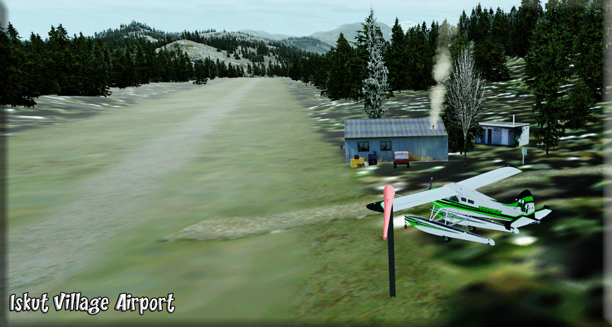
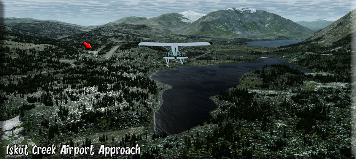
| 8 Iskut Village CBU2 ------ Direct Heading: 072 Distance: 36 Way Point: |
NOTAM ALTITUDE to 3500 FEET It is best to fly about 3500 feet as we go around the "top" of the Stikine Circle heading for Iskut Village. This is at the near shore (for us) of the Eddowtenajon Lake. The airport is on the far side of the first lake. (Approach). . .Give it a low pass. If there is no car beside the runway, then they have nothing for you. You don't have anything for them, so if the car is not there, then just touch and go and head on down Eddowtenajon Lake. As you make this 50 mile trip to the next stop, look for the "cones of Iskut" ... the flight plan takes you over one.
|
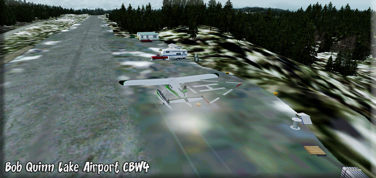
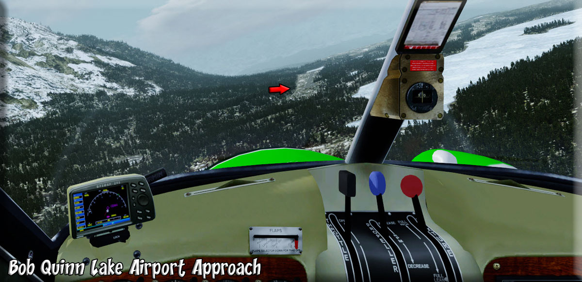
| 9 Bob Quinn Lake Airport (CBW4) ------ Direct Heading: 167 Distance: 52 m Way Point: CBW4 |
As you leave set the altitude at 3500 feet. Leave Iskut Village airport on a heading of about 136 and this will bring you over Eddowtenajon Lake. Follow the wide valley for 52 miles to Bob Quinn Lake Airport. (Approach) This is a leisurely part of the trip, it is long and wide and safe .You've set up the gps to follow the deep river canyons of the Iskut River (which you will follow all the way back to "The Junction" with the Stikine. NOTAM SAFE ALTITUDE 4500 FEET About a third of the way there, you can safely go to 2500 feet for a better view of the river. As you approach the airport, turn off the autopilot. Bob Quinn Airport will come up to port, land and exchange mail bags at the blue and while trailer. You bring a pouch of Robby White's favorite pipe tobacco. He's the postmaster of the area. Usually, you'll share a little lunch that he's brought from home.. |
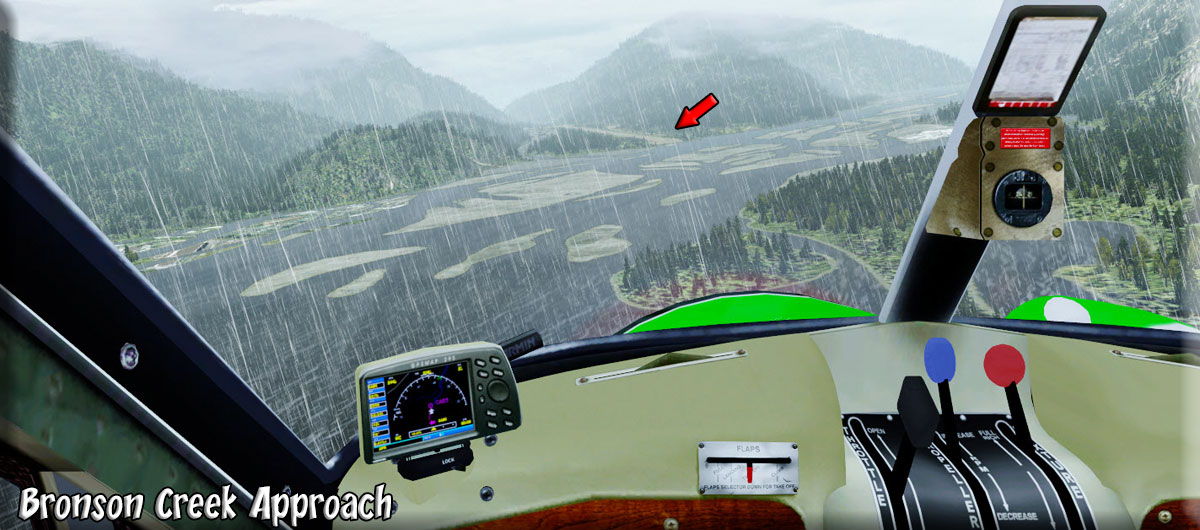
| 10 Bronson Creek (CAB5) ------ Direct Heading: 217 Distance: 31.2 m Way Point: CAB5 |
After taking off from the airport, reset the autopilot for 2500 feet. Fly a heading of about 226 to go back out over the Iskut River Basin and continue following the river to the next and final mail drop at Bronson Creek. When the river turns to the west to about 250, Bronson Creek will be 13 miles ahead to port. As you approach from this direction, stay to the starboard shore before your turn to final. NOTAM SAFE ALTITUDE 1500 FEET In this area you can safely go down to 1500 feet, making the approach to Bronson Creek easier. Turn off the autopilot and make a safe landing. Taxi to the end of the runway and you'll drop the bag at the little blue building there. Take off to fly back out over the Iskut River and turn to port following the river. |
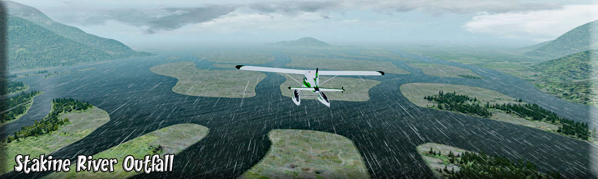
| 11 Stikine River Outfall ------ Direct Heading: 241 Distance: 42 m |
We take off from Bronson Creek and turn left over the Iskut River Basin. Reset the altitude of 1500 feet. We will be following the river to "The Junction" of the Stikine. At the junction, we turn to port to head for the outfall of the Stikine, following the river basin. |
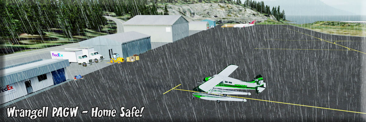
| 1 Wrangell Airport (PAWG) ------ Direct Heading: 156 Distance: 6 m Way Point: |
At the outfall of the Stikine, turn to 156 for 6 miles to Wrangell. Contact them by radio to let them know you are coming and get runway information. This is a busy airport with much commercial traffic so they may have to work you into a pattern. Drop off the mail you have picked up at the Federal Express office which also handles the mail for the area. Park the plane, tie it down, give it a post flight inspection, then into the office to do the paperwork and logs. Another beautiful day flying "The Circle" in the Stikine area. |
Route by Klaus Troeppner
Dispatch by JD Linn Copyright Return to Misty Moorings 2021 |