DISPATCHER'S | R E T U R N - TO - M I S T Y - M O O R I N G S |
|
|
| RIBBON |
B R I E F I N G |
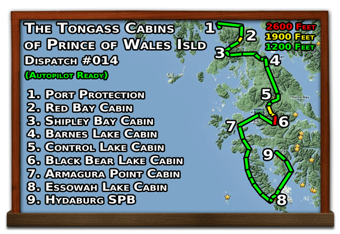
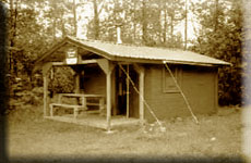
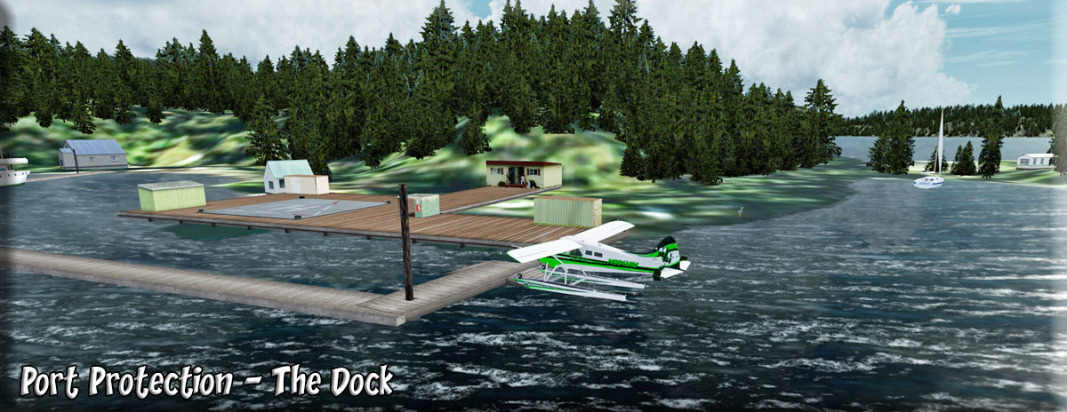
1 Port Protection |
We are flying to the USFS cabins on Prince of Wales Island included in the Tongass Fjords scenery package. Even if you don't use the autopilot (which will guide your whole trip), following the route on the GPS is recommended through some tricky country. You can download the autopilot ready flight plan HERE). We start of at beautiful Port Protection. (Water mooring point at pier is to left...helipad is N54 19.32 W133 36.71). Our journey takes us from this location throughout the northern and eastern portions of the Prince of Wales Island. We taxi to the starboard side of the island ahead lining up beside the white flashing channel marker on a heading of 292. Some flaps, a lot of throttle, and we are on our way! |
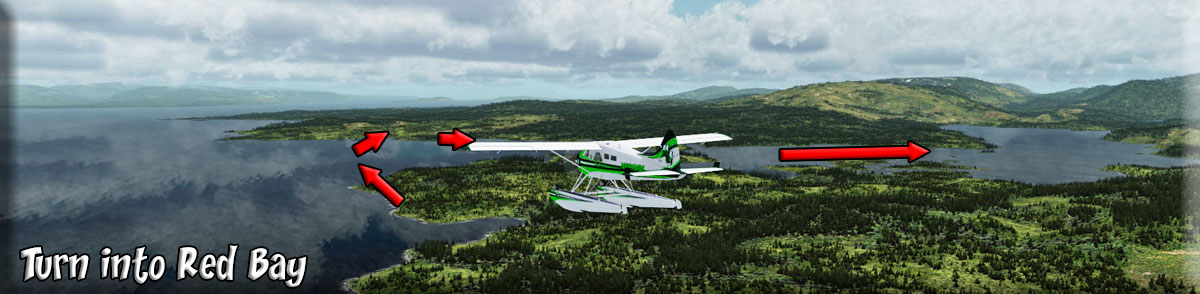
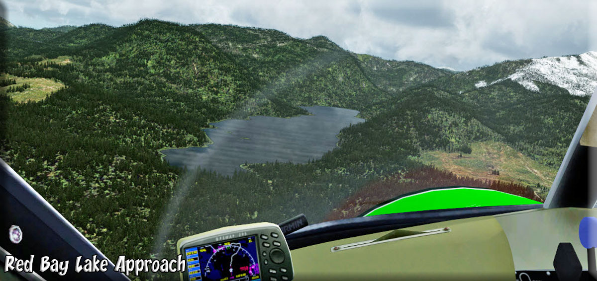
| 2 Red Bay Lake USFS Cabin ------ Direct Heading: 103 Distance: 12 m Way Point: R516A |
Set altitude at 1200 feet. As West Rock and Point Baker pass by to starboard, we turn to 075 for 10 miles to Red Bay. At the entrance of Red Bay, we turn to starboard to 159 flying over Dead Island. This heading takes us directly to the cabin.(If "on" turn the autopilot "off). On this heading you will cross the far shoreline of the bay and fly over Red Bay Lake. As you approach the lake, go to landing configuration, the cabin is 3 miles ahead on the port shore of the lake. |
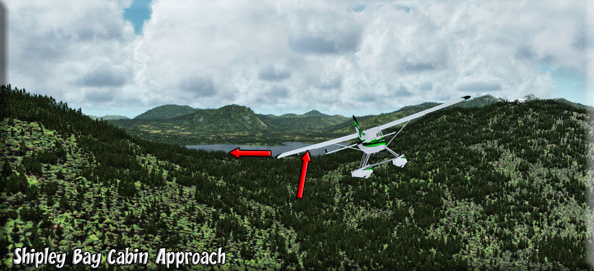
| 3 Shipley Bay USFS Cabin ------ Direct Heading: 192 Distance: 10.8 m Way Point: R531A |
Set altitude at 1900 feet. Take off on a heading of 188, flying the gap in the mountains ahead. Climb quickly to 1900 feet to clear the ridge. Once you have cleared the ridge, you may return to a 1200 foot cruising altitude setting a heading of 177 to pass over a small lake. Over the lake, set a heading of 226. You will come upon a bay, take the port fork of the bay staying just off shore, a heading of about 202. When you see the channel turning to starboard, look for a gap to port, fly through that gap. Go to landing configuration, the cabin is 2.5 miles ahead on the port shore of Shipley Bay. |
| 4 Barnes Lake USFS Cabin ------ Direct Heading: 084 Distance: 18.2 m Way Point: R377A |
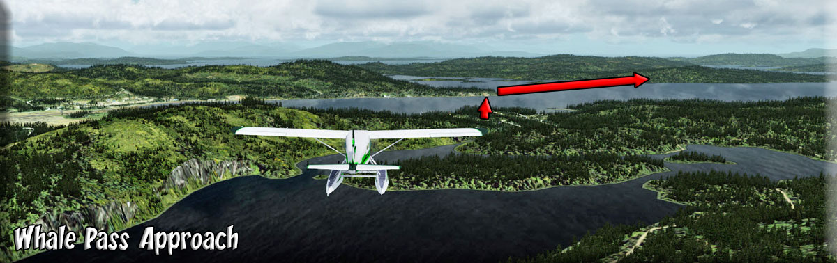
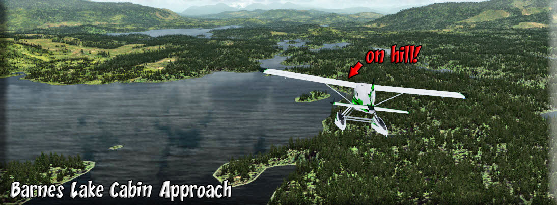
Leaving Shipley Bay, we taxi away from the cabin on a heading of 265. When we have enough room for a takeoff back toward the cabin, we turn and take off on about 070. We fly through the gap in the mountains there. We fly over and follow Shipley Lake. When the lake ends, the valley sweeps to port, follow it on a heading of 052 coming over and then following Devilfish Bay. At the end of the bay, we turn a little to starboard to 073 heading for Neck Lake. When you see the lake ahead, adjust your heading to fly down the lake. When you cross over the shoreline of Whale Pass (and the community is at 11:00 o'clock), turn to starboard to 115 and fly down Whale Passage for 3 miles. Whale Passage curves to port at Mable Island. Over the island, turn to port to 062. Get into landing configuration. You will turn to starboard to 155 at Indian Creek which leads you to Barnes Lake. The cabin is on the starboard shore on a bluff. |
| 5 Control Lake USFS Cabin ------ Direct Heading: 148 Distance: 19 m Way Point: R398A |
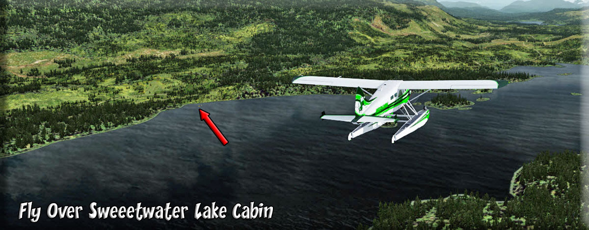
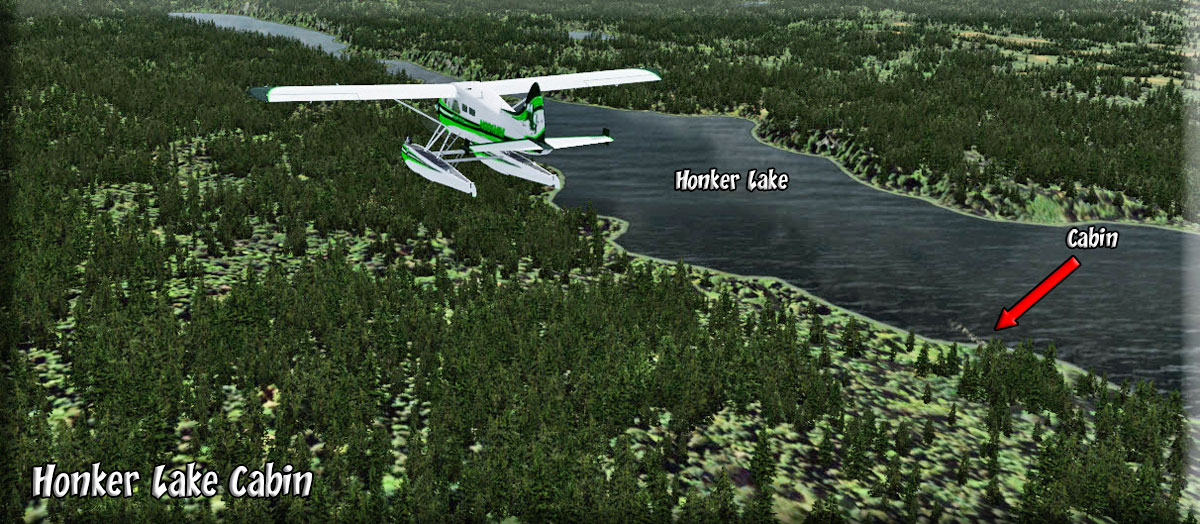
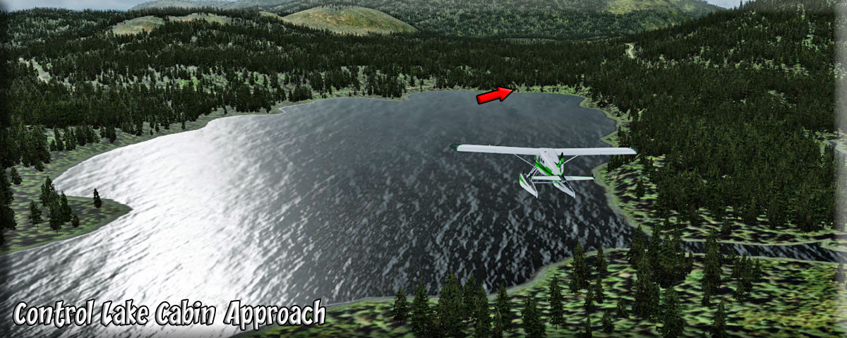
Take off from Barnes Lake and come to a heading of about 140. As you fly over Sweetwater lake, look for the cabin on the port shoreline. Sweetwater Lake passes to port and Hatchery Creek passes to starboard. we are going to follow a "cut" in the hills in almost a straight line on the 140 heading. Before you get to the mountains a long lake comes up to starboard. Watch for the cabin as you fly over Honker Lake. Look ahead at the gap in the mountains, fly through that pass. At the end of this pass is little Cutthroat Lake. When the mountain to starboard is at 3:00 o'clock, turn to starboard to 210. Control Lake is 2 miles head. Go to landing configuration. You pass over two small lakes and the next lake is Control Lake. It is best to fly to the port side of the lake, then turn to land toward starboard. The cabin is on the starboard side of the lake. NOTAM: This is a short landing zone. |
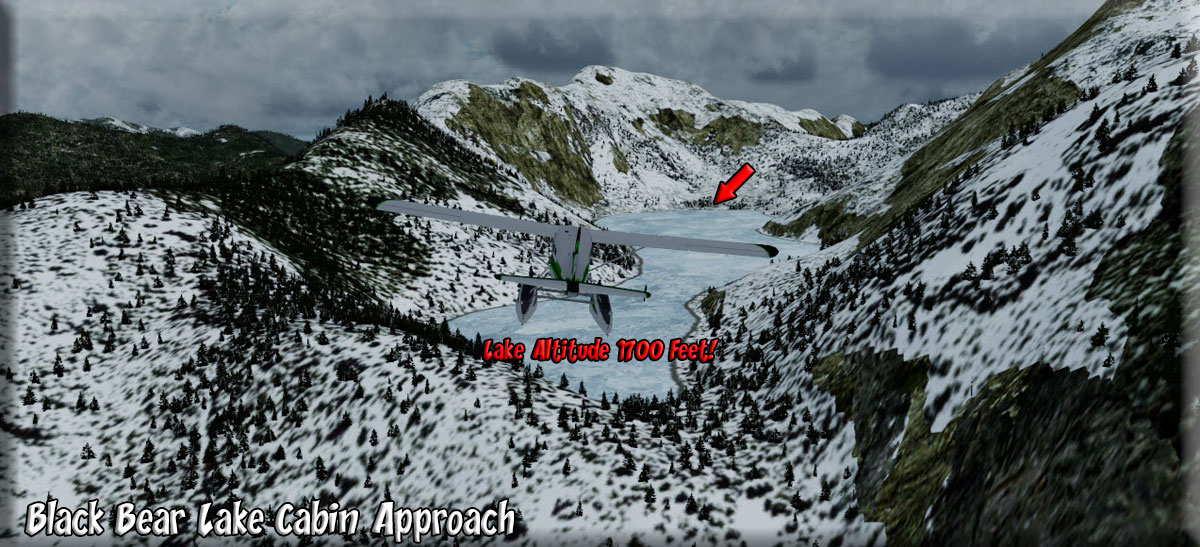
| 6 Black Bear Lake USFS Cabin ------ Direct Heading: 153 Distance: 9.2 m Way Point: R387A |
Take off away from the cabin then turn to starboard to a heading of 200. This is a short takeoff zone climb quickly and turn quickly. Once at altitude and over the ridge, you will see a body of water 5 miles ahead. Adjust your heading to fly for that shoreline. As you near the shoreline, look to port and you will see a valley. Turn to port and fly up that valley on about 157. NOTAM: Increase Altitude to 1900 feet for landing at Black Bear Lake ... 2600 to fly over! You will see Black Lake ahead and the valley turns to port, follow it. At the end, turn to port over the lower side, as you come over that ridge, you will literally be "on" Black Bear Lake. Go to landing configuration. The Cabin is at the far end of the lake. |
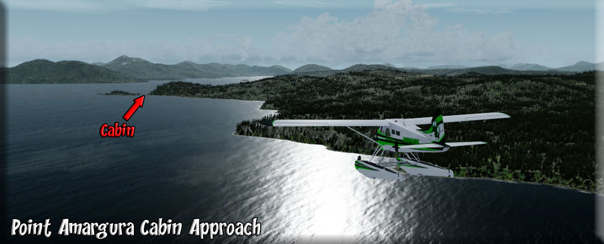
| 7 Point Amaragura USFS Cabin ------ Direct Heading: 231 Distance: 17.6 Way Point: R508A |
NOTAM: 2600 feet is necessary to clear the next peak! (leaving Black Bear Lake). Go to the far end of the lake away from the cabin. Take off toward the cabin and climb quickly to 2600 feet. Fly through the gap there. Once over this ridge, look down and a little to the left and you'll see a curving valley. You can go now to 1200 feet and follow that valley. You can stay at 1200 feet for the rest of this dispatch. NOTAM TRICKY TURN. Fly to starboard around the "last" mountain to your right, you will see the Klawock River to starboard ... turn to 250, taking that valley to starboard and flying over Klawock River to its outfall at Klawock on a heading of about 280. Over Klawock, turn to 212 for 10.7 miles. As land comes up on the starboard side, there are two "points". The second one is Point Amaragura, the cabin is on that point in the tiny bit of land connecting the main island to the little point. |
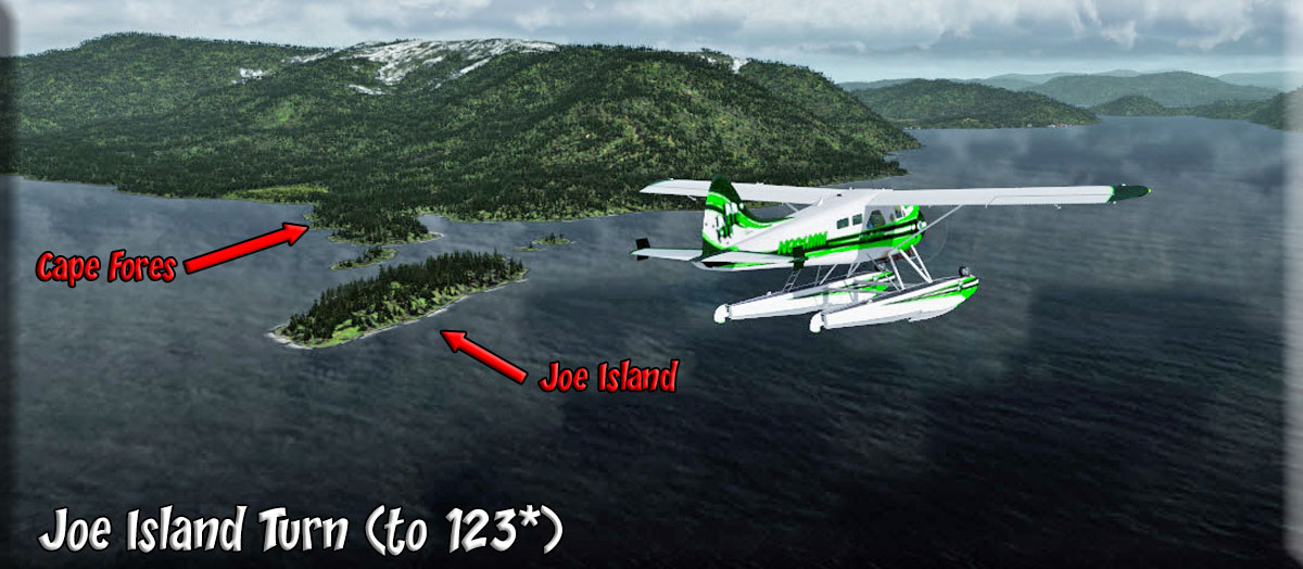
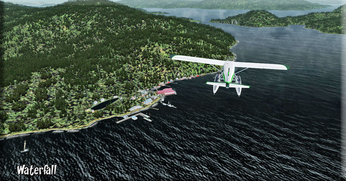
| 8 Essowah Lake USFS Cabin ------ Direct Heading: 135 Distance: 42.2 m Way Point: R420A |
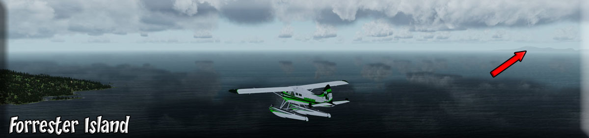
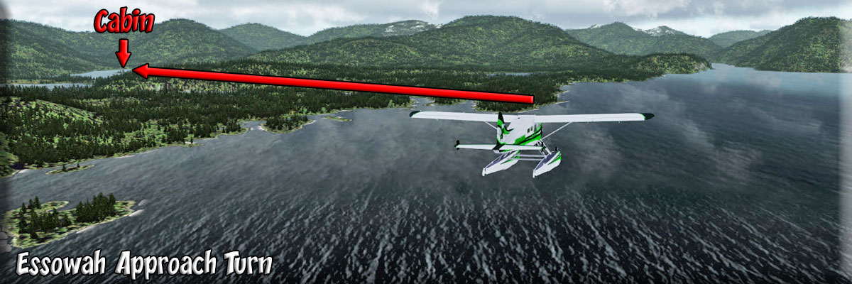
Take off from Point Amaragura on a heading of 144. When Joe Island and Cape Fores are at 9 o'clock to port, turn to a heading of 123 to pass by the community of Waterfall. When Waterfall passes at 9:00 o'clock, turn to a heading of 130 to fly over a strip of land between the main island to starboard and a hill to port. Once over the water beyond, turn to 167 and follow the waterway staying off the port shore. The shoreline will slowly curve to port over the next 30 miles. Stay about a mile off the shore and follow the coastline. Diver Rocks will pass to starboard, then Entrance Island to port. On a clear day you will see Forrester Island 12 miles off the coastline to starboard. Twenty miles later, when Port Bazan comes up, you will see a finger of land coming out from port. (If "on" turn the autopilot "off"). When you reach this finger of land, go into landing configuration, your cabin is 5 miles ahead around the next mountain to the left. You will see a flat area beyond the mountain, turn to port around the mountain to 021. The lake ahead is Essowah Lake, the cabin is on the far shore. NOTAM: It is a short landing zone. |
| 9 Hydaburg (HYG) ------ Direct Heading: 343 Distance: 26 m Way Point: HYG |
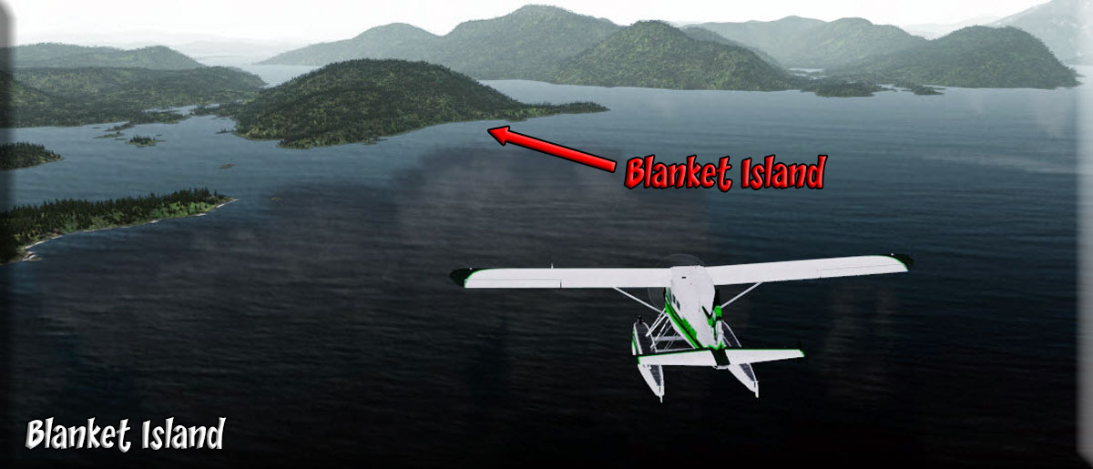
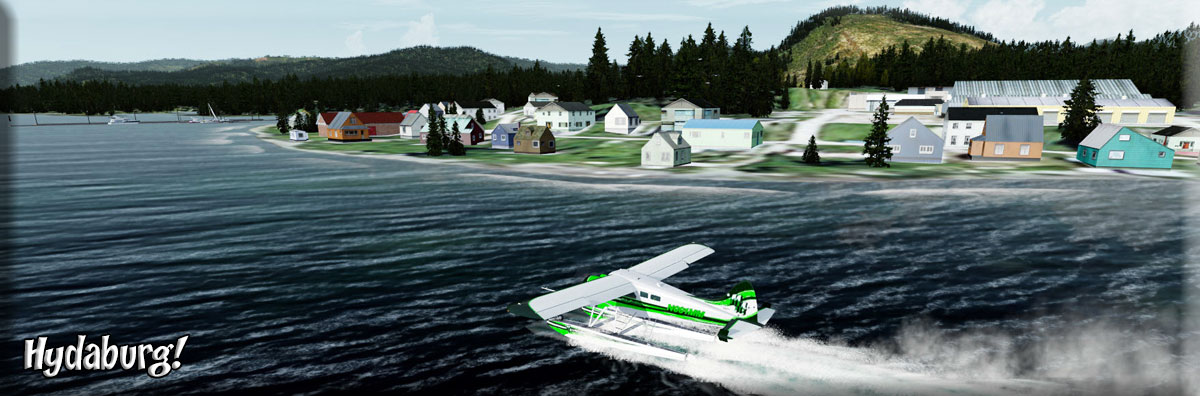
We taxi back across the lake away from the cabin, and set up a take off heading of 340.Go quickly to 1200 feet of altitude. You will find Parrot Lake in a mile ... turn to 017 over the lake then follow the depression there to American Bay. Fly over the little bay to its end and turn to port to about 333. Line up on the little Channel Islands there in the Howkan Narrows. Over the islands, set a heading of 008 for 11 miles. Jackson Island will pass nearby to port and little Lacey Island off to starboard. Fly toward Lima Point. When you are within a mile of Lima Point, turn to port to a heading of 323 for 6 miles. As Blanket Island comes up to port, flyover the tip of Round Point jutting out from Blanket Island. Pass into Sukkwan Straight and turn to port to 288 and follow the Sukkwan Strait to Hydaburg. Fly around Saltery Point and go to landing configuration for the Hydaburg sea plane base. The base is just beyond the seaport which passes to starboard. Welcome to Hydaburg. |
Return to Misty Moorings
Copyright 2021 Dispatch by JD Linn |