DISPATCHER'S | R E T U R N - TO - M I S T Y - M O O R I N G S |
|
|
| RIBBON |
B R I E F I N G |
Overview |
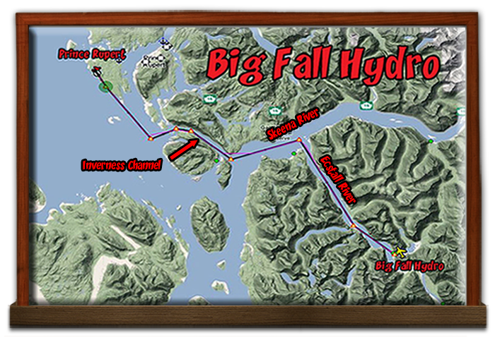
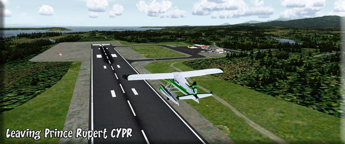
The purpose of this dispatch is to fly a piece of equipment that just arrived at Prince Rupert this afternoon to the Big Fall Hydro Plant. A key computer board burned out at Big Hydro and a young man from the computer company in Ohio has been sent out with a new panel. (Customer Pick-up) He's never been to this area of the world before, so you can show him a few sights as you make this emergency trip to Big Hydro. You can download the flight plan here. We will be leaving Prince Rupert (CYPR) and generally flying southeast 31 miles to Big Fall Hydro. You can fly this any time of day, (evening can be beautiful in this area). We'll be flying at 1200 feet so there will be plenty of sight seeing along the way. |
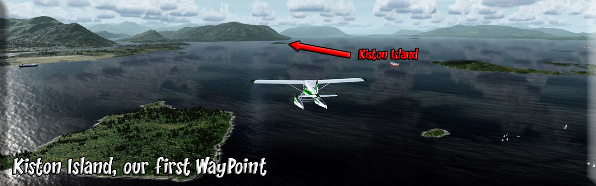
| 1 Prince Rupert (CYPR) ------ Direct Heading: 120 Distance: 6.4 Miles |
We take off from Prince Rupert flying the runway heading. Our flight plan takes us to Kitston Island, a small island ahead. Over Kitston Island you will turn to port heading for the Inverness Passage. Kitson Island and Kitson Islet, are both included in this Kitson Island Marine Provincial Park. The small sandy island is popular with kayakers and other small craft users for wilderness camping. |
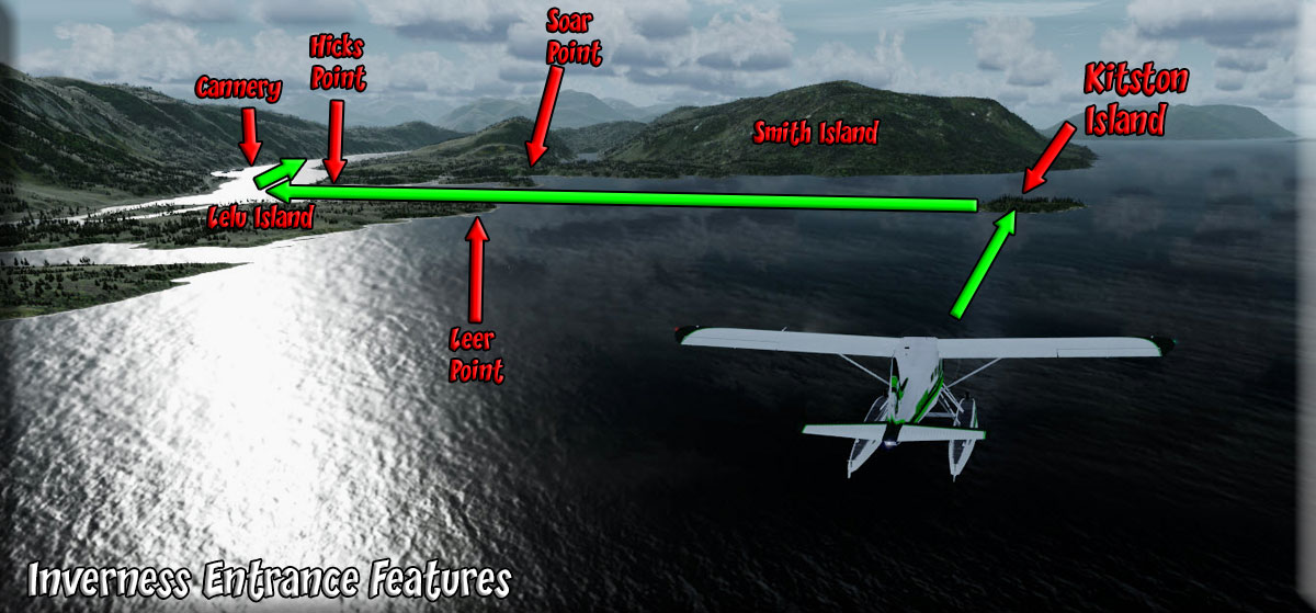
| 2 Inverness Passage Approach ------ Direct Heading: 041 Distance: 2.5 Miles |
Click on the link in the left column to get a detailed map of this area. (Inverness Passage Entrance Features) As we approach the Inverness Passage, we set our heading to follow this passage, coming to starboard (088)as the passage turns to starboard. As you approach the passage, you will pass over Hicks point where you will make your turn to starboard to follow the passage. Smith Island will be to starboard and Lelu Island to port. The point on the port side is Leer Point and the point to starboard is called Soar Point. As we approach the passage to turn into it, we are passing Hicks Point off the starboard wing. We now settled into following the Inverness Passage. We will now follow this passage for 4.5 miles on a heading of about 110. |
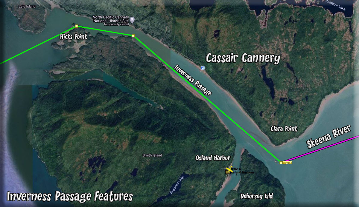
| 3 Inverness Passage ------ Direct Heading: 110 Distance: 4 Miles |
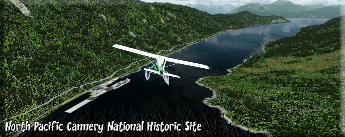
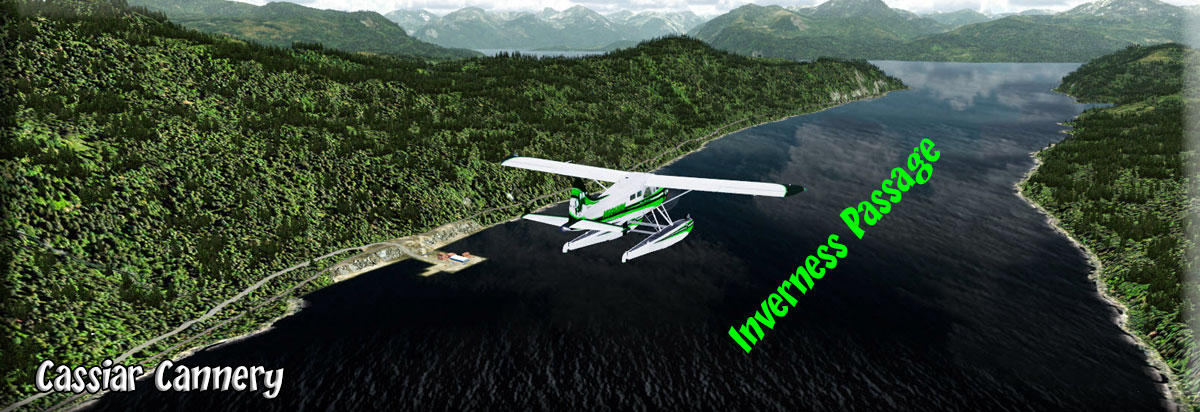
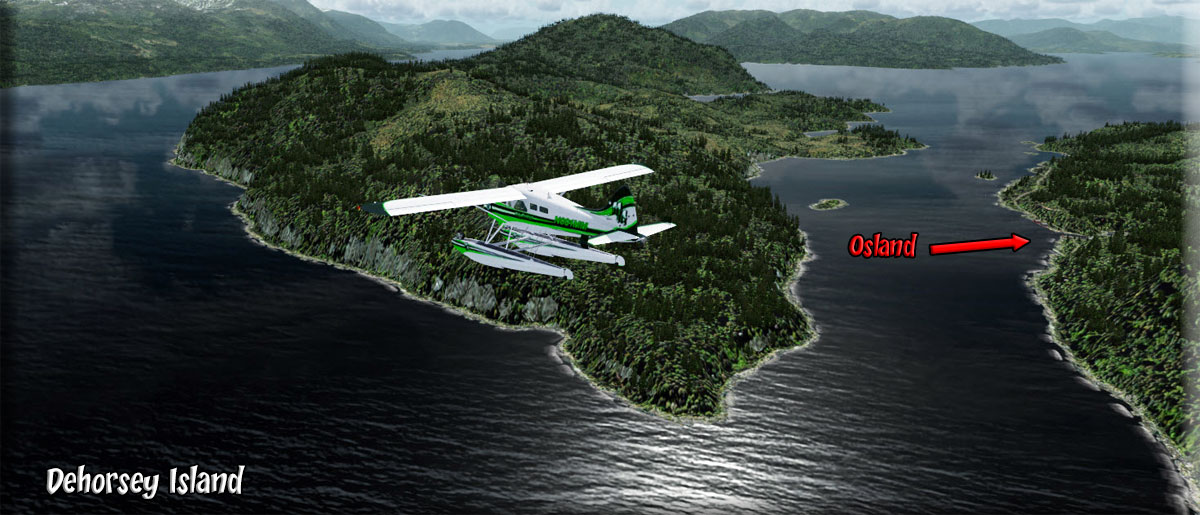
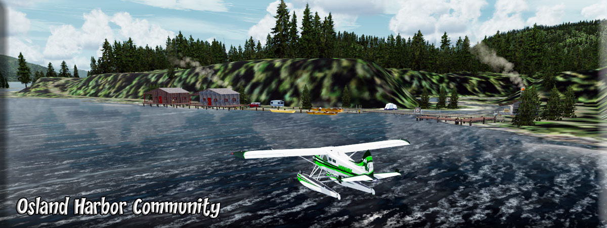
As we enter the passage, the first notable feature will be the North Pacific Cannery National Historic Site. (Interesting Website with History here) The second site is the Cassair Cannery, also on the port shoreline beside Skeena Drive. The inverness passage is about 4 miles long and has a heading of 110. If you fly along the port shoreline, you will fly over two canneries one is still active. As you approach the end of this passage, you will see DeHorsey Island to starboard. The Osland Harbor community is in that passage. Gust Point to Port. Out over the water, we will be turning to starboard to follow this larger passage, the Skeena River. |
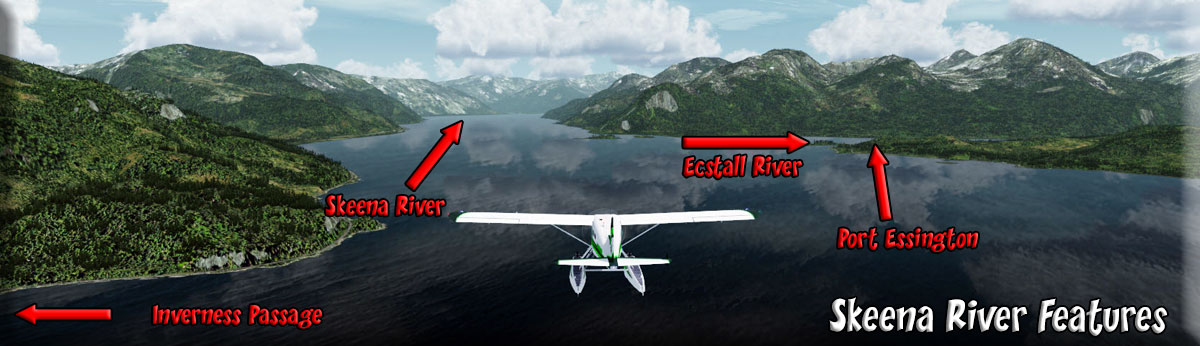
| 4 Skeena River ------ Direct Heading: 050 Distance: 6.3 Miles |
As you turn to port into the Skeena River, you will only go about 6.3 Miles on a heading of 050.
Norwich Point comes up to port and ahead to starboard, you will see Ecstall Island guarding the entrance to the Ecstall River. We will be turning to starboard to follow the river. |
| 5 The Ecstall River ------ Direct Heading: 132 Distance: 9.8 Miles |
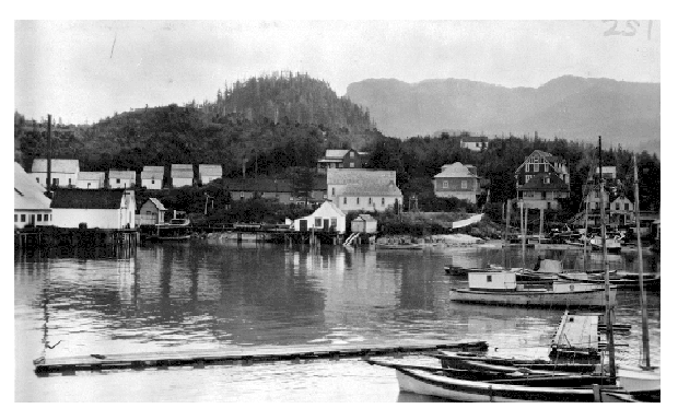
The point guarding the outfall of the Ecstall is Port Essington: Port Essington was a cannery town on the south bank of the Skeena River estuary in northwestern British Columbia, Canada, between Prince Rupert and Terrace, and at the confluence of the Skeena and Ecstall Rivers. (1915 Picture) It was founded in 1871 by Robert Cunningham and Thomas Hankin, (father of the interpreter Constance Cox) and was for a time the largest settlement in the region. During its heyday it was home to an ethnic mix of European-Canadians, Japanese-Canadians, and members of First Nations from throughout the region, especially Tsimshians from the Kitselas and Kitsumkalum tribes. In the Tsimshian language, the site of Port Essington is called Spaksuut or, in English spelling, "Spokeshute", which means "autumn camping place". This also became the Tsimshian name for the town of Port Essington, and was conferred on Spokeshute Mountain, which stands above and behind the community. It sits on the traditional territory of the Gitzaxłaał tribe, one of the nine Tsimshian tribes based at Lax Kw'alaams. In 1888, the anthropologist Franz Boas visited Port Essington, interviewing Haida and Tsimshian individuals and establishing a working relationship with Odille Morison, the Tsimshian linguist, who lived in Port Essington.We will now follow the Ecstall River for about 10 miles. As you fly, look at the power lines along the port shoreline, this power is coming from Big Fall Hydro, your destination. The next thing to watch for is the Ecstall Sandbar, a large sand bar in the middle of the river where the river turns gently to port. Follow the river and watch for Big Fall Cove coming up to port in about 4.5 Miles As you pass over the sand bar, begin dropping in altitude to about 500 feet. Use your flaps and go slowly so you can not only make a safe landing, but enjoy the view. (Notice the power lines on the port shore, coming from Big Hydro) |
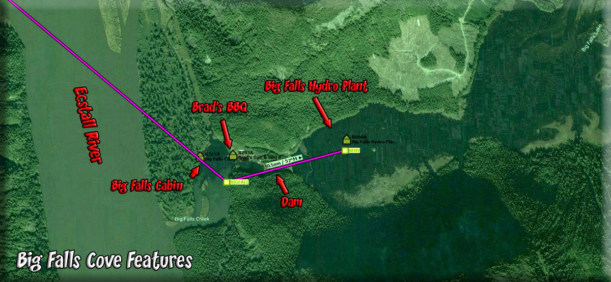
| 6 Big Fall Cove ------ Direct Heading: 045 Distance: 4.5 Miles |
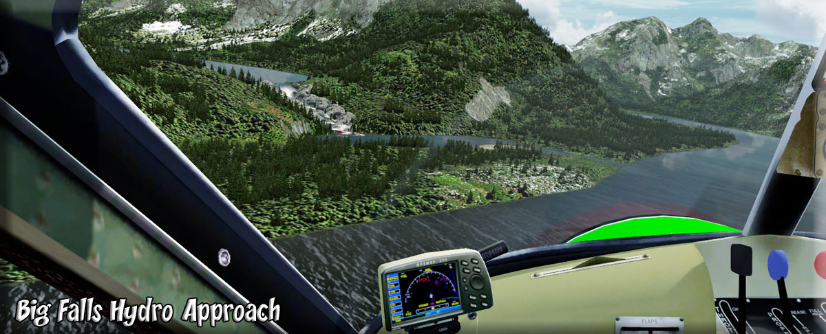
The entrance to Big Fall Cove comes up to port, this is Big Falls Creek. Since our delivery is being made at the Hydro Plant above the falls, begin dropping altitude. You will want to be in landing formation going over the falls and at an altitude of about 400 feet. As you approach the cove and can see the falls ahead to port, take manual control of the aircraft and land above the falls near the dock at the hydro plant. You will be flying over a Brad BBQ, remember it, that's where you will find your next meal! |
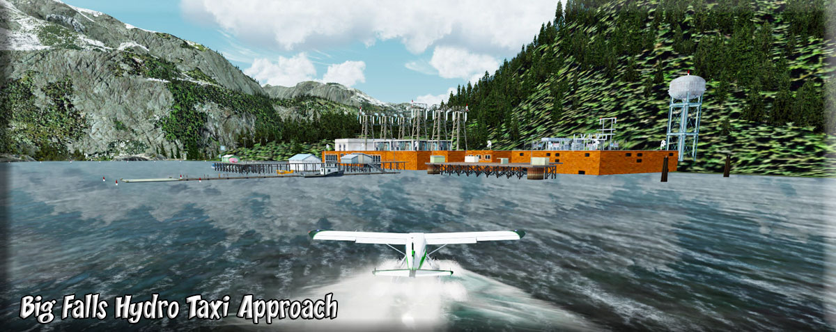
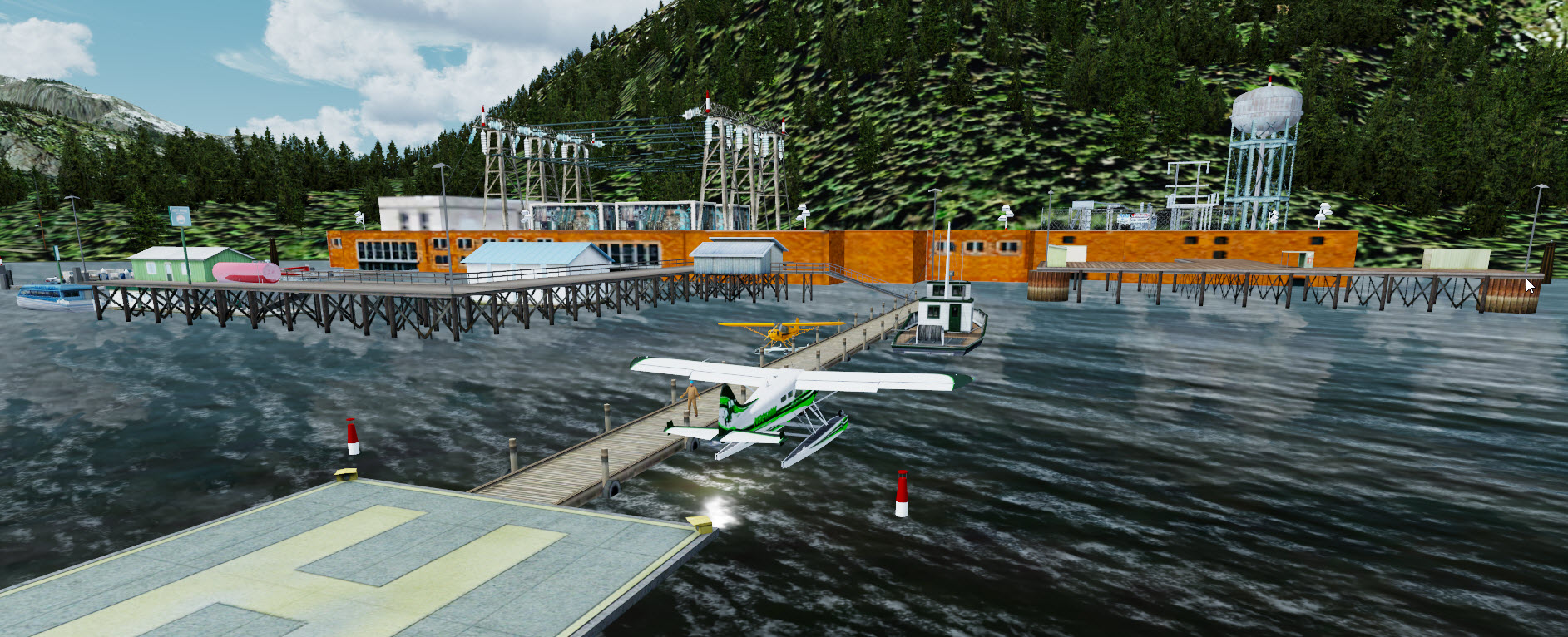
| 7 Big Fall Hydro ------ Direct Heading: above falls Distance: 2 miles |
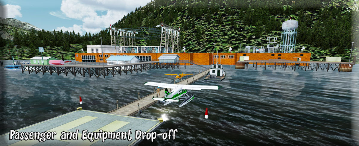
Fly over the falls and land near the dock. A worker will meet you and wave you into position along the dock. You will then taxi to the dock and unload your passenger and his equipment and get a signed receipt from the dock manager for the passenger and his equipment. Once your business is finished, time for a little fun. |
| 8 Brad's Bait & BBQ ------ Direct Heading: base of falls Distance: 2 miles |
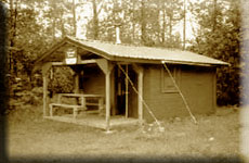
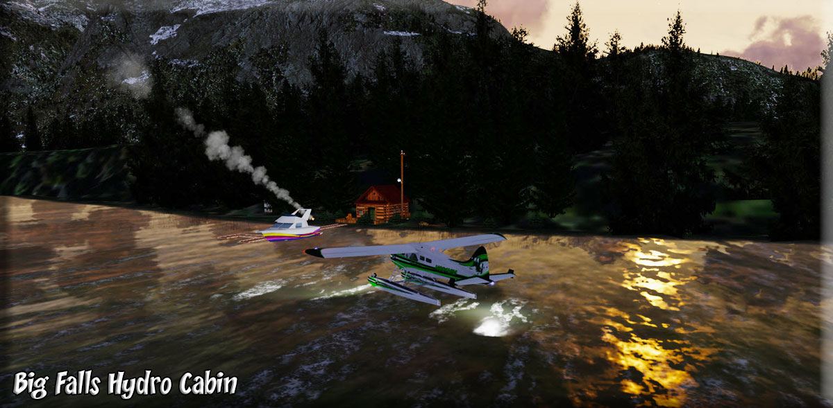
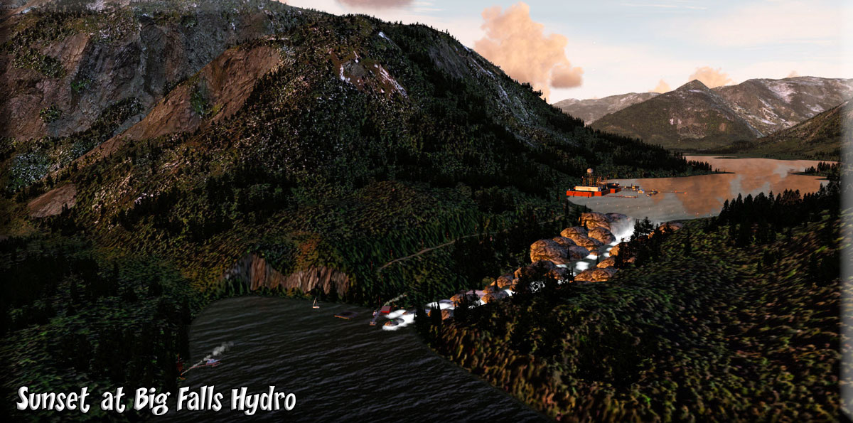
Remember that Brad's BBQ you flew over at the base of the falls? Well how hungry are you ... and are you a good enough pilot to lift off from this lake, fly over the falls at full flaps and slow, and drop down quick enough to land in the cove below? Pull up to the Brad's and enjoy a great meal before you fly back to Prince Rupert. (Link to left shows you the BBQ and falls). As you taxi away from Brads, go over and take a peek at the Big Falls Cabin across the cove. Then set up for a take-off to head back to Prince Rupert Airport. (Flying at Sunset is spectacular!). A final pass around Big Falls Cove at sunset gives you the whole picture. The Hydro Plant above on the lake, the falls, Brad's BBQ at the base of the falls and the little cabin across the lake. We hope you enjoyed the tour. |
Copyright Return to Misty Moorings 2021
|