DISPATCHER'S | R E T U R N - TO - M I S T Y - M O O R I N G S |
|
|
| RIBBON |
B R I E F I N G |
1. Start at Misty's Place |
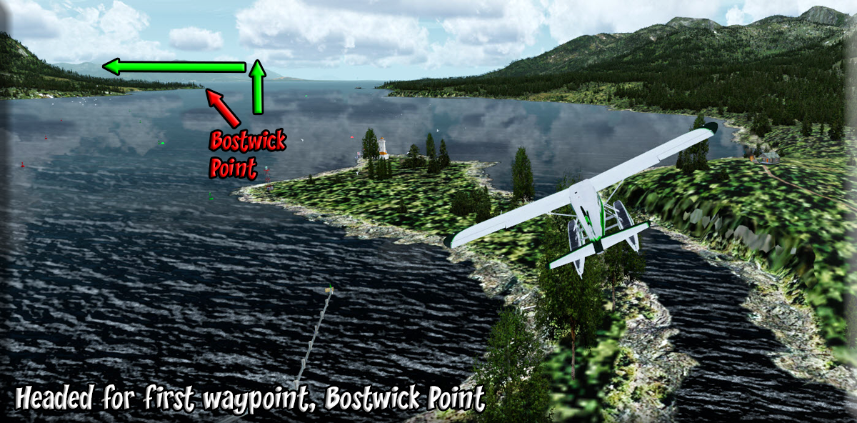
You can download the flight plan for this dispatch HERE. Border Lake Provincial Park rests in the Unuk River Valley, on the border of Alaska. The occasional river rafter will enjoy the pristine, wild waters of the Unuk River, flowing through the park and into the Misty Fjords National Monument in Alaska. The highly productive wetland complex surrounding three small lakes included in the park offers habitat for a wide range of vegetation, waterfowl, mammals and fish. We will be flying up the Behm Canal on our way to the Unuk River. Start off at Misty's Place, lining up on the runway to fly out over Bostwick Inlet. Click on the link to the left of each section for a graphic of the flight ahead. Our first way point is Bostwick Point about five miles ahead, port side. |
2 To Bostwick Point |
Fly out of Misty's Place out over the Bostwick Inlet on a heading of 113 degrees for about 4 miles until you get to Bostwick Point on the port shore. Here you turn to port into the Nichols Passage. Come to a heading of 025, heading for Race Point, 6.4 miles ahead |
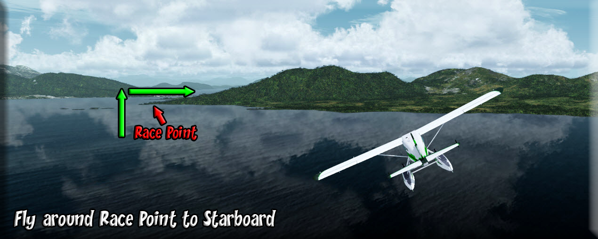
3 To Race Point |
As you fly to Race Point, you will see PAKT off to port, watch for traffic as you are approaching a busy through-way for planes, the glide slope for PAKT as well as the routes of multiple float flight-seeing planes that fly out of Ketchikan harbor. You will pass over Waldon Rocks, tiny islands near the first point to starboard which is China Town, you will fly past this point to the next sharper point to starboard, called Race Point. The next way point is Bold Island. |
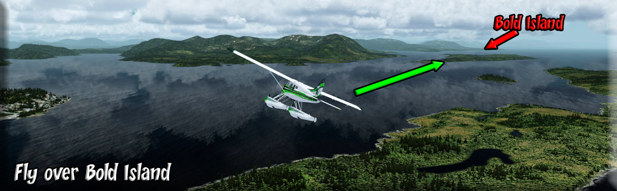
4 To Bold Island |
Over Race Point, you come to a heading of 091 and follow this for 6 miles to Bold Island in the middle of the Tongass Narrows.. Spire Island and Spire Light (a significant navigation light in the area) pass just to starboard. Once over Bold Island,, you angle to port to head for the mouth of the Behm Canal and Alava Point. The first inlet to port ahead is Thorne Arm, you will head for the second inlet, about 10.2 miles ahead. The next way point is Alava Point. |
5 To Alava Point |
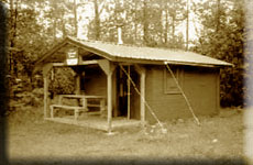
As you near the Behm Canal, you cross over Alava Point, at the entrance of the Behm. Over Alava point, you turn to a new heading of 010 that you will stay on for about 12 miles. After you pass Alava Point, look into Alava Bay on the port shore and see if you can see the US Forestry Cabin nestled in the cove. The next way point is Short Pass. |
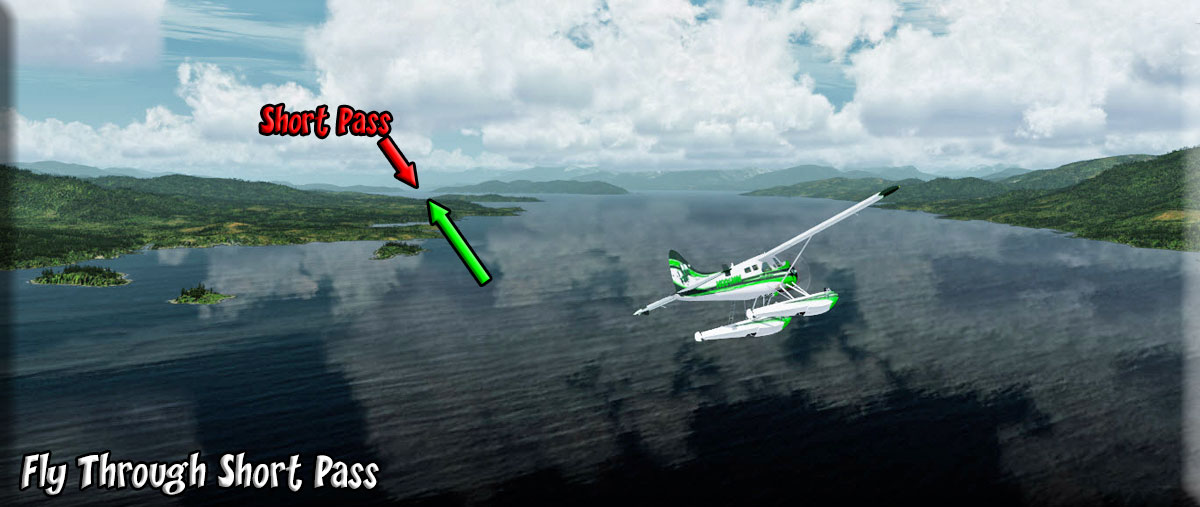
6 To Short Pass |
After you make the turn at Alava Point, look to port into Alava Bay, there is a US Forest Service Cabin on one of the island there. Rudyerd Island will come up under your starboard wing. The next, and larger, island under the starboard wing will be Smeaton Island. The pass between Smeaton Island and the port shore is Short Pass. Once at Short Pass, you are ready to begin looking for New Eddystone Rock. If you are flying autopilot at 1200 feet, you might want to go down to about 300 feet to see Eddystone (then return to 1200 feet). |
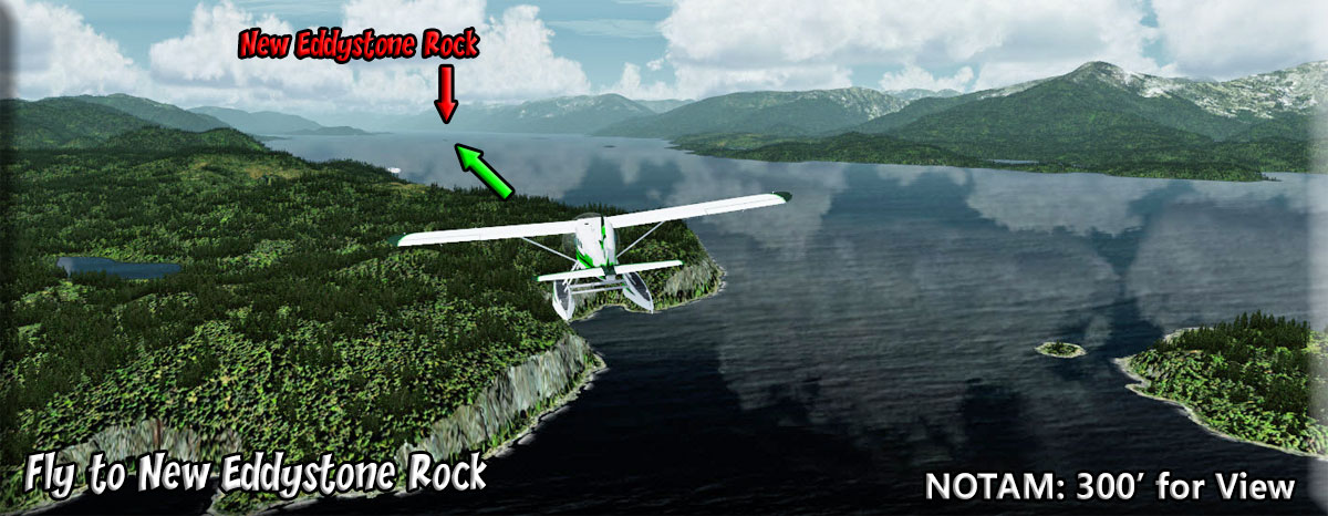
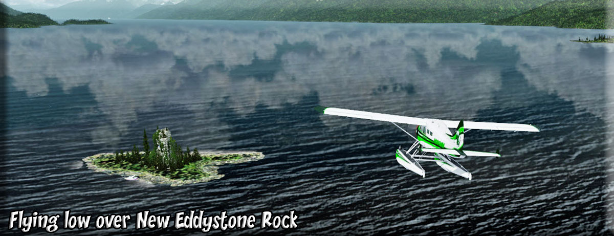
7 To New Eddystone Rock |
Over Short Pass, come to a heading of 352. As you head toward New Eddystone Rock, the Winstanley Islands will come up off your starboard side, there are two cabins in that area, and 4 more in the mountains beyond. New Eddystone Rock is one of the highlights on any cruise you will take in this area, almost all the cruise ships take a short trip up into Misty Fjords, passing closely by this amazing geographical structure. Over Eddystone Rock, set a course of 013 for a short 3.4 mile long leg to the entrance of Rudyerd Bay. |
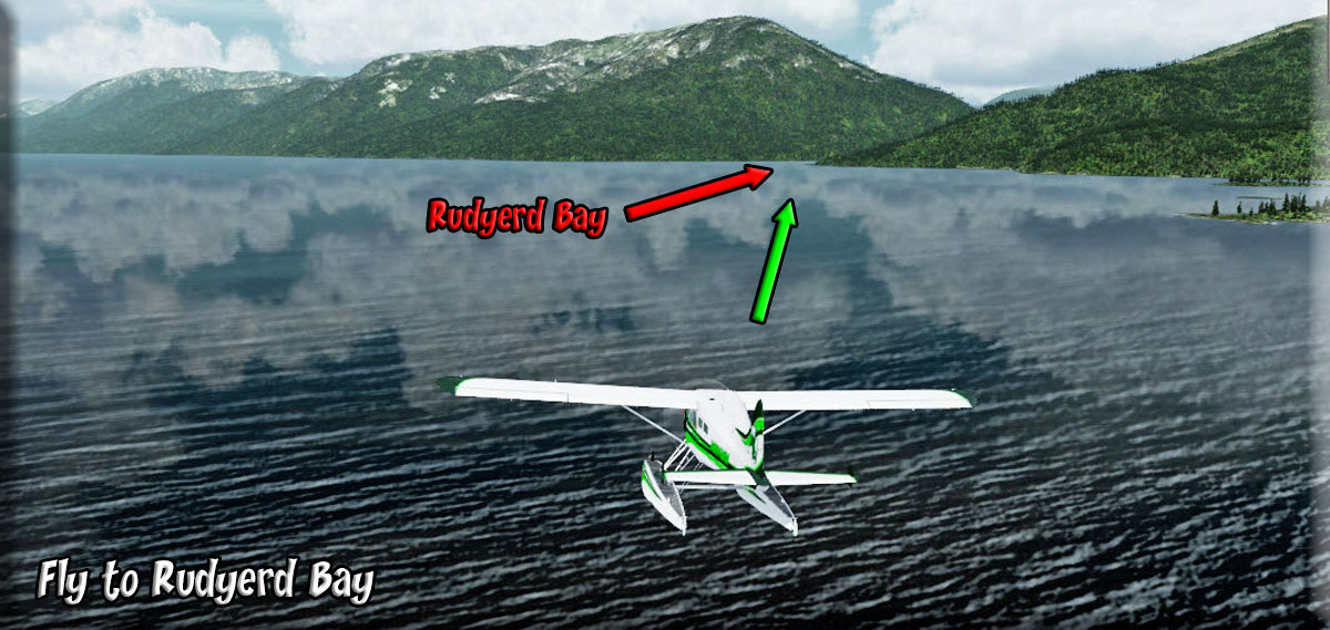
8 To Rudyerd Bay Entrance |
Most cruise ships that are giving tourists a look at Misty Fjords turn into the Behm Canal, then go slowly past the New Eddystone Rock (which is absolutely amazing), then they turn into Rudyerd Bay and cruise very slowly back into the waterway. (Our AI Cruise Ship takes this route). This gives people an "up close" view of Misty Fjords. Even the larger ships will go nearly to a dead end, then use their thrusters to turn in place and come back out, heading back toward the Inner Coastal Waterway to continue their journey. Your next way point is Walker Cove, come to a 328 heading. |
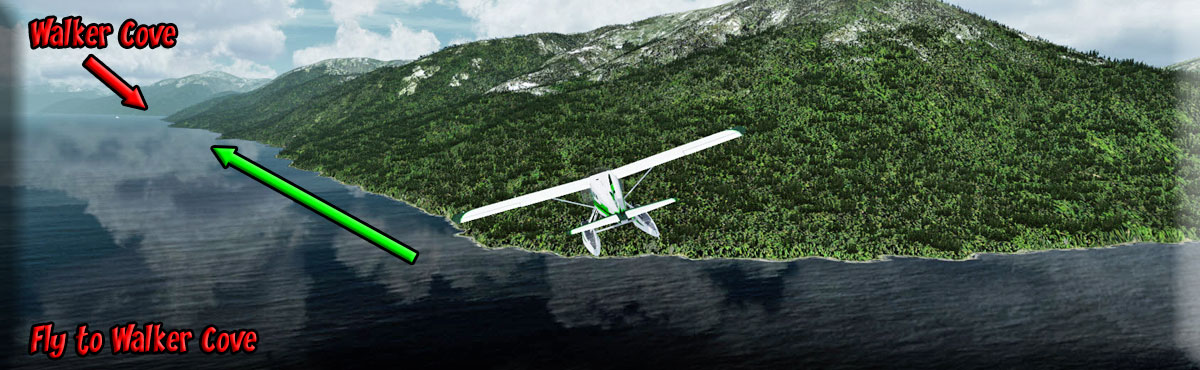
9 To Walker Cove |
We will follow the starboard shoreline for for 10.2 miles on a rough heading of 328 to Walker Cove which will come up to starboard. Ledge point is on the near shore of Walker Cove and Hutt Point on the far shore. Flying up Walker Cove will lead you to the world of winter, even in summer. This is a basin for glacier runoff from the high glaciers about 15 miles to starboard. (CIRP has a trip ticket for this route). At Walker Cove, your next way point is the outfall of the Chickamin River. |
10 To Chickamin River Outfall |
After passing Walker Cove, come to a heading of 314 for 5.8 miles. You will be looking for the outfall of the Chickamin River on the starboard shore. This too is a glacial outfall, so another trip you should put onto your list. Following the river about 10 miles inland, you will find yourself in a world of snow and ice even in the summer. You'll also not be flying at 1200 feet as the mountains rise to almost 6000 feet in that area. Watch for the little Channel Islands, the outfall is the next inlet. From here your next way point will be Saka Cove. |
11 To Saka [Saks] Cove |
Be sure to take a good look up the Chicamin River. This is coming from the glaciers and is another beautiful route. As you pass by the outfall of the Chickamin River, Alter your heading to roughly 303 to follow the starboard shoreline to Saka Cove, 10.6 miles ahead. Keep in mind as we fly along here, the shoreline to port is actually a very large island, Revillagigedo Island, the island that is the home of Ketchikan. When you see Saka Cove come up to starboard, you will next be looking for Burroughs Bay, make your heading 303.. |
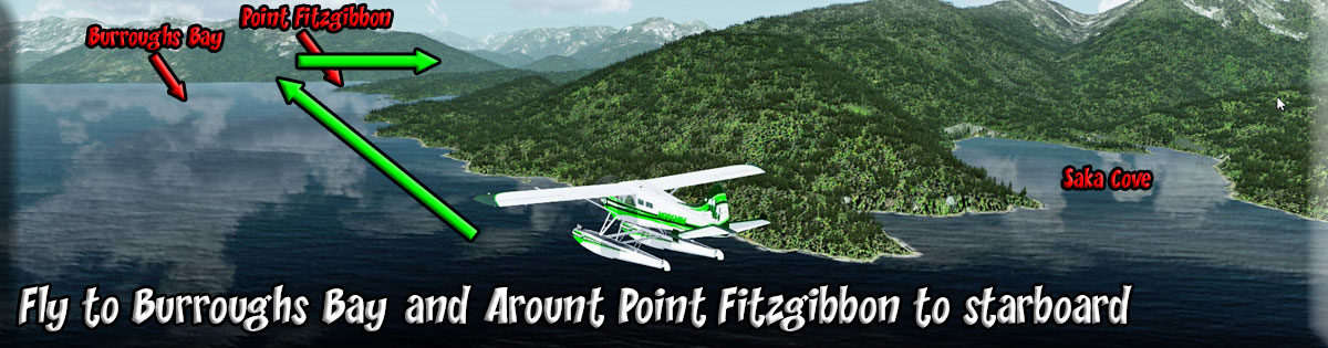
12 To Burroughs Bay |
After Saka Cove, stay on a heading of 303 and look ahead for a "T" intersection. This is where the Behm Canal flows into Burroughs Bay. If you would go to port at the Bay, you would be going around the north end of Regillagigedo Island. We are going to turn to starboard and go to the headwaters of Burroughs Bay. You will see Fitzgibbon Cove on the starboard shore, then the final point on the starboard side of the Behm Canal, is Pt. Fitzgibbon. We will turn to starboard around that point staying out in the bay. Your next way point will be the outfall of the Unoc River. |
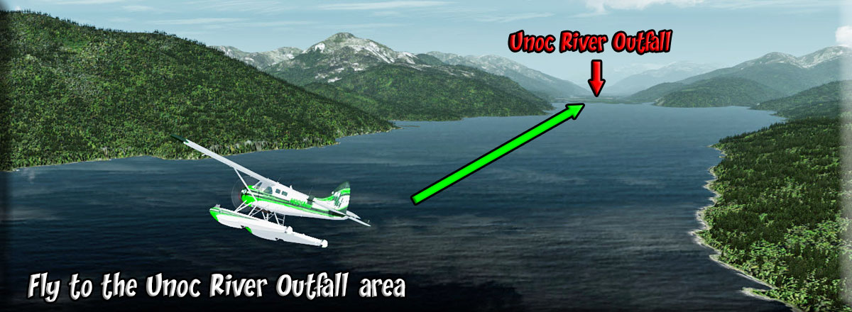
13 To Unoc River Outfall |
As you turn to 024 going up Burroughs Bay, you will see the Unoc River about 7 miles ahead flowing into Burroughs Bay. We will be flying up that river. There are several RTMM locations in this area particularly off to port, some in some beautiful locations. As you approach, you will see the Unoc River is many little streams making the Willow Islands in this area. Once you reach the Willow Islands, the next way point will be First Canyon. |
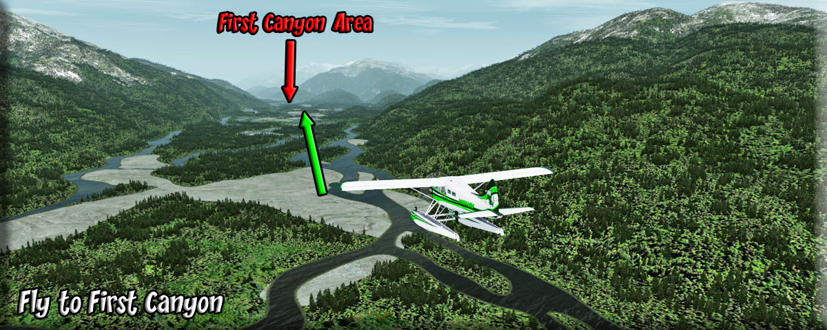
14 To First Canyon |
Follow the river basin on a rough heading of 015 making heading adjustments to stay centered over the river basin. As you near the end of this, you will see a large hill/small mountain ahead. You will keep the hill to starboard going past that structure. The waterway there is called First Canyon. Your next way point is Border Lake Park. Follow the river basin and go into landing configuration as you pass by First Canyon. |
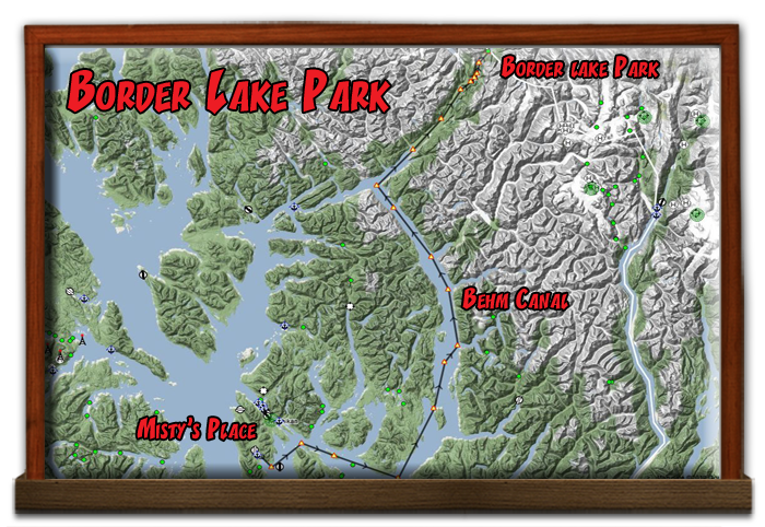
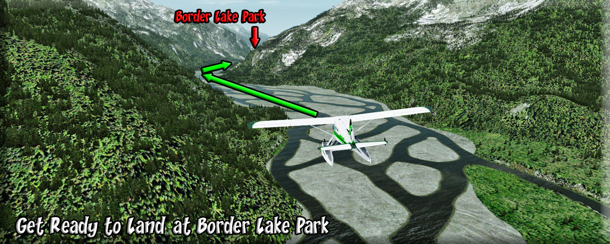
15 Border Lake Park |
After First Canyon, come to a rough heading of 006, follow the river basin to your landing area at Border Lake Park, you can reduce altitude to 600 feet safely and put down the flaps and get ready for your landing. You will be flying over Hell Roaring Creek, when you see this begin to open up, the island at the opening is your destination. There is water ahead of the island to land a float plane. Watch closely for an island with some few large rocks. Land carefully on the island and look for a large rock to starboard. You will find your passengers there waiting for you so you can return them back to Ketchikan.
Welcome to Border Lake Park! |


Copyright Return to Misty Moorings 2021
|
![To Saka [Saks] Cove](img/saka-cove.jpg)