
Destination: Dan's Hideaway
Route Notes
- This Scenery is for "Return to Misty Moorings" only.
- Minimum Altitude: 500 Feet
- Landing zone is: Water Only, Does not freeze in winter
- GPS for destination: N55 9.02 W132 21.04 Alt 6 feet
- Print-Able copy HERE
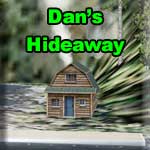
Dan's Hideaway
A beautiful residence tucked away in a cove at the very southern tip of the south arm of the Cholmondeley Sound. In the center of the Prince of Wales Island. Route Highlights Leaving Ketchikan and flying West-Northwest past Ward Cove to Vallenar Point you make a left turn heading197 which will bring you to the 1.5 mile wide opening of the Cholmondeley (Pronounced Chumley) Sound, keep heading West up the sound, which is peppered with numerous small islands making a very picturesque scene.
Seven miles up the channel and to the left is Dora Bay which has a very steep sided headland near the Western entrance. Just past that point is a narrow channel that curves away to the left and is your route to Dan's Hideaway which lies a further 6 miles up this peaceful waterway. As you round the final part of the curve ahead of you at the end of the channel lies an unnamed peak 3580 ft in height, and in the center of the channel is an island, on the right hand shore opposite the island is your destination.
A well equipped cabin sits just onshore from the jetty at which you can tie up your plane, a useful launch is also at your disposal for fishing or just enjoying a day on the water.
TreeTop VFR Plan
FROM: Ketchikan International Airport (PAKT)
TO: Dan's Hideaway
1. From PAKT or Totem Bight, head for Vallenar point, at the northwest end of the Tongass Narrows. ... this will be an approximate heading of 295.
2. At Vallenar Point, set a heading of 190 for 11 miles to Chasina Point ... the southern point at the entrance of Cholamandeley Sound ... after you make the turn, you will see Vallenar Bay to port on Gravina Island. ... you are now heading for the Prince of Wales Island, 10 miles ahead. ... you are flying over the Clarence Straight ... Chasina Point is the port entrance to Cholamandeley Sound. ... Skin Island passes about a mile to starboard.
3. At Chasina Point, set a heading of 199 for 4 miles to Hump Island. ... Hump Island is in the center of the Cholamandeley Sound about. Set a heading to fly over it. (Hump Island is not named in FSDiscover) however it is the first "humped" island you will encounter in the channel. After you make your turn, continue down this channel.
4. At Hump Island, set a heading (257) to fly a left-around of Divide Head. Divide Head is 5 miles away, you will fly to port around this point. ... You are flying toward the West Arm of Cholamandeley Sound ... as you approach Divide Head, Skinny Cove, a narrow inlet will be seen off to starboard. ... as Skinny Cove passes to starboard, be ready for a left turn past Divide Head, which puts you into the South Arm of the Cholamandeley Sound. Divide Head is a tall rounded hump, you want to fly around it to port lining up on that channel.
5. You are entering the southern arm of Cholamandeley Sound. Be at landing altitude when the Arm turns to port, your destination is just beyond that turn on the starboard shore. Follow the sound to the very southern end. ... you will see an island in the center of the arm near the end of the arm, Dan's Hideaway will be to the right of that island on the starboard shore, plan to land near that island.
Welcome to Dan's Hideaway!
Doug Linn
Charter Manager
Misty Moorings, Inc
contact@mistymoorings.com