
Destination: Dog Salmon Creek
Dog Village
Route Notes
- This Scenery is for "Return to Misty Moorings" only.
- Minimum Altitude: 1200 feet
- Landing zone is: Water Only, does not freeze
- GPS for destination
- Dog Salmon Creek N55 20.84 W132 30.17 Alt 9 feet
- Dog Village N55 21.36 W132 30.33 Alt 8.8 feet
- Print-Able copy HERE
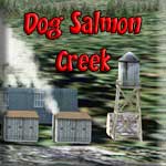
Dog Salmon Creek
Dog Village
Dog Salmon Creek is a small stream where Chum Salmon go to spawn in the fall. Also called, "Dog" or "Keta" salmon, these fish return to this creek each year to complete their life cycle. This is a fishing place for the local native tribe in the area who follow these spawning runs to get their winter supply of smoked fish.
Each year they set up a fish camp for a week or so and live on the site until they have what they need to last the entire winter. The smoke houses used to be made from cedar bows as opposed to huts that we see now. During the spawning run, the men fish, catching the salmon by hand and throwing them up on the beach. The children help and gather the fish for the women who clean and hang the salmon in the smoke sheds.
The creek is shallow with many oxbow turns and is not navigable. The stream bed is a mix of gravel and mud, with its silty glacier headwaters growing increasingly muddy as it progresses. There are many rivers in Alaska bearing the name Dog Salmon River and this creek should not be confused with those located on the Yukon-Kuskokwim Delta or eastern Norton Sound.
As its name suggests, the river primarily hosts large numbers of Chum Salmon along with smaller numbers of Pink Salmon and Dolly Varden char. There is a dock for any floatplane or boat visitors.
This scenery has two locations included. In addition to the fish camp be sure to also stop by the nearby village of Dog Salmon, just North of the creek. There's also a dock there to pull up to and Bob can enjoy the sights at these two destinations.
WaveTop VFR Plan
FROM: Ketchikan International Airport (PAKT)
TO: Dog Salmon Creek and Village
COURSE: Heading 290 (runway heading). We leave PAKT and fly up the Tongass Narrows (Ketchikan on our starboard wing) to Vallenar Point on the north end of Gravina island. Watch ahead and out the starboard windows when we make the turn to see the Guard Lighthouse. It is the navigational signal that is built on the Guard Islands.
COURSE: At Vallenar Point we turn to port to a new heading of 247. We are heading for Skoal Point about 6 miles ahead.
We are going to a "fishing" village of the Tlingit. The Tlingit, whose name means "people of the tidelands," migrated from Asia across the Bering Land Bridge For centuries, the Tlingit (CLINK-it) Indians of Southeastern Alaska believed that the salmon teeming in their waters belonged to a sacred race of people. The "salmon people" swam up the rivers in invisible canoes each spring, offering themselves to humans as food. The Tlingit showed their gratitude with songs and ceremonies. Afterward, they returned the bones of the salmon people to the sea to be reborn. In this region of rolling waves, rugged coastlines, and lush rain forests, they created a unique culture. When we arrive, you must look around the area ... there is a great deal of culture to see.
We are headed for the Kaasan Peninsula. Originally Tlingit territory, Kasaan gets its name from the Tlingit word meaning "pretty town." Haidas migrated north from the Queen Charlotte Islands in the early 1700s to the Island and established the village now known as "Old Kasaan," 7 miles south on Skowl Arm. In 1892 the Copper Queen mine, camp, sawmill, post office and store were built on Kasaan Bay, and the Haida people relocated to this new village.
In 1902 the first salmon cannery was constructed in Kasaan. The cannery burned in 1907, 1910 and again in 1911, but was rebuilt each season. The cannery operated sporadically until 1953. During this time, Kasaan had a school, three stores, a Presbyterian Church and other businesses.
Chief Sonihat built the Whale House, a traditional long house which became the focus of the new Kasaan Totem Park, established during the 1930s. Many of the totems left from the old village site were moved to the park in 1938. Kavilco, Inc., the local village corporation, purchased the old cannery buildings and property in 1974, and in 1980 removed the cannery buildings. Remnants of the historical Karta River village and petroglyphs lie north of the city, and the Old Tom Creek village and fort lie south of the city.
Today, Kasaan was traditionally a Haida village, but the population has become mixed, with Haidas, Aleuts, Eskimos and non-Natives. Subsistence activities are a major contributor to villagers' diets. Most villagers participate in subsistence or recreational activities for food sources, harvesting deer, salmon, halibut, shrimp and crab. With the addition of tourism, the mainstays of that economy is fishing, mining and logging.
COURSE: You will approach the entrance to the Skoal Arm. You will continue over this body of water which will eventually curve to port almost 90 degrees. Sit back, relax and enjoy the beautiful scenery.
COURSE: As the arm narrows, we have Thumb Point on the port side. The little island we pass over (port side) is Skoal Point meaning we are officially in the Skoal arm. We will fly by Smith Cove ... you will see it off the starboard wing.
COURSE: As the arm begins to bend to the left ... alter your course to follow it and bring your altitude down to 500 feet.
COURSE: As the waterway bends left, we are in Polk Inlet. As you turn further left ahead into the South Arm, be at landing altitude and configuration.
COURSE: Ahead the water way splits. Going to starboard you will find the village. If you fly to port at the split, at the end of the arm you will find Dog Salmon Creek.
Get out and look around ... be sure to take your camera!
Doug Linn
Charter Manager
Misty Moorings, Inc
contact@mistymoorings.com