
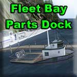
Destination: Fleets Bay Parts Dock
Route Notes
- This Scenery is for "Return to Misty Moorings" only.
- Minimum Altitude: 1200 feet
- Landing zone is: Water, does not freeze
- GPS for destination: N54 41.90 W132 1.39 Alt 9 feet
- Print-Able copy HERE
WaveTop VFR Plan
FROM: Ketchikan International Airport (PAKT)
TO: Fleets Bay Parts Dock
ake off from runway 11 at Ketchikan International Airport (PAKT) aT
*Take off from runway 11 at Ketchikan International Airport (PAKT) and fly a heading of about 110 down the Tongass Narrows Channel
*Fly down the starboard side of Pennock Island over the narrows there to near Gravina Point (the last point of land to starboard on Gravina Island) and turn to starboard to a heading of 168, ideally at an altitude of at least 1200 feet.
*You are now flying into the Nichols Passage, the strait of water between Gravina Island to starboard and Annette Island to port. The inlet to starboard is "Blank Inlet" and the little islands near its entrance are the "Blank Islands".
ANNETTE ISLAND: On the far shore of Annette Island to port, the peninsula of land protruding into the water is Driest point. Beyond that point is Port Chester. On the far shore of the bay is Metlakatla, a native Community founded by the Anglican missionary William Duncan. The island's population comprises mainly of Tsimshian Natives and is a cultural crossroads for Tlingit and Haida Natives as well. The largest settlement on the island is Metlakatla. The entire island is a Native reservation, the only one in Alaska. Annette Island’s population was 1,447 persons at the time of the 2000 census.
*You will see a tiny island come up about 2mi/3.2km to port. This is Warburton Island, named after Alexander Bannerman Warburton, a politician, jurist and author, who served as the seventh Premier of Prince Edward Island, Canada. Notice there is a navigational danger light blinking off of it. Looking at this open water you'd think you'd be safe ... then suddenly there's a tiny rock in your way!
*On the starboard side is the tip of Gravina Island, called Dahl Head. From there you will be heading out over the open waters of the Clarence Strait. On a clear day, you can see the point of land that you are heading for straight ahead - Prince of Wales Island. Hold a course of 180 for about 25 miles. In the meantime, here are some facts regarding the Prince of Wales Island for you to enjoy..
PRINCE OF WALES ISLAND [POWI]: 135mi/217km long, 45mi/73km wide, 2,577sqmi/6675sqkm; it is the fourth largest island in the USA and approximately 6,000 people live here. The largest community on POWI is Craig [N 55 28.35 W 133 08.54], population 1,000, which was founded as a saltery in the early 20th century. Another 750 people live 6mi/10km to the north in Klawock [N55 33.18 W133 05.07], a long-established village that grew with the fishing industry and home to the only airport on the island [PAKW**] but there are several airstrips on the island that show in Plan G. Another significant location is Hollis which is about 33km/20mi [or a one hour drive] to the east of Klawock and was a 'boom and bust' mining town from 1900 to about 1915 and then abandoned; it was re-established as a logging camp in the '50s and now has a population of 100. Hollis is where the ferry terminal is located [N55 28.57 W132 38.50] and it's a three-hour voyage to Ketchikan. The Tongass National Forest which covers much of the POWI is characterized by steep-sided mountain peaks, many reaching over 3,000 feet - all but the tallest of which were buried by Pleistocene glaciation - fjords and dense forests. Extensive tracts of limestone include 'karst' features such as 'El Capitan Pit', which, at 598.3ft/182m, is the deepest vertical shaft in the United States. POWI is the homeland of the Kaigani Haida people. Kaigani is a mispronunciation of the Tlingit word "x'aax' aani" (crabapple country). The Tlingit name for POWI is Taan, meaning 'sea lion'. POWI is traditional Tlingit territory with the Haida moving into the area in the late 18th century and the abandoned Haida villages still carry Tlingit names. In 1741, a Russian explorer, Alexi Chirikov, made the first European landfall on the west coast of POWI and in 1775 a Spanish expedition reached POWI and claimed it for Spain. The first accurate mapping of POWI was made by Captain James Cook in 1778.
*As you approach the southern end of the POWI, alter course to stay about 2 miles offshore, heading for Cape Chacon, about 8 miles ahead. The narrow inlet you will see to starboard is the McLean Arm, a popular fishing spot for tourists to the island. The cliff coming up on starboard is Huaji Cliff.
*Continue about 2 miles off shore because you are going to pass Cape Chacon; travel on for a mile or so, then do a 180 to starboard to head back toward the Cape with it to starboard; look to the port side of the Cape to see the Fleets Bay Parts Dock tucked back in that tiny inlet.
*Watch for the red and green channel marker buoys ... that is your safe landing zone. Lower flaps, decrease speed ... NICE!! A safe landing. Well done.
Welcome to the Fleets Bay Parts Dock.
** RTMM's Klawock airport scenery enhancement package can be downloaded under "K" on the Scenery Page.
Doug Linn
Charter Manager
Misty Moorings, Inc
contact@mistymoorings.com