
Destination: Gwent Bay Cannery
Route Notes
- This Scenery is for Return to Misty Moorings only.
- Minimum Altitude: 1200
- Landing zone is: Water, does not freeze
- GPS for destination: N54 57.18 W130 9.51 Alt 6
- Print-Able copy HERE
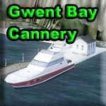
Gwent Bay Cannery
The Gwent Bay Cannery is located in Gwent Bay situated on the northeast point of Pearse Island about 10 miles up the Portland Inlet about 59 miles east southeast of Ketchikan. This is an old cannery complex, circa 1934, that is not actually a functioning cannery but one that has been restored for historical reasons. There is a shop that dispenses bait and beer upon request. You can also refuel your boat or your floatplane at the boat dock. There is limited lodging available for people getting caught in sudden dangerous weather. There are also supplies here for the many U.S. Forestry Cabins that are out in this area of the Misty Fjords National Monument. This is a nice destination South of the Misty Fjords area. A nice stopping off point for a break on your way up the Portland Canal to Stewart and close to the Khutzeymateen Grizzly Bear Sanctuary.
WaveTop VFR Plan
FROM: Misty's Place
TO: Gwent Bay Cannery
COURSE: We will be starting our journey at Misty's Place in Bostwick Inlet. (This will be a different route than the FSX flight plan at Return to Misty Moorings). Taxi to the little white house, turn around on the runway to a heading of about 170 degrees. If clear of traffic proceed with takeoff. Once airborne, bank to port to fly out over the little lighthouse and into the center of Bostwick Inlet. (Heading about 120).
COURSE: As you start to leave the Bostwick Inlet, turn to starboard to a heading of 138 that we will fly to for about 12 miles crossing Nichols Passage on our way to Smugglers Cove on Annette Island.
As we approach Smuggler's Cove on the west side of Annette Island, we will cross over the Metlakatla Indian Community.
This is the only remaining native reservation in Alaska. Metlakatla is located on this upcoming shore of Annette Island. (We are about 15 miles south of Ketchikan). Metlakatla was once supported by its timber and fishing industries, but today survives primarily on grants from the U.S. government. The community must continually look for new economic resources like tourism and native art work in order to become more self-sufficient.
The Nichols Passage we are crossing looks like a wide-open expanse of water, but look closely ... it is peppered with tiny islands (many of them with navigational lights). Although a large expanse of water, you can see why there were so many shipwrecks in this area years ago.
COURSE: The Annette Island airport (PANT) is ahead about 5 miles. Fly to cross over the airport. Maintain heading.
COURSE: Over PAKT, adjust your heading to about 131 (slight to port).
Harris Island is the little island that appears just before the larger Hotspur Island, about 3 miles ahead.
COURSE: Over Hotspur Island, turn to port to 55 degrees. Your next waypoint is about 9 miles ahead.
About 8 miles to starboard is a large mountain, one of the landmarks of the area. That is Mt Lazarro on Duke Island. It is only 1700 feet tall, but looks taller on such a flat island. Ahead you will see Grave Point jutting out from Duke Island. We will make a course change there. Look carefully because Dog Island is near the coast and could be mistaken for Grave Point which is actually 4 miles further ahead.
COURSE: Over Grave Point select a heading of 90 degrees. 12 Miles ahead we will be reaching the shoreline.
You are now flying over the Revillagigedo Channel. Many of the cruise ships coming up from the lower 48 can be seen plying these waters in the summer. The mountain you see straight ahead (about 8 miles) is High Mountain.
COURSE: Watch for the De Long Islands, a little chain of islands, on the port wing. You will see a point of land coming up about 1 o'clock. That is Foggy Point. Fly toward it and then we will turn to starboard to follow the coast about one mile off shore. Your heading should be roughly 140 degrees.
About 6 miles ahead is Tree Point ... and just off shore you will see the Tree Point Lighthouse. The Lighthouse Board approved the construction of the Tree Point Lighthouse on April 24, 1903, and just over a year later, the light was activated on April 30, 1904. The lighthouse was the first, and only lighthouse, to be built on mainland Alaska. Two weeks after its debut, a small fire damaged the lighthouse, taking it out of service for a brief period before repairs were made. The design of the lighthouse was similar to its neighbor to the north, the Mary Island Lighthouse that was completed a year earlier. The ground floor of the octagonal structure housed the fog signal equipment, which was connected to two horns protruding seaward from the western side of the lighthouse. Above the fog building, an octagonal tower extended upwards to a height of roughly sixty feet. The lantern room housed a third-order Fresnel lens, which produced a fixed-white light with a red sector alerting mariners of dangerous Lord Rocks. To store fuel for the lamp, two oil houses were constructed at distances of 50 and 100 feet southeast of the lighthouse.
And conditions at the station appear to have been far from normal. When the officer-in-charge (OIC) announced that he would no longer be taking his six-hour turn at the radio watches, an enraged subordinate spent the following night getting drunk on a bottle of whiskey he had smuggled to the station. The OIC put the fellow on report, but then had to lock himself in the lighthouse for safety as the madman bellowed taunts at him from the hill behind the tower and then “split the top panel of the lighthouse door with a broad head hunting arrow” shot from his seventy-pound lemon-wood hunting bow. The OIC radioed to Ketchikan for help, and a few hours later an investigation party, armed with a pistol and a rifle, arrived on an eighty-three footer. Sometimes you can spend just too much time in a lighthouse with a good bottle of whiskey!
COURSE: As you pass over the Tree Point Lighthouse, continue following the coast edging a little to port as we fly on a rough heading of 130 degrees. Your next waypoint is Cape Fox about 4 miles ahead.
COURSE: Over Cape Fox, alter your course to port to a heading of about 90 degrees. We will stay close to this heading for about 15 miles.
The bay to port is Nakat Bay. The tiny Lord Islands pass to starboard. Fly over Garnet Point 3 miles further. To port is the Tongass Passage.
COURSE: 4 miles ahead to starboard are the Haystack Islands. Set your course to fly over them. Line up on the point ahead. Just beyond that point is Tracy Island. Adjust to fly over Tracy Island and toward the next point to port.
COURSE: After the point, turn to port into the Portland Inlet and fly along the port coast. You are not in British Columbia ... Port Rupert is about 25 miles away at your 5 o'clock.
Pearse Island is the large island to port. Continue along the coast at about a heading of 15 degrees. The Gwent Bay Cannery is about 16 miles ahead on the port shore, just before you would clear the far point.
Lizard Cove and Lizard point appear on on the port shore and look closely for two navigational buoys. When you see these, your landing zone is near Stick Point, 10 miles ahead.
COURSE: As you near the far point, change to landing configuration, flaps and reduced speed.
Just before the final point of land on the port side, you will find Gwent Bay Cannery tucked up against the face of the mountain.
Welcome to Gwent Bay Cannery!
Doug Linn
Charter Manager
Misty Moorings, Inc
contact@mistymoorings.com