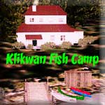
Destination: Klinkwan Fish Camp

Route Notes
- This Scenery is for Return to Misty Moorings only.
- Minimum Altitude: 1200 Feet
- Landing zone is: Water, does not freeze in winter
- GPS for destination: N54 52.69 W132 20.57 alt 8'
- Print-Able copy HERE
- Flight Seeing Plan available HERE
Klinkwan Fish Camp
The Klinkwan Fish Camp is located 2 miles west of the Hunter Bay Cannery Complex. The lodge can house 12 people comfortably with 4 small bedrooms, a fully supplied kitchen and sitting area. This lodge is equipped for busy fishing expeditions in this fishing-rich area of Misty Fjords. There is a picnic table and a small smokehouse for smoking fish. There is also a separate dock for any boating visitors, and the fishing off the dock is also excellent especially in the evening. The long pier is the perfect place to catch that huge Coho Salmon at. Just remember it's a long walk back to the camp and you have to carry whatever you catch!
This location is a favorite destination for fishing and tourist excursions. Don't miss out on seeing the small hidden lake nearby that's a great place for camping out and swimming.
WaveTop VFR Plan
From: Misty's Place
To: Klinkwan Fish Camp
Check local time and weather: HERE
Set FSX for time and weather.
We will start our journey at Misty's Place. Line up on Rwy 17 (near the white cottage). We'll be flying at 1200 feet, so you can preset your autopilot if you wish. As you lift off, turn sharply to port to fly over the Misty Lighthouse (watch out for the circling birds that are always there). Fly to the starboard side of Bostwick Inlet as we will be turning to starboard at Seal Cove Rocks.
COURSE: The furthest point to starboard on Boswick Inlet is Seal Cove Rocks. When you reach the "Rocks," you will be leaving Bostwick Inlet and turning into the Nichols Passage. Turn to starboard to a heading of 174. Your next waypoint is Dall Head.
COURSE: Over Dall Head, the furthest point ahead on Gravina Island, we alter course to a heading of 220. Our next waypoint is Moira Island about 9 miles ahead. We are crossing the Clarence Straight at this point.
-
Fishing on Prince of Wales Island. America’s third largest island holds a delightful surprise for any angler who makes the journey to this remarkable location just a little off the beaten path. Known affectionately to the islands’ 6,000 residents as POW, its 2,600 square miles also host good populations of many types of fish and wildlife.
-
Seas rich with baitfish and plankton set the stage for saltwater charter fishing for all 5 species of Pacific salmon, halibut, Pacific cod, rockfish, lingcod, shrimp, and two types of crab. Freshwater rivers and lakes produce opportunities for that rainbow, cutthroat, and brook trout, as well as steelhead. Alongside runs of returning salmon swim Dolly Varden Char. Even grayling and kokanee are scattered about. In terms of assortment, POW is a smorgasbord for just about everything Southeast Alaska has to offer the angler.
COURSE: Note there are several islands in the mouth of Moira Sound. There are two significant ones. The one just to port is Whiterock Island, the one of similar size ahead and just beyond is Moira Island. As you approach Moira Island, adjust to fly over it and to the center of Moira Sound.
COURSE: Over Moira Island, adjust your course to a heading of 212 to fly to the South Arm of Moira Sound.
- NOTAM: In the distance, you will see the sound break into two branches. One branch will go ahead and a little to starboard (1 o'clock). That is the West Arm of Moira Sound. Another branch veers off sharply to port, this is the South Arm of Moira sound.
COURSE: Turn into the South arm and follow it south on a heading of 188. Follow the South Arm to its end.
COURSE: At the end of the South Arm, make a slight heading adjustment (about 5 degrees) to port. You will be flying a shallow valley for about 3 miles, then prepare for a sharp turn to starboard.
COURSE: Ahead you will see a low, rounded mountain with a lake before it. About 1 mile before the lake, turn starboard to a heading of about 255. You are again flying in a shallow valley toward the water 5 miles ahead. Follow this slight valley to the water.
- NOTAM: Assume landing configuration, flaps, lower speed and lower altitude to 500 feet. Turn off AutoPilot if you have it on.
COURSE: You will fly over a large lake, a rounded mountain is ahead. Fly to the port side of the mountain adjusting your course another 5 degrees to port. Maintain altitude at 500 feet.
COURSE: Just past the mountain is Klinkwan Cove. Fly as though you were going to land on it, but stay aloft. On a point to starboard, you will see a pier jutting into the water. Turn into that cove beyond the pier. Be ready to land safely.
COURSE: You will pass another small pier to port, continue to taxi to the end of the inlet, the camp is located there.
Welcome to Klinkwan Fish Camp!
Doug Linn
Charter Manager
Misty Moorings, Inc
contact@mistymoorings.com