
Destination: Little Oliver Creek
Route Notes
- This Scenery is for Return to Misty Moorings only.
- Minimum Altitude: 1200 feet
- Landing zone is: Dirt, Gravel
- GPS for destination: N54 50.25 W128 15.62 Alt 780 Ft
- Print-Able copy HERE
- Flight Seeing Plan available HERE
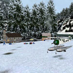
Little Oliver Creek
This scenery was devised primarily to present a challenge to the bush pilots skills, it was Brad's idea and a month or so back he asked me to find a place that was hard to approach, in a valley, with a sharp turn around a hill before you see the strip, I looked for some time before I found this place. In something like a piper cub this will not present a great challenge, but once you get above 70 knots landing speed this is no push over.
As set out below, the reason for flying to such a dangerous spot, why else? Money! People want to go here to see the sights mentioned below and need supplies for camping trips, a couple of small cabins are occupied by folks who help out at the strip when it gets busy, there are numerous people to find as they head off up the valley to see the sights.
PF12 LOC is also special in that it has the first sloping strip in the RTMM scenery enhancements, yes! The ramp end of the strip is higher than the lower end. The beauty of this is that it allows the strip to fall at the same incline as the creek, a level strip at this place would get you a 30ft cliff at the lower end, but as a sloper it looks far better.
Set 25nm to the NNW of Terrace Little Oliver Creek is a popular destination for Ice Climbers in the winter time, Little Oliver Creek is not an easy place to access, involving a fair hike before you reach the main attractions, the spectacular Ice Falls.
However there is a narrow strip of flat rocky terrain that runs alongside the waterway that give a quicker access to the main trail for exploring the delights of the creek, approach to this "runway" can only be made from the Terrace end of the valley as it is blocked by a mountain the other way, take offs are best from the opposite end, so wind conditions are a major factor in the accessibility of this place. The approach is also blind as you will be making a steady left hand turn while you fly in at treetop height up the river valley waiting for the strip to appear. Flying into this location to bring sightseers and supplies for camper etc, this is a journey you will either want to remember or have expunged from your mind, depending on how you did!
The strip is not silly short, having just over 1000ft of useable space, but the approach and timing make it seem a lot shorter. Make sure your brakes are well serviced!
Tree Top VFR Plan
From: Terrance, BC
To: Little Oliver Creek
- NOTAM: Set Weather and Time from Misty's Place, also go to the Map Room to see a rough flight plan of this flight.
Overview: You will be flying up the beautiful (and famous) Skeena River on your way to Little Oliver Creek. Basically you follow the river until you reach Little Oliver Creek, then you turn back into a gap in the mountains and hold on for dear life! A short strip, a sharp turn to make it and a beautiful setting.
Terrance BC - Terrace is a city on the Skeena River in British Columbia, Canada. The Kitselas people, a tribe of the Tsimshian Nation, have lived in the Terrace area for thousands of years. The community population fell between 2001 and 2006 from 12,109 with a regional population of 19,980 (Statistics Canada, 2001) to 11,320 and regional of 18,581 (Statistics Canada, 2006. The community is the regional retail and service hub for the northwestern portion of British Columbia. The administrative offices of the Kitimat-Stikine Regional District are also located in Terrace.
The community sits on the Canadian National Railway and the Yellowhead Highway. Air services for the community are provided through Northwest Regional Airport, with connections to Prince George, Smithers, and Vancouver. The Terrace railway station is served by Via Rail's Jasper – Prince Rupert train. Health care in Terrace is administered by Northern Health and provided, in part, by Mills Memorial Hospital.
COURSE: We begin in Terrance, BC a community 58 miles east of Prince Rupert, BC . At liftoff, set a course of 23 degrees. This takes you to the the Skeena River.. We will be flying up this river for most of the trip.
COURSE: Fly the center of the river for the next 18 miles.
Along the way ...
- Just after you pass the town of Copper River, the river on your starboard side will be Copper River.
- The highway to the starboard of the river is Highway 16. It follows the river most of the way to New Hazelton, BC
The route of the Skeena River: The Skeena River originates at the southern end of Spatsizi Plateau, in a valley between Mount Gunanoot and Mount Thule, south of the Stikine River watershed. The abandoned track of BC Rail's Dease Lake Extension runs along the river in its upper course. It flows south-east, between the shallow peaks of the Skeena Mountains, through the McEvoy and Jackson Flats. It continues in this direction until it passes the Slamgeesh Range, then flows westwards to Fourth Cabin, when it turns south through a shallow canyon below Poison Mountain. After Kuldo it takes an eastward turn, then flows again south below Cutoff Mountain and Mount Pope. It continues through rolling hills to the community of Kispiox and then Hazelton, where it receives the waters of Morice-Bulkley River, and turns south-west.
The Yellowhead Highway and a Canadian National Railway track follow the course of the Skeena on this section. At Kitseguecla, the river is crossed by Highway 37, and then turns south around the Seven Sisters Peaks and Bulkley Ranges, through the Skeena Provincial Forest, then between the Nass Ranges and Borden Glacier, past the ferry crossing at Usk, through the Kitselas Canyon, and then through the Kleanza Creek Provincial Park. It then flows south-west through the city of Terrace, where the river widens. It continues westwards, followed by the Highway 16 and Canadian National Railway line, passes near the Exchamsiks River Provincial Park, then flows into the Dixon Entrance at Eleanor Passage, between Port Edward and Port Essington, facing De Horsey Island..
- Kleanza Mountain passes to starboard just after the Copper River, it is 4400 feet tall.
- And ahead to starboard is Bornite Mountain, 5000 feet tall. To the starboard side of the river is the community of USK. This was depicted in a book by Elizabeth M. Whitlow in a story of Usk, BC.
COURSE: As you near Bornite Mountain, the Skeena River takes a sharp jog to port then starboard ... follow the river.
USK, BC - Back in 1912, there was nothing at Usk except the slashing through, clearing and construction on the right of way of the Grand Trunk Pacific Railway.
When the construction of the railroad past Kitselas Canyon and east to Hazelton was completed, the people of the old town site of Kitselas and vicinity found themselves cut off from obtaining freight and mail service with the cessation of their old standby, the riverboats, and taking on of the mail contracts by the railroad. Those who did not completely desert the district moved on to Usk, the nearest station.
The name Usk, how come? The origin of this name has never been ascertained but it was thought to have been given by one of the railroad engineers who might have had his birthplace near the river Usk in England or Wales.
The earliest residents around Usk station were Dick Lowrie, who took up a 160-acre pre-emption of land surrounding the station, and his brother-in-law Harry Daniels, who with their families, made their homes there. This pre-emption was later subdivided into approximately one-acre lots becoming the nucleus of the village.
The Dominion Government had moved the Kitselas telegraph office to a site opposite the station on the south side of the track and here, also, Lee Bethurem built a general store. This was eventually enlarged with an upstairs that was used for public entertainment, meetings, etc. Adding to his business as merchant, he took on the jobs of postmaster and mining recorder.
J.D (Jimmy) Well and Eli Hamblett prospected on Kitselas Mountain. They were the discoverers of the Cordeliera Group of mining claims that showed fine samples of free gold. So the next thing was a great influx of prospectors into the vicinity.
Jim Darby and A. Snodgrass from Portland, Ore. became partners in this venture and were instrumental in getting a number of people from the states interested. There was prospecting and development work going on until about 1923 or 24. However, the ore was found to be too spotty for profitable output.
Along the way ...
- You will pass the small community of Pitman, BC on the port shore of the river.
- Right after Pitman, the Skeena jogs to starboard, then back to port. Follow the River.
COURSE: After you make this jog, Little Oliver Creek will be 4.9 miles ahead and back into the mountains. Watch for a creek coming in from your starboard side ... this first one is NOT your turn, look 1 mile ahead and you will see Little Oliver Creek and a gap in the mountains to starboard into which you will fly.
- NOTAM: Critical Turn - Watch on the port side of the river for Little Oliver Creek entering the river. You will see it comes from between a gap in the mountains to starboard. If you have the Autopilot on ... turn it OFF!
- NOTAM - slow down for the turn, some flaps, gear down if necessary. Full flaps as you are "in the gap" ... slow!
COURSE: Follow the Creek back into that gap. Flaps, lower speed, your destination is a mile ahead after a sharp turn to port. (Good Luck!)
- NOTAM: Check you seatbelts, remember the little bag stuffed in the pocket behind the seat ... hold on.
Welcome to Little Oliver Creek!
Doug Linn
Charter Manager
Misty Moorings, Inc
contact@mistymoorings.com