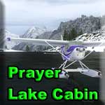
Destination: Prayer Lake cabin

Route Notes
- This Scenery is for Return to Misty Moorings only.
- Minimum Altitude: 1500 Feet
- Landing zone is: Water, does not freeze
- GPS for destination: N52 56.54 W132 4.16 Alt 954
- Print-Able copy HERE
- Flight Seeing Plan available HERE
Prayer Lake Cabin
You may be wondering why this lake has that name? Well it's not your typical low altitude lake. This one is just a little different. This is a place that is located on the island of Haida Gwaii, just north of Takakia Lake and this location is perfect for pilots that like a challenge. It's a small lake with a cabin at the end of it. Sounds simple enough, only it's location is nestled into the side of a mountain! There's only one way in and one way out and the approach has to be just right or you may not have enough airspeed to recover and any go around in here. Land at your own risk and you better say your prayers!
They lie on the edge of the province's collective memory like a dream scarce remembered; mythical and elusive, full of meaning and great beauty, yet incomprehensible to the waking mind. Impossible not to marvel at, and revel in, these are the Queen Charlotte Islands (Haida Gwaii), arguably one of the most beautiful and diverse landscapes in the world. This group of islands nestled under the Alaska panhandle is the ancestral home of the Haida - the West Coast Aboriginals who have lived here for thousands of years. The Queen Charlotte Islands were officially renamed Haida Gwaii in December 2009 as part of an historic reconciliation agreement between the Haida Nation and the province of British Columbia. Haida Gwaii was created as an alternative name for the islands to acknowledge the history of the Haida Nation. The name Haida Gwaii translates as "islands of the people" in the Haida language.
According to Haida legend, Haida Gwaii is the place where time began. There is an older name for this place, a name that comes from the mists of time and seems to be the most appropriate name of all: Xhaaidlagha Gwaayaai - Islands at the Boundary of the World. Certainly it is not hard to miss the spiritual, even mystical nature of the place. The unusual and abundant flora and fauna that thrive in this Galapagos of the North and the marine and wildlife diversity of the surrounding waters and forests make it an ecological marvel.
WaveTop VFR Plan
From: Sandspit, BC (CYZP)
To: Prayer Lake Cabin
-
NOTAM: Set Weather and Time from Misty's Place, also go to the Map Room to see a rough flight plan of this flight.
Overview: We start in Sandspit, BC flying south over the relatively flat (non-mountaneous) terrain, then over Lake Skidgate. We then angle down to the mountains and take some tricky "passes" to arrive at our (very short landing zoned) destination of Prayer Lake Cabin.
COURSE: Take off from Sandspit, BC. Once airborne, set a heading of about 180 degrees. This takes you to Lake Skidgate, about 10 miles ahead.
-
Sandspit: The hamlet of Sandspit, on the northeastern tip of Moresby Island, is the Gateway to Gwaii Haanas. The only settlement on Moresby Island, Sandpit is the location of the main airport for Haida Gwaii (Queen Charlotte Islands). Sandspit's history goes back to at least one ancient Haida Village, Kil, which was situated east of Haans Creek. The first settlers at Sandspit established farms and ranches around the grassy flats.
COURSE: Over Lake Skidgate, set a new heading to starboard of about 203 Degrees. You are now heading for a range of mountains, and a pass between the large ones ahead.
- Moresby Camp will come by your starboard wing in about 3 miles. We are flying over an inlet of the Hecate Strait. Five miles to the west of Moresby Camp is Mosquito Lake, one of the finest fly fishing lakes in BC.
- NOTAM: Slow down, the turns are difficult ahead. 90 mph max.
COURSE: As you approach the shoreline, ahead you will see a small inlet. Fly over that inlet. Beyond it a large mountain looms. As you near the mountain turn sharply to port behind a low ridge to port and follow that valley.
COURSE: Immediately after your turn to port,Watch for a road that turns sharply off to starboard, you will follow that road turning into a narrow valley. Make a sharp starboard turn to follow the road.
COURSE: When you approach the water, keep your speed low, you are going to make a sharp turn to port around the mountainside to your left. You will fly into a narrow inlet of water. Follow that inlet.
- NOTAM: As you see the end of the inlet coming, TURN OFF the autopilot. Assume landing configuration for a water landing.
COURSE: When you see the end of the inlet, look about 20 degrees to starboard, there is a valley line and you will see it rise up to meet with the shoreline of prayer lake. Your altitude should be about right for a safe landing.
Land safely
Welcome to Prayer Lake.
Doug Linn
Charter Manager
Misty Moorings, Inc
contact@mistymoorings.com