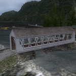
Destination: Thorne Bay Island Retreat

Route Notes
- This Scenery is for Return to Misty Moorings only.
- Minimum Altitude: 1200
- Landing zone is: Gravel and Water, does not freeze
- GPS for destination: N55 41.60 W132 34.71 Alt 9'
- Print-Able copy HERE
- Flight Seeing Plan available HERE
Thorne Bay Island Retreat
Located in the Northwest arm of Thorne Bay, this destination welcomes pilots with a gravel airstrip located on a mudflat island. This is also a sea plane destination. There is a Pilot office, Restaurant, Bar, Lodge and several cabins located on the island. A maintenance hangar and watercraft facility are also on the grounds. While many pilots in the area don't agree with the superstitions, the local first nation tribe claims that there are spirits at play here that have cursed this destination. Several accidents have occurred here that have claimed the lives of misfortunate pilots so be sure to use caution when landing here.
WaveTop VFR Plan
From: Murphy's Pullout (8K9)
To: Thorne Bay Island Retreat
-
NOTAM: Set Weather and Time from Misty's Place, also go to the Map Room to see a rough flight plan of this flight.
Overview: This is a fairly routine flight at a 1200 foot altitude up the Clarence Strait to Tolstoi Point where you will turn to port into Thorne Bay and find your destination.
COURSE: We start this journey from Murphy's Pullout in the Tongass Narrows. (Do a "go to airport" ICAO of "8K9"). You will find yourself at the dock of Murphy's Pullout.
-
NOTAM: Before pulling away from the dock, look both ways carefully as there are cruise ships that ply the narrows regularly. Also watch for small water craft.
-
NOTAM: You will be taking off into the incoming pattern for PAKT, watch for incoming aircraft.
COURSE: When you clear the dock, set a taxi heading of 278 for Vallenar Point. Take off and keep an altitude of 1200 feet.
COURSE: At Vallenar Point, set a heading of 287. We will fly this course for 23 miles, coming close to the shoreline to starboard, but then heading straight for a the next waypoint, Tolstoi Point.
-
Caamaño Point is on the southern tip of Cleveland Peninsula, at the right hand of the Channel. You see it coming up to starboard. It was recorded as Cabo Caamaño by Jacinto Caamaño in 1792, and accepted as such by George Vancouver the following year. It also appears as Punta Caamaño in some maps. Jacinto Caamaño Moraleja (1759-1825?) was the leader of the last great Hispanic exploration of Alaska. He was a Knight of the Military Order of Calatrava. Born in Madrid, he came from an aristocratic Galician family, whose homestead was near Santiago de Compostela. His father was Juan Fernández de Caamaño, and his mother, Mariana Moraleja Alocen. He entered the Navy (Armada) as an adventurer at 18, and two years later he was an Ensign (Alférez de navio).
A few years later he formed part of a politico-commercial expedition to Constantinople to establish business relations with Turkey, Poland, and Russia. After a quick trip to Cuba in 1787, he was sent to the Pacific Coast of Mexico, based in San Blas, the headquarters for the exploration of the Pacific Northwest. Alongside went his brother-in-law, Francisco de Eliza, who would distinguish himself as Governor of Nootka in Vancouver Island. On their ship to Mexico was the recently named Viceroy of New Spain, Don. Juan Vicente de Güemes, Count of Revillagigedo. On February 3, 1790, Caamaño took part on an expedition to the Pacific Northwest. He was commanding the Nuestra Señora del Rosario (also known as the Princesa), a 189-ton frigate built in San Blas for the exploration of the North. He did not go beyond Nootka on this voyage, but on his next one, (1792), came as far as Bucareli Bay commanding the frigate Aránzazu, a ship built at Cavite in the Philippines. This expedition did a thorough study of the coast from Bucareli to Nootka, marking the map of Alaska and British Columbia with many names which are there today.
Having successfully completed his trip to Alaska, Caamaño was sent, after a brief stay in San Blas, across the Pacific Ocean to the Philippines. From 1794 to 1807 he served at various posts between México and Perú, having married on one of those trips the Ecuadorian, Francisca de Arteta Santistevan, who gave him eight children. In 1820 he was still living in Guayaquil, the birthplace of his youngest daughter, but nothing is known of the date and place of his death. Some of his descendants (the Staggs Caamaño) live nowadays in Arizona.
COURSE: The point of land we approach from starboard is Niblick's Point and just beyond it is the tiny "ship" island.
COURSE: Continue on your heading of 287. As you leave Niblick's Point, Tolstoi point is 9.5 miles ahead.
We are crossing over the Clarence Strait.
COURSE: Just past Tolstoi Point, turn sharply to port to a heading of 227. Follow this for 3 miles.
NOTAM: Adjust to landing configuration, either water or land, both are available. Lower altitude to 800 feet.
COURSE: As you reach the center of Thorne Bay, turn to starboard to a heading of 280 and you will be lined up on your landing zone for the Thorne Bay Island Retreat about 2 miles ahead. You will pass over a peninsula jutting out from the starboard shore, be ready to land after you fly over this feature.
Safe landing!
Welcome to Thorne Bay Island Retreat!
Doug Linn
Charter Manager
Misty Moorings, Inc
contact@mistymoorings.com