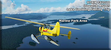
MAP
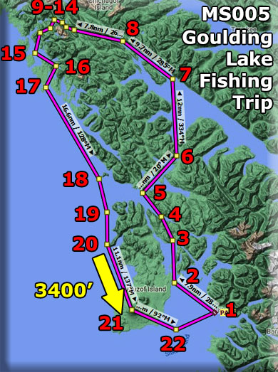
Flight Plan
Dispatch Setup
- Suggested Altitude: 1200Feet
- Notam: WayPoint Altitude: 3400 feet
- Landing zone is: Land/Water Optional
- Aircraft Type: Wheeled/Amphibian
- Distance approximately: 130 nm
- Estimated Flight Time: 1 hour with stops
- Autoroute Flight Plan (.pln) HERE
- Dispatch Usage Instructions HERE
NOTAM: As you are viewing on down the dispatch, if you need to see the map, you can click on the "LEG" link and the map will pop up, click on <- at the top to return.
Dispatch Overview
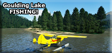
Your flight starts in Sitka AK at PASI. You are taking a customer fishing at Goulding Lake, one of the most famous lakes north of Sitka, AK. On a clear day you can fly direct, but with typical inclimate weather, you stay at 1200 feet. Also, the customer has requested "Flight-Seeing" so this is another reason to fly low and slow. The Dispatch below will give you the talking points for the trip. You return from Goulding Lake via the coastal route that gives the customer a different vista for the return trip to Sitka.
If you have an amphibian, you should land on Goulding Lake and explore it. Also, the next lake to the north, Otter Lake, is a great fishing lake and another one to explore. The fish species in these lakes are Dolly Varden and Cutthroat.
NOTAM: Non-Amphibian - If you do not have an amphibian, you can used a "wheeled" aircraft and just fly low over the fishing zones.
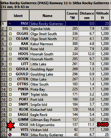
Leg #01: Sitka, AK - PASI
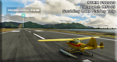
You begin your flight at Sitka's Rocky Gutierrez Airport (PASI).
- Sitka Rocky Gutierrez Airport (PASI) is a state-owned, public-use airport located west of the central business district of Sitka, a city and borough in the U.S. state of Alaska.
- The airport is named after Sitka's former mayor Rocky Gutierrez. It features a single terminal with jetway with air service operated year-round by Alaska Airlines and seasonally by Delta Air Lines regional affiliate Delta Connection operated by SkyWest Airlines. There is a single paved runway located on a causeway that juts off Japonski Island. Deceased tuberculosis patients from the nearby SEARHC/Mt. Edgecumbe Hospital were buried on airport grounds and had to be relocated during construction. That section of the airport is still unofficially called The Mausoleum.
- The airport also has hangars and offices for local air traffic control, the Civil Air Patrol, and various private enterprises. U.S. Coast Guard Air Station Sitka also has a complex attached to the airport for their helicopters but their rotary-wing aircraft based in Sitka seldom use the runway for takeoffs and landings.
- Safety hazards include ocean waves washing onto the runway during storms, high winds because of its exposed location, and large flocks of birds that live very close to the airport. Due to these hazards, the airport is listed by airfarewatchdog.com as one of the ten most thrilling landing experiences in the world.
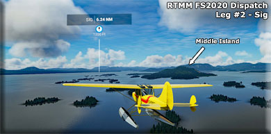
Leg #02: To "SIG" (Siginika Islands)
Heading: 285*
Distance: 7.9 nm
Altitude: 1200'
History of Sitka ... (Off the Starboard Wing)
- The City and Borough of Sitka (Tlingit: Sheetʼká, Russian: Ситка), formerly (between 1799 and 1867) Novo-Arkhangelsk (or New Archangel) under Russian rule (Russian: Ново-Архангельск or Новоaрхангельск, t Novoarkhangelsk), is a unified city-borough in the southeast portion of the U.S. state of Alaska. The city is situated on the west side of Baranof Island and the south half of Chichagof Island in the Alexander Archipelago of the Pacific Ocean (part of the Alaska Panhandle). As of the 2010 census, Sitka had a population of 8,881.
- Russian explorers settled Old Sitka in 1799, naming it Fort of Archangel Michael (Russian: форт Архангела Михаила, Fort Arkhangela Mikhaila). The governor of Russian America, Alexander Baranov, arrived under the auspices of the Russian-American Company, a colonial trading company chartered by Tsar Paul I. In June 1802, Tlingit warriors destroyed the original settlement, killing many of the Russians, with only a few managing to escape Baranov was forced to levy 10,000 rubles in ransom for the safe return of the surviving settlers.
- Baranov returned to Sitka in August 1804 with a large force, including Yuri Lisyansky's Neva. The ship bombarded the Tlingit fortification on the 20th, but was not able to cause significant damage. The Russians then launched an attack on the fort and were repelled. Following two days of bombardment, the Tlingit "hung out a white flag" on the 22nd, deserting the fort on the 26th.
- Following their victory at the Battle of Sitka, the Russians established the settlement "New Archangel", named after Arkhangelsk. As a permanent settlement, New Archangel became the largest city in the region. The Tlingit re-established their fort on the Chatham Strait side of Peril Strait to enforce a trade embargo with the Russian establishment. In 1808, with Baranov still governor, Sitka was designated the capital of Russian America.
Middle Island will pass under your starboard wing.
The ILS for Runway 11 passover over this island, so watch for "incoming" traffic.
Leg #03: To "OLGAS" (Olga Strait Entrance)
Heading: 336*
Distance: 6.7 nm
Altitude: 1200'
You will be flying over the Magoun Island State Marine Park on your way to OLGAS, the Souther entrance to the Olga Strait.
- Magoun Islands State Marine Park is located near Krestof Sound, approximately 12 miles northwest of Sitka. Access to this park is primarily by boat and the park remains undeveloped with no visitor facilities. Attractions at this marine park include protected island sheltered bays with opportunities for camping, hunting, fishing, exploring, and beach combing.
You will be flying over Krestof Sound.
Leg #04: To "OLGAN" (Olga Strait North)
Heading: 312*
Distance: 4.1 nm
Altitude: 1200'
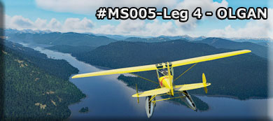
We will not be flying the 5 mile length of the Olga Strait. This is a great salt water fishing area.
- Olga Strait is a channel located just 11.8 miles from Sitka, in Sitka Borough, in the state of Alaska, United States, near Mount Edgecombe, AK. Whether you’re spinning, fly fishing or baitcasting your chances of getting a bite here are good. So grab your favorite fly fishing rod and reel, and head out to Olga Strait.
Leg #05: To "KAK" (Kakul Narrows)
Heading: 300*
Distance: 4.8 nm
Altitude: 1200'
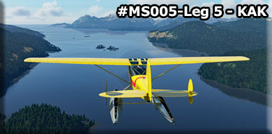
At OLGAN, you entered the Neva Strait. The strait was named in 1804 by Captain U. T. Lisianski, Imperial Russian Navy (IRN), for his vessel the Neva. and included the water now known as "Olga Strait." Neva Strait is the Olga Strait of the Russian chart of 1809, but not of M. D. Tebenkov.
The Kakui Narrows was Named in 1897 by Lieutenant Commander E. K. Moore, U.S. Navy (USN), probably for Kakul Point at the mouth of the narrows.
When you approach the Narrows, you will turn to starboard.
Leg #06: To "ROSE" (Little Rose Island)
Heading: 020*
Distance: 7.9 nm
Altitude: 1200'
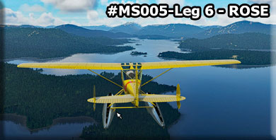
You will pass by Suloia Bay under the port wing. You will pass over several "Rock Like Islands" then past those Liesnoi Island comes up to the port side of the narrows. The large bay to the right is Fish Bay, another well-known fishing destination for this area. There are two islands, Little Rose and Big Rose Island, over these you will adjust your course to intersect the HOONS WayPoint.
Leg #07: To "HOOS" (Hoonah South)
Heading: 334*
Distance: 12.0 nm
Altitude: 1200'
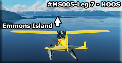
As you head for HOOS (Hoonah South), you will cross over Emmons Island then make your turn into the north arm of the Hoonah Sound.
Moser Island forms the left side of the Hoonah North Arm we are entering.
Leg #08: To "HOON" (Hoonah North)
Heading: 285*
Distance: 9.7 nm
Altitude: 1200'
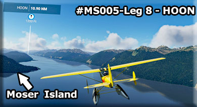
This is the North Arm of the MUCH larger Hoonah Sound. Moser Island is on our left. We will fly to the end of the North Arm and there will turn to port over Granite Creek to head for our landing at Goulding Lake.
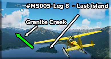
As you reach the end of the arm, look for Nelson Island. You will see another small island further toward the end, you will turn to port over that last little island.
Leg #09: To "LITT" (Little Lake)
Heading: 261*
Distance: 7.8 nm
Altitude: 1200' Descending to Approach
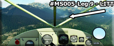
On the way to LITT, you will be flying over the little valley caused by Granite Creek that comes from the lakes. As you a approach a small lake, begin to reduce your altitude. The next lake is Goulding. There is come great fishing just as the lake begins, and you may want to land there.
You will be flying lower than the mountain tops and the creek valley narrows as you near LITT. Be careful! Over Little Lake move into landing configuration.
Leg #10: To "GOULDA" (Guilding Lake Approach)
Heading: 269*
Distance: 1.3 nm
Altitude: Approach to Water (if Amphibian)
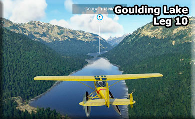
You can land here near the narrow part of the lake. This is an excellent fishing location.
Leg #11: To "GOULD" (Goulding Lake)
Heading: 296*
Distance: 0.9 nm
Altitude: Land on Water if Amphibian
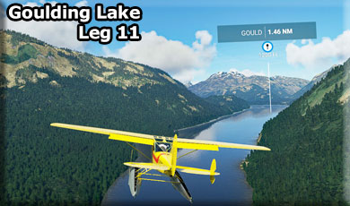
Flying on down the lake to GOULD is about the center of Goulding Lake. You will find a large arm of the lake off to starboard which you should explore just by taxiing. But the shorelines all around the lake are excellent for Dolly Varden and Cutthroat.
As you approach the landing, you may turn to starboard at a very large arm of the lake there. You will find an island you can land near and taxi to. Great fishing spot!!!
Leg #12: To "OTTER" (Otter Lake)
Heading: 267*
Distance: 1.3 nm
Altitude: Short hop from Goulding Lake
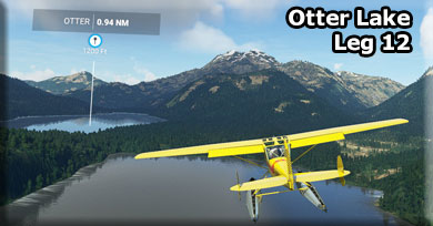
Use your "virtual paddle" (Slew) and turn around to a heading of the main lake.
Take off and turn to starboard, stay low to land at Otter Lake. You can stay "low and slow" with flaps to "hop" to Otter Lake. Also, you can turn to port over Otter Lake and head for the southern end, beautiful geography and great fishing.
Leg #13: To "OTTRS" (Otter Lake South)
Heading: 183*
Distance: 1.4 nm
Altitude: Short hop or water taxi
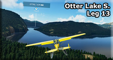
You can "low fly" to the south end of Otter Lake. This is a beautiful "hop" ... it is even better if you taxi to it through the narrow part of the lake. One of the most beautiful fishing spots I've found.
As you take off from OTTRS, you go back to the 1200' sight-seeing altitude and continue your journey returning back to Sitka, AK.
Leg #14: To "PINTA" (Pinta Bay)
Heading: 225*
Distance: 1.7 nm
Altitude: 1200'
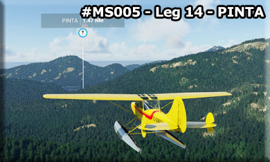
You are now leaving the lakes behind. The fish you caught are stored on ice in the icebox behind the last seat, it will be some great eating tonight!
we are now going to head out to the Pacific Coast of the island and meander down the coast. This is a very unique geographical area with hundreds of unnamed little islands. Sit back and enjoy the beautiful Alaska scenery and sunset.
(Setting your sim to "early sunset" makes for a pleasant trip home)
Leg #15: To "TRIP" (Triplet Islands)
Heading: 171*
Distance: 3.2 nm
Altitude: 1200'
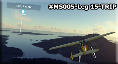
The Pacific Ocean is ahead of us and we are headed for the little Triplet Islands for our next WayPoint.
Leg #16: To "PORT" (Port Island)
Heading: 100*
Distance: 3.8 nm
Altitude: 1200'
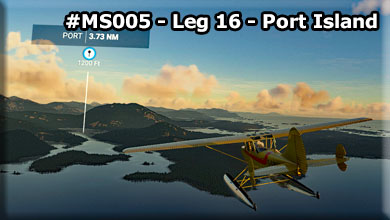
For a little scenery, we are going to cut back into the island for a few miles, this is great for taking pictures at the photographer's "magic hour". We head for Port Island.
Leg #17: To "SNIPE" (Snipe Island)
Heading: 184*
Distance: 3.7 nm
Altitude: 1200'
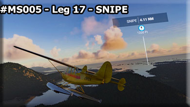
We turn back toward the ocean heading for little Snipe Island. From here we will stay on the shorline so you can see the many islands and the beautiful scenery of the Alaskan coast to port at sunset.
Leg #18: To "KLOK" (Klokachef Island)
Heading: 128*
Distance: 16.6 nm
Altitude: 1200'
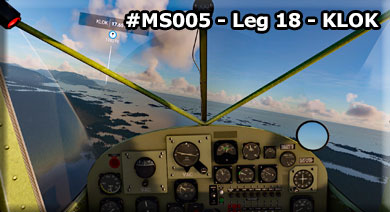
The longest leg of the trip, 17 miles. Continuing down the western coast of Channel Island heading for the Klokachef Island, just of the coast 17 miles ahead. The large point of land coming up to port is Khaz head. The waterway angling off to port from the head is the Slocum Arm.
Here you will see the hundreds of islands that are typical of this part of the world. A ships' demise, a fishermans' paradise and a low flyer's dream. You are flying along the western coast of Chichagof Island.
- Chichagof Island (Russian: Остров Чичагова), or Shee Kaax, is an island in the Alexander Archipelago of the Alaska Panhandle. At 75 miles (121 km) long and 50 miles (80 km) wide, it has a land area of 2,048.61 square miles (5,305.9 km2), making it the fifth largest island in the United States and the 109th largest island in the world. Its coastline measures 742 miles. There was a 2000 census population of 1,342 persons. It is one of the ABC islands of Alaska. Chichagof Island has the highest population of bears per square mile of any place on Earth.
- Chichagof Island is directly north of Baranof Island, with Peril Strait separating the two islands. It is bounded by Chatham Strait to the east, Icy Strait to the northeast, Cross Sound to the northwest, and the Gulf of Alaska to the west.
- The communities of Hoonah, Pelican, Tenakee Springs, and Elfin Cove are all located on the northern half of Chichagof Island, in the Hoonah-Angoon Census Area. The southern half of the island comprises the northern part of the City and Borough of Sitka. Only eight persons were counted in this portion of Sitka at the 2000 census. The primary economic sources for all these communities come from either Chichagof Island or the waters and fjords surrounding it. Commercial fishing, guided hunting trips, charter fishing and logging are all vital economic facets of the local economies.
- This island is named after Admiral Vasili Chichagov, a Russian Arctic explorer who never visited Alaska.The entire island lies within the limits of Tongass National Forest. The western coastal portion has been officially designated as the West Chichagof-Yakobi Wilderness.
Leg #19: To "EAGLE" (Eagle Rock)
Heading: 144*
Distance: 5.4 nm
Altitude: 1200'
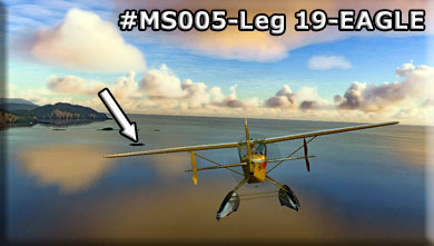
We are flying beside Kruzof Island. Eagle Rock is just that, a rock (we bet it had eagles on it when it was named!)
- Before being named by Lisianski, it was called San Jacinto after its highest point, Mount Edgecumbe, was named Montaña de San Jacinto by Don Juan de la Bodega y Quadra in 1775. La Pérouse referred to that name by calling the island St. Hyacinthe. Captain Nathaniel Portlock named the island Pitt Island in 1787. Early Russian traders called it Sitka Island. In 1849, Constantin Grewingk called the island Edgecumbe. It later became known as Kruzow Island before finally becoming Kruzof Island.
Leg #20: To "GIMM" (Gillman Bay Point)
Heading: 157*
Distance: 5.0 nm
Altitude: 1200'
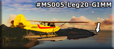
The next point of land coming out from port is the point that guards Gilman Bay. Once crossing GIMM, we need to begin increasing altitude to 3400'.
- Named by Field and Cooper (1937, p. 62) for Daniel Coit Gilman, 1831-1908, educator. He was president of the University of California, 1872-75, first president of Johns Hopkins University, 1876-1901, and president of the Carnegie Institution of Washington, 1902-04.
Leg #21: To "EDGE" (Mt Edgecumbe)
Heading: 137*
Distance: 11.2 nm
Altitude: 3400'
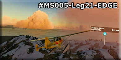
Be at 3400' as you fly over Mount Edgecumbe. This will give your customer the best view of the dormant crater on the top of the volcaon.
- Mount Edgecumbe (Russian: Эджком) is a dormant volcano located at the southern end of Kruzof Island, Alaska. The volcano is about 9.9 miles (16 km) east of the Queen Charlotte Fault that separates the North American and Pacific Plates, and is the highest point in the Mount Edgecumbe volcanic field, an area of about 100 square miles (260 km2) on Kruzov Island that also includes Crater Ridge and Shell Mountain
- On April 1, 1974, a local prankster named Oliver "Porky" Bickar ignited 70 old tires in the crater, which he had flown in for an April Fools' Day joke. The dark smoke rising from the crater convinced nearby residents of Sitka, Alaska that the volcano was erupting. The hoax was soon revealed, as around the rim of the volcano, "April Fool" was spray-painted in 50-foot (15 m) letters. The Guardian reports that Bickar had been planning the prank for four years, and lists it among the ten best Aprils Fools hoaxes of all time
Leg #22: To "VITS" (Vitskan Island)
Heading: 092*
Distance: 7.7 nm
Altitude: 1200'
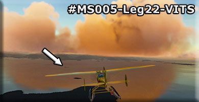
As we leave the dormant volcano, we can once again descend to 1200' for sight-seeing as we head for our next waypoint at Vitskan Island. This island is about 7 miles from Rocky Guterrez Airport in Sitka and your heading puts you 90* to the runway.
Over VITS, you should radio PASI of your landing intentions and choose the runway for landing. Then it is time to line up on the approach you choose.
Leg #15: To "PASI" (Rocky Guterrez Airport, Sitka, AK)
Heading: 043*
Distance: 6.7 nm
Altitude: Approach and Land
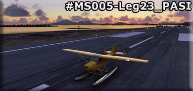
Welcome back to Sitka. We hope you enjoyed the flight, the tour, the sight-seeing and some of the information along the way. Please join us for more fishing trips when you have the time.

|