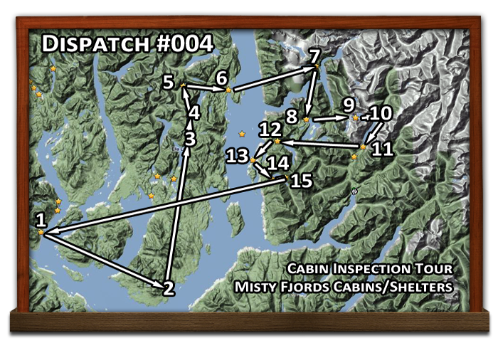
DISPATCHER'S | R E T U R N - TO - M I S T Y - M O O R I N G S |
|
|
| RIBBON |
B R I E F I N G |
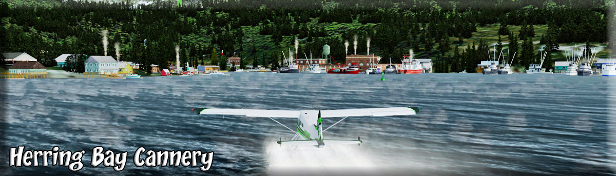
1 Herring Bay Cannery |
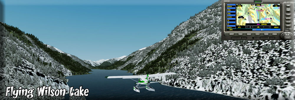
Here we go on another Cabin Inspection Flight. We'll see 14 USFS Cabins and Shelters on this trip ... in in the Misty Fjords National Park area. We take off from Herring Bay Cannery (Go to Way Points Table and select start longitude and latitude, then enter into the sim under "change location". (Set a starting point info) Taxi away from the dock and fly 096. If weather is bad, fly to starboard around the point then follow the coast to Alava Point. You will pass the Thorne Arm, the next "left" will be the Behm Canal. The Cabin will be only a mile or so around the point on the port shore. |
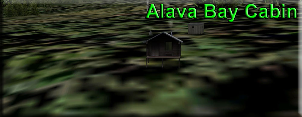
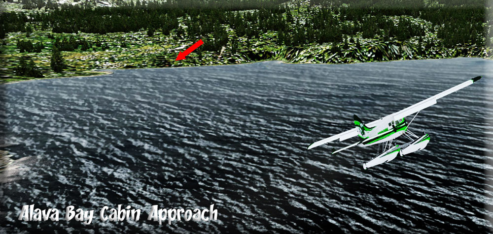
| 2 Alava Bay Cabin ------ Direct Heading: 096 Distance: 13.6 m Way Point: R367A |
Set GPS for Alava Bay Cabin, R367A. Fly low (1200) and stay over water, watching where your way point is on the GPS. As we round Alava Point turning into the Behm Canal, we begin to lower our speed and get into landing configuration, the landing zone for the cabin is about 2.5 miles ahead. Watch for Alava Bay cutting into the port shoreline. As you near it, there is a small lake you'll see first, then Alava Bay is just past that lake. The Cabin is immediately to port on a small bluff. The boat is not on the mooring buoy, so the renters are not "home" ... but we check around the cabin and all seems to be in order. We head back to the plane and set off for the Ella Narrows Cabin. |
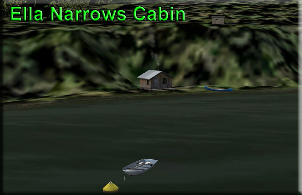
| 3 Ella Narrows Cabin ------ Direct Heading: 346 Distance: 16.4 m Way Point: R418A |
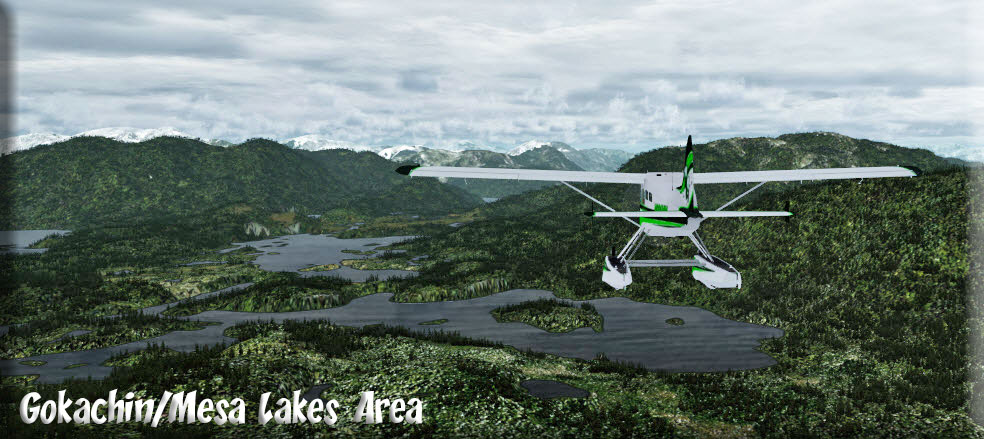
We leave Alava Bay taking off on a 050 heading until airborne, gps set to way point R418A, then we come to 346 which is the heading for the Ella Narrows Cabin. Far ahead we see a gap in the mountains, we are going to fly though that gap. Safe altitude over the mountains in this area is about 2500 feet. On the way we fly over beautiful Gokachin and Mesa Lakes. You should fly directly over Mesa Lake Cabin and see Gokachin Lake Cabin a little to port about 2 miles ahead. (Fly to the left of the mountain). After Gokachin Lake a a little to starboard is Ella Lake, we fly to the far end of the lake. Over the lake, we assume landing configuration. The cabin is to the left just before the lake narrows. We inspect the cabin and there are no problems. |
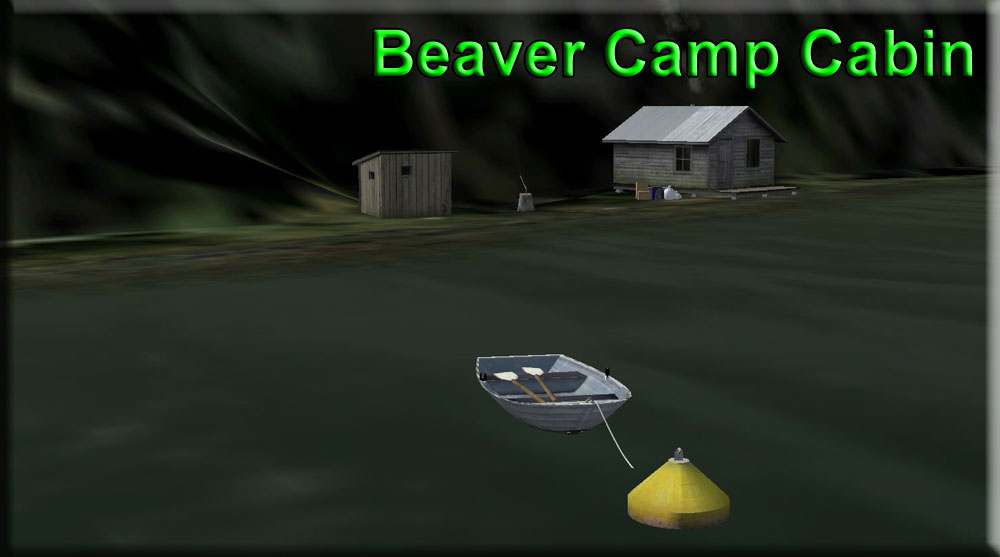
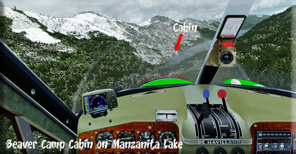
| 4 Beaver Camp Cabin ------ Direct Heading: 344 Distance: 3.2 m Way Point: R379A |
Set gps way point for R379A. We take off down the "narrows part of Ella Lake. After liftoff, we maintain the heading of the narrows until it begins to end, then we turn to port to 300 degrees. We stay low with flaps, because the Beaver Camp Cabin is very close. After we make the turn, we see narrow Manzanita Lake. We fly to the "port" side of the lake and turn to starboard to land quickly on the lake. The Cabin is on the port shore. (This would be a difficult if not impossible heli landing zone). |
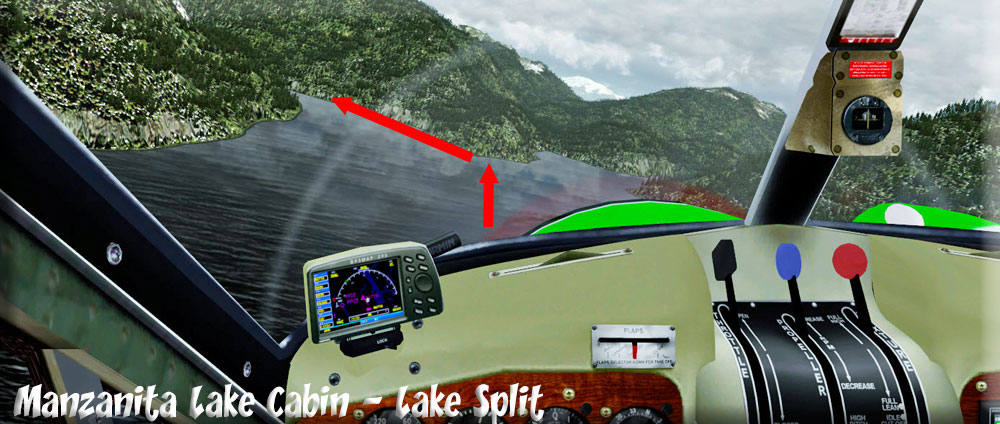
| 5 Manzanita Lake Cabin ------ Direct Heading: 325 Distance: 3.4 m Way Point: R477A |
Set the gps way point for R477A. Our next cabin to inspect is the Manzanita Lake Cabin, about 4 miles away. We take off down the lake (heading about 010). We stay low with flaps and fly the length of the lake. The lake splits to port and starboard. we follow the port split, staying low watching for the cabin about 2 miles ahead. What a beautiful approach!! The cabin is ahead on a point toward the end of the lake to port. The ranger asks me to watch for sand bars because there are several on the approach to this cabin. We do our inspection ... everything is OK, we sign the sheets and get back into the aircraft. |
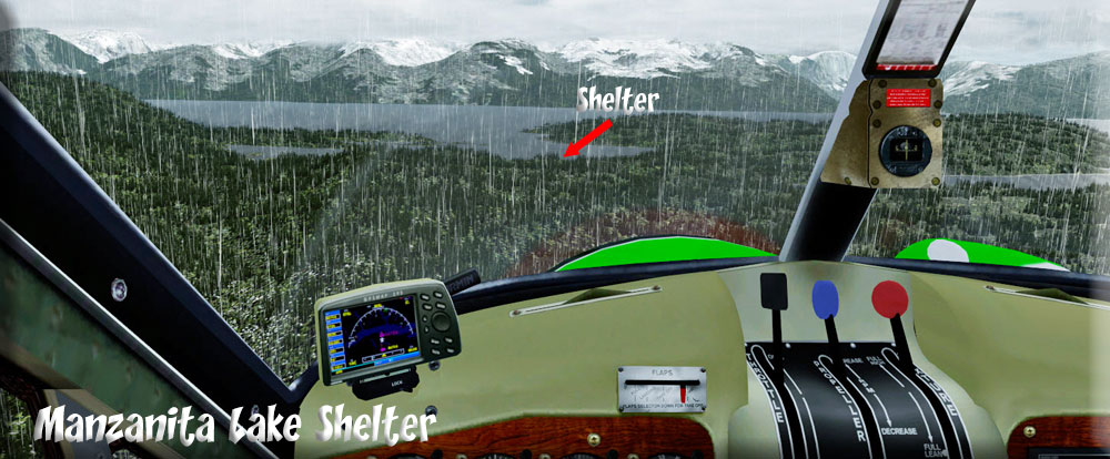
| 6 Manzanita Bay Shelter ------ Direct Heading: 071 Distance: 4.4 m Way Point: R476A |
Set Way point When leaving, we take off on a heading of 070. We'll stay on this heading to get to the Manzanita Bay Shelter. A shelter is just that, not a cabin, just a place to be out of the weather ... these are difficult to find so we'll have to pay special attention. It is about 4 miles ahead. As you near the Behm Canal, look for a little bay, you will land on that bay and will fly over the shelter on your approach. Your only clue there is a shelter is there is a mooring buoy. The shelter is a 10 minute hike up the bluff and inland. We find the shelter in good shape, ready for the next visitor. |
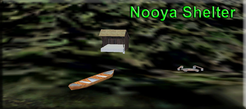
| 7 Nooya Bay Shelter ------ Direct Heading:048 Distance: 8.8 m Way Point: R491A |
We take off on a heading of about 37 degrees, set way point at R491A. A "direct" route to Nooya Bay is difficult because of some high mountains, the easier route is up Rudyerd Bay. We choose "easy" and set a heading of 100 degrees for 4 miles and fly into the entrance of Rudyard Bay. We will follow the port shore of Rudyerd Bay. When the channel splits, we stay to port. (Remember this split point, we'll fly here going to Punchbowl Lake). When you take a cruise to Alaska, this is the part of Misty Fjords you see, the ship comes into this bay. At the end of the bay, turn to sharply to port. You will see a gap in the mountains about a half mile ahead, turn to port into that gap. You will fly over the shelter (it will be to starboard) as you land on Nooya Lake. Watch out for small islands in the landing zone! (A good example of NOT flying directly to the way point, but using the gps to find a water route to the target). |
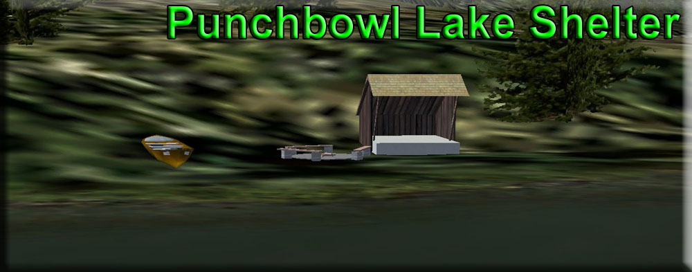
| 8 Punchbowl Lake Shelter ------ Direct Heading: 172 Distance: 5.2 m Way Point: R512A |
Set your way point on the gps. Now we fly back the way we came, taxiing out onto Nooya Lake back out through the gap turning to starboard and making the turn into Rudyerd Bay (back the way we came). There is a narrow channel to the right leading you back into Rudyerd Bay. You will turn to port into Punchbowl Cove and fly to the end of it ... gain a little altitude (3500') because we are going to fly "over" a bluff at the port-side-end of this cove. As you turn to port at the end of the cove, you'll see Punchbowl Lake ahead. Be prepared to land on the lake, but lose altitude and circle to port. You are 2500 feet above the shelter when you cross the ridge. You will see the shelter on a point of land, fly over it landing in the lake in front of the shelter. Such a shelter would be "roughing it!" All checks out OK, so we proceed. |
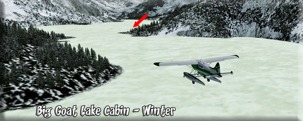
| 9 Big Goat Lake Cabin ------ Direct Heading: 058 Distance: 5 m Way Point: R383A |
Set Way point Remember, Big Goat Lake will freeze in the winter, it is about 1700 feet in altitude, We take off on a heading of 090. We climb but we do not have to "clear" the mountains ahead. We turn to port behind the mountain to our left into a valley. We see Big Goat Inlet coming in from Rudyerd Bay, and turn to starboard up a valley there. Continue to climb, you will be flying though the gap in the mountains at the end of the valley. The lake is almost at the level of the gap ahead. Be ready to land, the shelter is only a half mile ahead. You will see it on a point of land coming out from starboard. Land and check out the cabin. |
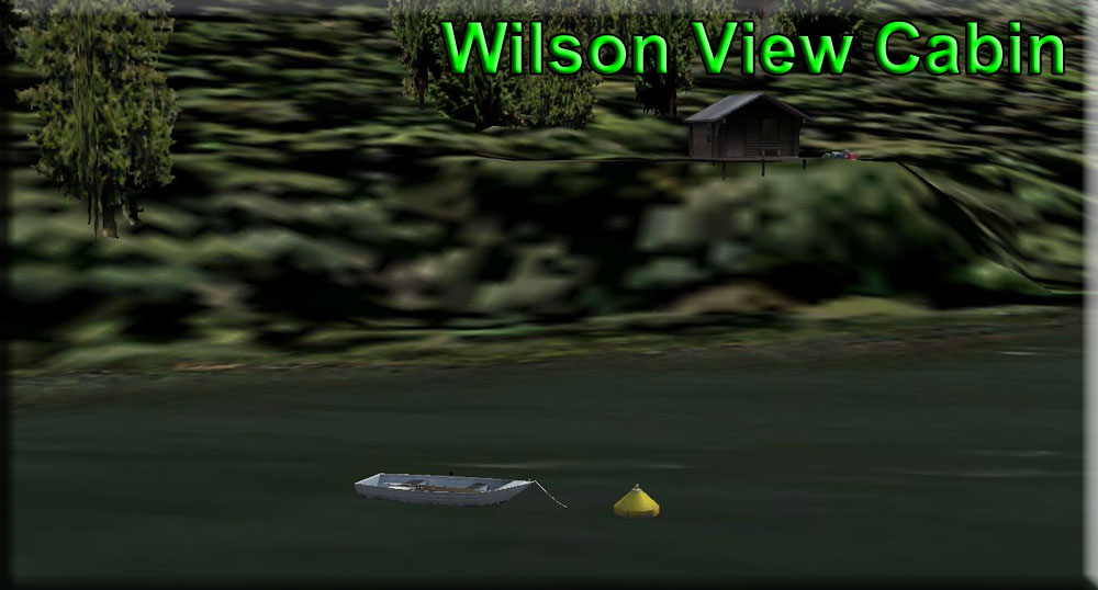
| 10 Wilson View Cabin ------ Direct Heading:062 Distance: 2.4 m Way Point: R564A |
Set your way point Take off from the cabin on a heading of 082. Wilson View Cabin is BELOW you and a little to port about 2 miles ahead. GO SLOW with full flaps over the far end of the lake and be prepared to float down steeply to Wilson View Cabin on the starboard shore. Notice there is not much lake to land on in this direction, You may want to play it safe and turn to starboard, plenty of lake to land on in that direction! We didn't play it safe! Whooo, that'll tickle the tummy a little! This cabin has a beautiful view down Wilson lake. We check it out and all is in order. |
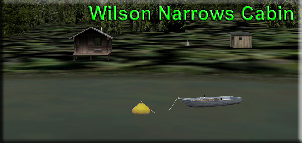
| 11 Wilson Narrows Cabin ------ Direct Heading: 189 Distance: 3.7 m Way Point: R563A |
We take off down the lake on a heading of about 200. We will fly low over the lake to its outfall (the Wilson River). The Wilson Narrows Cabin is to the port side of the end of the lake. And as we land we are greeted by the folks renting the cabin. Another couple who have had a life-long dream to stay in one of the USFS cabins in Misty Fjords ... a dream now realized. We are invited to share some coffee by the campfire and a few stories. We check out the cabin, it is in "spotless" condition ... we thank them and continue on our way. |
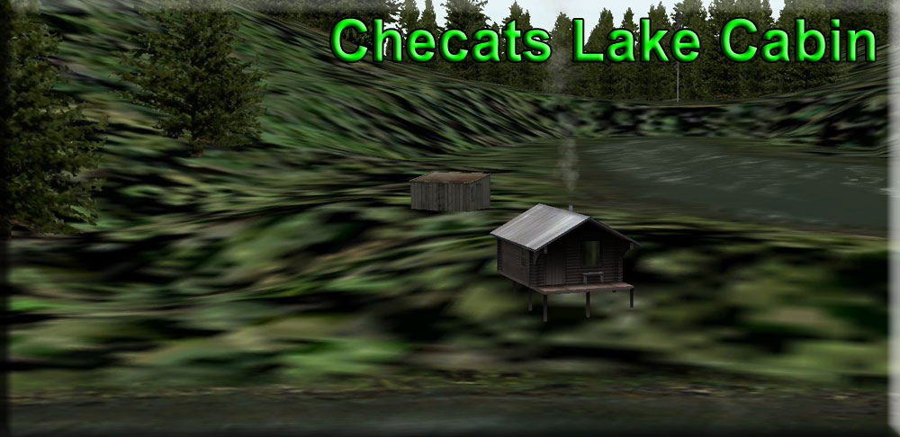
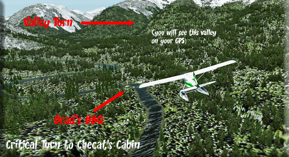
| 12 Checats Lake Cabin ------ Direct Heading: 253 Distance: 8.0 m Way Point: R395A |
(Don't forget to set you way point in the GPS) We taxi back out onto the lake to take off toward the river (about a heading of 260, Note the difference between the way point position and your recommended direction. You will "turn" toward the way point, but avoiding the terrain). Unless we pass over tall mountains on a clear day, it is best not to fly 253, but to follow the Wilson River. About a mile past Brad's Bait & BBQ, turn to starboard into a valley. Follow it for about 2 miles ... at it's end, take the starboard valley and go over the ridge ahead. Once over the ridge, it is a steep glide path to Upper Checat's Lake. The cabin is on the far end of the lake. We found a broken window pane. |
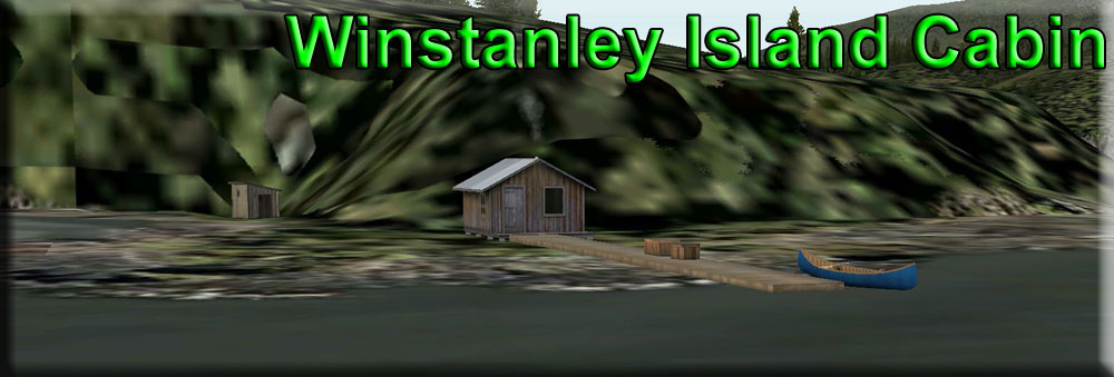
| 13 Winstanley Island Cabin ------ Direct Heading: 206 Distance: 3.5 m Way Point: R565A |
After fixing a broken window pane and leaving a note for the visitors that are out hiking, we taxi back out onto the lake so we can take off on a heading of 270, flying back over Checat's Lake Cabin. Once clear of the lake, we turn to 215. After flying over Lower Checats Lake, the cabin is about 2.5 miles ahead, continue to lose altitude. You will cross another narrow body of water and the cabin is right ahead in a cove. No boat at the mooring ball, so they are out fishing on the Bhem. Cabin seems ok, heading for the shelter. |
| 14 Winstanley Lake Shelter ------ Direct Heading: 112 Distance: 2.7 m Way Point: R567A |
Leaving the cabin, we take of on a heading of 130. We come to 112 .. the shelter is only about 2 miles ahead, you will fly over a ridge, then be prepared for a sharp turn to port with full flaps ... You'll be landing on Winstanley Lake and the shelter will be to starboard at the beginning of the lake. We check out the shelter, all is ready for the people who are being dropped off here early in the morning, the rowboat is securely tied to the mooring ball.. Nothing out of place. One more to go! |
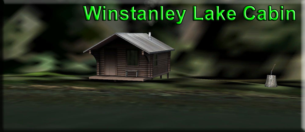
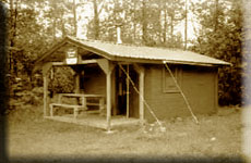
| 15 Winstanley Lake Cabin ------ Direct Heading: 058 Distance: 1.2 m Way Point: R566A |
The Winstanley Lake Cabin is 1.2 miles further on down the lake on the port shore. Since it is such a short hop, you can taxi there, or do a quick "hop" down the lake to land in front of the cabin. It is rather pleasant to just taxi along slowly. Maybe we should get out the fly rod and spend an hour or so trying our luck? We've had a good day, only a couple of things to fix, everything passes inspection and we are ready to head back to Herring Bay. |
| 1 Herring Bay ------ Direct Heading:234 Distance: 24 m Way Point: R151A |
We take off down the lake on a 275 heading, coming to 234 once at altitude over the ridge lines. We get to altitude and if the weather is clear, fly direct to Herring Bay (2200 feet works well), however, if there are low clouds, then the safe way home is turning to port down the Behm Canal, following it to Alava Point (where the first cabin today was located) ... turning to starboard and following the shoreline to Herring Bay, (remembering NOT to turn into the Thorne Arm but cross it.) Another great trip with the USFS ranger. Hopefully you've been helpful enough, you'll be asked to ride again soon! |
 |
Dispatch Notams
|
Copyright Return to Misty Moorings 2021