DISPATCHER'S | R E T U R N - TO - M I S T Y - M O O R I N G S |
|
 |
| RIBBON |
B R I E F I N G |
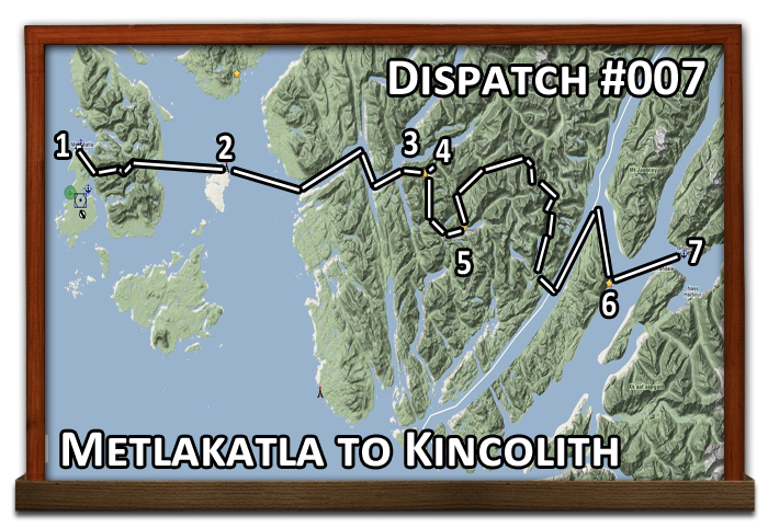
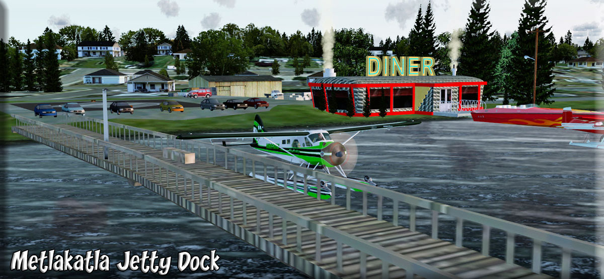
1 Metlakatla |
We have been asked to make a run from Metlakatla to Kincolith with 5 intermediate stops along the way. We start out at the helipad (see mooring lat/long/mag to left ... enter these into FSX Map for start point). The plane is loaded with the supplies we need for the trip. Our route supposed there will be bad weather with low ceilings. If the weather is good and you want to fly higher, just use the gps waypoints for each stop. Otherwise, follow the "low and slow" directions to weave your way through the cloudy and Misty fjords! |
| 2 Mary Island Lighthouse ------ Direct Heading: 076 Distance: 13.8 m Way Point: R651A |
(Set gps waypoint for Mary Island Light, R651A). If in an amphib, taxi straight ahead to the water, find a take off point and take off. (If in a float, "drag it!") If in a heli, go "up" :-). If a clear day, fly direct using the "TO" heading for Mary Lighthouse. If cloudy taxi out to a safe takeoff heading for 120. Taxi far enough to take off back OVER the helipad! Fly this for 2.4 miles and to port into Purple Lake on a heading of 065. Follow the lake to the other side of the island. At the passage, set a heading of 064 for the north tip of Mary Island. Fly around Mary Island with the shore line to starboard and land at Mary Light. You are met at the beach, transfer made ... next stop, Hugh Smith Lake. (Tip: Remember to you can update GPS Route to waypoint by clicking on the GPS's "direct" button one time and "enter" twice. That gives you an updated direct route). |
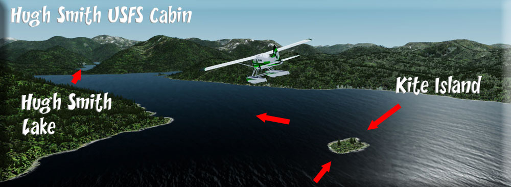
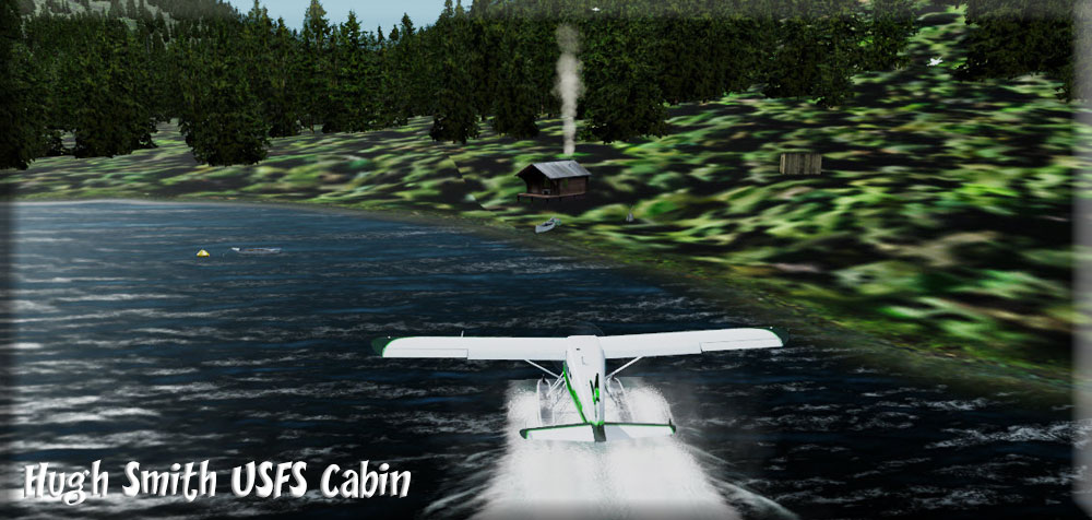
| 3 Hugh Smith Lake USFS Cabin ------ Direct Heading: 068 Distance: 18.0 m Way Point: R441A |
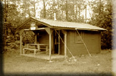
We take off on a heading of 080 and fly across the passage into the Boca de Quadra channel 6 miles ahead. Follow the "boca" about 036 for 6 miles. At Orca Point, the Boca turns sharply to starboard ... fly 121 for 3 miles. Watch for the tiny Kite Island. Over Kite Island, turn sharply to port to 056. Look ahead and you will see Sockeye Creek emptying into the Boca, fly over that shoreline and over the creek draining from Hugh Smith Lake, just beyond. Follow the Lake. The USFS cabin is 3 miles down the lake on the starboard shore. Land and do a "cabin inspection" and fill out the report for the USFS. |
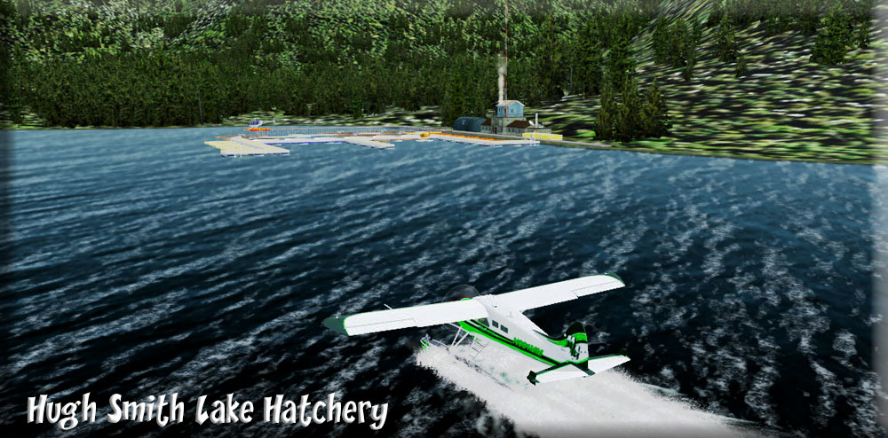
| 4 Hugh Smith Lake Hatchery ------ Direct Heading: 037 Distance: 1.0 m Way Point: |
The Hugh Smith Lake Hatchery is only one mile away on a heading of 037 ... you can easily see it on down the starboard shore of the lake. You can "hop" there or just taxi along and enjoy the beautiful scenery (if the fish are biting, the collapsing fishing pole under the seat might come in handy for a 1 mile "troll" over to the hatchery. You tie up at the hatchery dock and give them the packages they are waiting for you to deliver. While here, might as well buy a nice Sockeye to take home and cook tonight. They have plenty! |
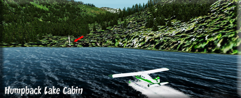
| 5 Humpback Lake Cabin ------ Direct Heading: 127 Distance: 5.4 m Way Point: R442A |
Taxi about half way between The USFS Cabin and the Hatchery. Set up a take off heading of 162 ... this is a valley you will fly for 3 miles. The valley turns a little to port. After passing over a small lake, turn to port over another small lake (heading about 154). You are over Humpback lake it winds to port, follow the lake. When the lake becomes very narrow, you'll find the USFS cabin tucked back in a cove on the port shore. Stop and do a cabin inspection for the USFS. |
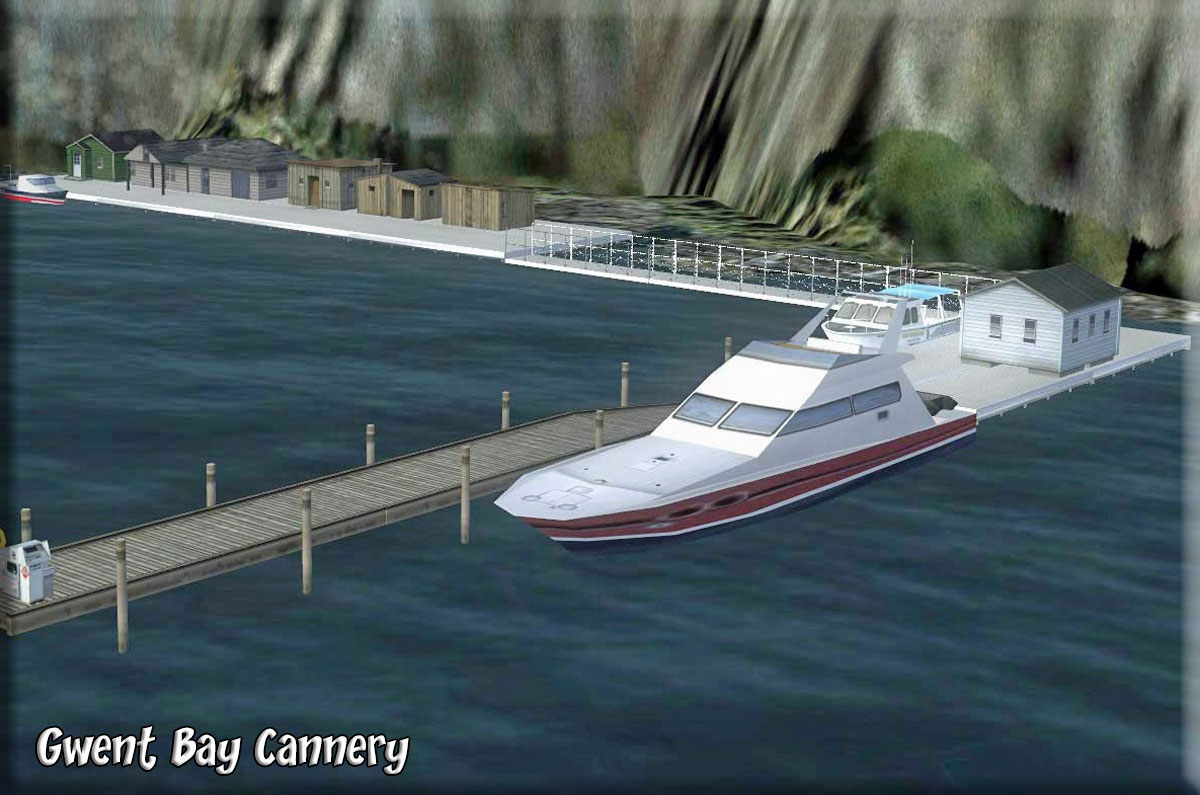
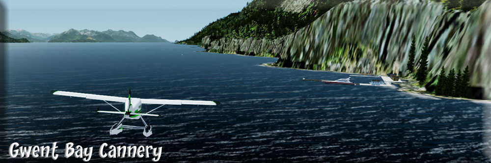
| 6 Gwent Bay Cannery ------ Direct Heading: 086 Distance: 14.0 Way Point: R148A |
Taxi past the cabin into the narrow part of the lake, about a half mile in, turn around and take off back toward the cabin , as you lift off turn to starboard to fly over the cabin and into the valley beyond (About 320). The valley turns to port coming to a heading of about 10 degrees. In 2 miles the valley splits, left, right and straight. Take the RIGHT leg to starboard and follow that valley to the end. The valley becomes narrow, but it is safe. It winds first to port then back to starboard ... just follow it. As you come out of the sharp starboard turn, you see the end of the valley. As you come to the end, there is a gap to port, fly through the gap. The new valley you are in turns to starboard, then back to port to bring you out over Hidden Inlet. You can go back down to the water here. Follow Hidden Inlet to the Pearse Canal. Pearse Island is ahead of you, turn to port and follow the shore line of Pearse Island around the point where you will find the Gwent Bay cannery ... land and drop off your supplies. |
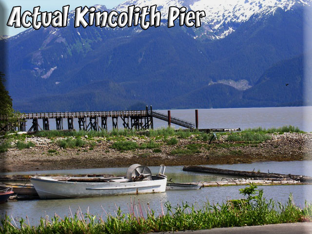
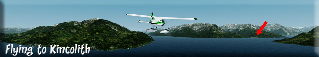
| 7 Kincolith (CBA3) ------ Direct Heading: 050 Distance: 7.2 Way Point: CBA3 |
We line up on a heading of 050 for takeoff directly to Kincolith (CBA3) ... a straight flight for about 7 miles. You can safely stay low for this flight. You are flying over the Portland Inlet (which goes all the way up to Hyder BC) and into the Observatory Inlet where you will find Kincolith. You will see it across the inlet on the port short ... a very nice little community. The seaplane mooring dock is to the "right" (Starboard) side of the community ... line up to land and taxi to there. The lighted helipad is in the same vicinity. Great flight, hope you enjoyed it. (NOTAM: If house objects are off the ground at Kincolith, switch mesh from 5 to 2, then back) |
Copyright Return to Misty Moorings 2021
|